Buckeye Lake in Licking County, Ohio — The American Midwest (Great Lakes)
Buckeye Lake
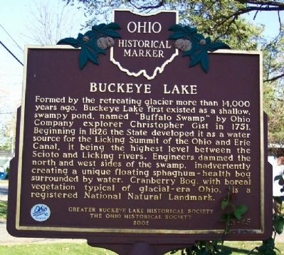
Formed by the retreating glacier more than 14,000 years ago, Buckeye Lake first existed as a shallow, swampy pond, named "Buffalo Swamp" by Ohio Company explorer Christopher Gist in 1751. Beginning in 1826 the State developed it as a water source for the Licking Summit of the Ohio and Erie Canal, it being the highest level between the Scioto and Licking rivers. Engineers dammed the north and west sides of the swamp, inadvertently creating a unique floating sphagnum-heath bog surrounded by water. Cranberry Bog, with boreal vegetation typical of glacial-era Ohio, is a registered National Natural Landmark.
[Marker Reverse]:
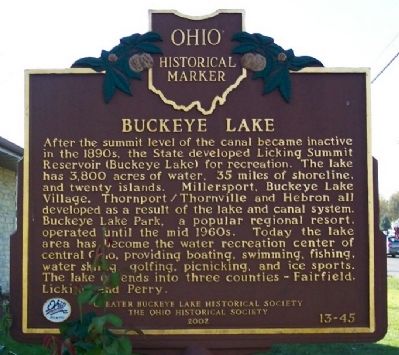
After the summit level of the canal became inactive in the 1890s, the State developed Licking Summit Reservoir (Buckeye Lake) for recreation. The lake has 3,800 acres of water, 35 miles of shoreline, and twenty islands. Millersport, Buckeye Lake Village, Thornport/Thornville and Hebron all developed as a result of the lake and canal system. Buckeye Lake Park, a popular regional resort, operated until the mid 1960s. Today the lake area has become the water recreation center of central Ohio, providing boating, swimming, fishing, water skiing, golfing, picnicking, and ice sports. The lake extends into three counties - Fairfield, Licking and Perry.
Erected 2002 by Greater Buckeye Lake Historical Society and The Ohio Historical Society. (Marker Number 13-45.)
Topics and series. This historical marker is listed in these topic lists: Entertainment • Natural Features • Notable Places • Waterways & Vessels. In addition, it is included in the Ohio and Erie Canal, and the Ohio Historical Society / The Ohio History Connection series lists. A significant historical year for this entry is 1751.
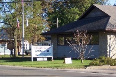
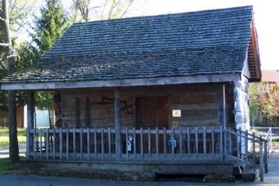
Location. 39° 55.709′ N, 82° 29.403′ W. Marker is in Buckeye Lake, Ohio, in Licking County. Marker is at the intersection of Walnut Road (Ohio Route 79) and Cottage Street, on the right when traveling east on Walnut Road. Marker is on grounds of the Greater Buckeye Lake Museum. Touch for map. Marker is at or near this postal address: 4729 Walnut Road, Buckeye Lake OH 43008, United States of America. Touch for directions.
Other nearby markers. At least 8 other markers are within 3 miles of this marker, measured as the crow flies. Buckeye Lake Dam (approx. 0.6 miles away); Buckeye Lake Park (approx. 0.7 miles away); Hebron Mill (approx. 2.3 miles away); Hebron (approx. 2.3 miles away); Hebron Milling Company (approx. 2.3 miles away); a different marker also named Hebron (approx. 2.3 miles away); Eisenhower Interstate System (approx. 2.3 miles away); a different marker also named Eisenhower Interstate System (approx. 2.4 miles away). Touch for a list and map of all markers in Buckeye Lake.
Credits. This page was last revised on October 4, 2021. It was originally submitted on October 25, 2008, by William Fischer, Jr. of Scranton, Pennsylvania. This page has been viewed 1,832 times since then and 77 times this year. Last updated on October 4, 2021, by Grant & Mary Ann Fish of Galloway, Ohio. Photos: 1, 2, 3. submitted on October 25, 2008, by William Fischer, Jr. of Scranton, Pennsylvania. 4, 5. submitted on October 27, 2008, by William Fischer, Jr. of Scranton, Pennsylvania. • J. Makali Bruton was the editor who published this page.
