Near Berryville in Clarke County, Virginia — The American South (Mid-Atlantic)
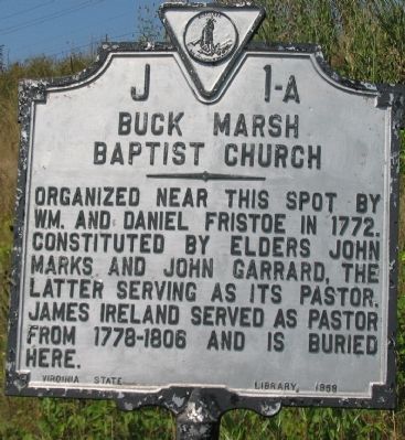
Buck Marsh Baptist Church
Erected 1958 by Virginia State Library. (Marker Number J-1a.)
Topics and series. This historical marker is listed in these topic lists: Cemeteries & Burial Sites • Churches & Religion • Colonial Era. In addition, it is included in the Virginia Department of Historic Resources (DHR) series list. A significant historical year for this entry is 1772.
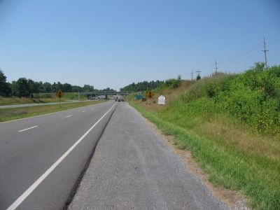
Location. 39° 9.846′ N, 77° 58.537′ W. Marker is near Berryville, Virginia, in Clarke County. Marker is at the intersection of Lord Fairfax Highway (U.S. 340) and Trapp Hill Road (County Route 729), on the right when traveling south on Lord Fairfax Highway. Touch for map. Marker is in this post office area: Berryville VA 22611, United States of America. Touch for directions.
Other nearby markers. At least 8 other markers are within walking distance of this marker. Buck Marsh Fight (a few steps from this marker); Lee's Bivouac, Gettysburg Campaign (approx. 0.3 miles away); Berryville Wagon Train Raid (approx. 0.3 miles away); James Ireland (approx. 0.8 miles away); Traveler Was Tethered on This Spot (approx. 0.9 miles away); Berryville (approx. 0.9 miles away); Clarke County Courthouse (approx. 0.9 miles away); Clarke County Civil War Monument (approx. 0.9 miles away). Touch for a list and map of all markers in Berryville.
Regarding Buck Marsh Baptist Church. Buck Marsh Church site is north of present day John Mosby Highway (Route 7) but is inaccessible at present.
Credits. This page was last revised on July 6, 2021. It was originally submitted on July 22, 2007, by Craig Swain of Leesburg, Virginia. This page has been viewed 2,310 times since then and 65 times this year. Photos: 1, 2. submitted on July 22, 2007, by Craig Swain of Leesburg, Virginia. • J. J. Prats was the editor who published this page.

