Castalian Springs in Sumner County, Tennessee — The American South (East South Central)
Site of Bledsoe's Fort
Photographed by Darren Jefferson Clay, April 11, 2021
1. Site of Bledsoe's Fort Marker
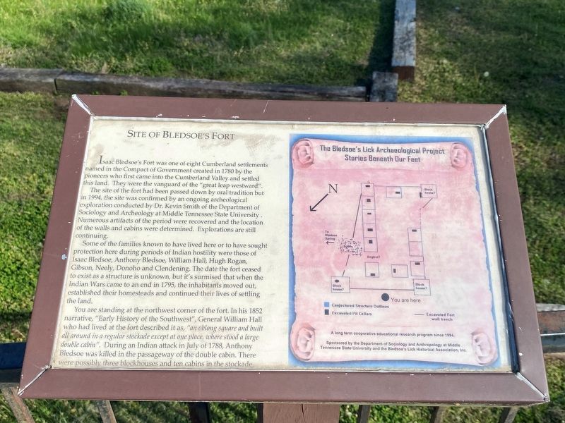
Isaac Bledsoe's Fort was one of eight Cumberland settlements named in the Compact of Government created in 1780 by the pioneers who first came into the Cumberland Valley and settled this land. They were the vanguard of the “great leap westward".
The site of the fort had been passed down by oral tradition but in 1994, the site was confirmed by an ongoing archeological exploration conducted by Dr. Kevin Smith of the Department of Sociology and Archeology at Middle Tennessee State University. Numerous artifacts of the period were recovered and the location of the walls and cabins were determined. Explorations are still continuing.
Some of the families known to have lived here or to have sought protection here during periods of Indian hostility were those of Isaac Bledsoe, Anthony Bledsoe, William Hall, Hugh Rogan, Gibson, Neely, Donoho and Clendening. The date the fort ceased to exist as a structure is unknown, but it's surmised that when the Indian Wars came to an end in 1795, the inhabitants moved out, established their homesteads and continued their lives of settling the land.
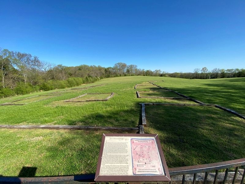
You are standing at the northwest
this page online
Erected by Department of Sociology and Anthropology at Middle Tennessee State University and the Bledsoe's Lick Historical Association.
Topics. This historical marker is listed in these topic lists: Anthropology & Archaeology • Forts and Castles • Settlements & Settlers. A significant historical month for this entry is July 1788.
Location. 36° 24.016′ N, 86° 19.231′ W. Marker is in Castalian Springs, Tennessee, in Sumner County. It can be reached from Hartsville Pike (Tennessee Route 25) 0.6 miles west of Rock Springs Road, on the right when traveling west. Touch for map. Marker is at or near this postal address: 175 Rock Springs Rd, Castalian Springs TN 37031, United States of America. Touch for directions.

Regionally,
Photographed by Darren Jefferson Clay, April 11, 2021
2. Site of Bledsoe's Fort Marker
Other nearby markers. At least 8 other markers are within walking distance of this marker: Bledsoe's Fort, 1783-1806 (here, next to this marker); Isaac Bledsoe (a few steps from this marker); Bledsoe Monument (about 700 feet away, measured in a direct line); An Early Catholic Community (about 700 feet away); Hugh Rogan, Irish Immigrant (about 700 feet away); A Traditional Irish Farmhouse (about 700 feet away); a different marker also named Hugh Rogan (about 700 feet away); Bill "Hoss" Allen (about 700 feet away). Touch for a list and map of all markers in Castalian Springs.
Credits. This page was last revised on October 9, 2021. It was originally submitted on October 8, 2021, by Darren Jefferson Clay of Duluth, Georgia. This page has been viewed 718 times since then and 35 times this year. Photos: 1, 2. submitted on October 8, 2021, by Darren Jefferson Clay of Duluth, Georgia. • Devry Becker Jones was the editor who published this page.
