Centro histórico de Morelia , Michoacán, Mexico — The Pacific Coast (and Central Highlands)
The Chapel of 'El Prendimiento'
Photographed by J. Makali Bruton, September 26, 2021
1. The Chapel of 'El Prendimiento' Marker

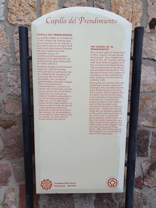
la capilla debe su nombre al Cristo atado de manos que se encuentra en su interior y fue edificada en el siglo XVIII junto con otras nueve capillas, de los cuales hoy sólo quedan cinco. La construcción fue posible gracias a la aportación de particulares que promovian el culto católico.
Durante el siglo XX se hicieron algunas intervenciones incluyendo la sustitución de la cubierta de viguería por una losa de concreto; su lachado, con ventanas geminadas y arcados ciegas, tiene una fisonomía neortománica, y la torre al centro de la fachada resulta poco común en los templos católicos. La nave en su interior muestra adosados a los muros seis pilastras del lado sur y ocho del lado norte, entre cada pilastro, al lado sur de la nove, se ubican nos ventanas altas que permiten iluminar el interior del templo. En el presbiterio se localiza el altor mayor con un ciprés, el cual aloja el Cristo atado de manos.
The Chapel of El Prendimiento
The chapel gets its name from a Christ figure whose hands are bound. This chapel was built in the 18th Century along with nine other chapels,
this page online
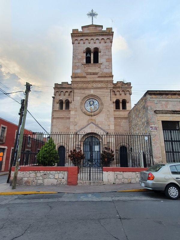
During the 20th Century, this site underwent some significant changes; the wooden beams were replaced by concrete. The facade, with its geminate windows and blind arcades, is an example of neo-romantic architecture, however, the tower located in the central part of the façade is not commonly found in Catholic churches. Inside the chapel, there are six pilasters affixed to the south wall and eight to the north wall in between each pilaster, to the south of the main aisle, there are very high windows that light up the inside area of the chapel. You can see the bound Christ figue, after whom this chapel was named, in a small dome above the main altar.
Topics. This historical marker is listed in these topic lists: Colonial Era • Religion & Religious Structures.
Location. 19° 41.927′ N, 101° 11.657′ W. Marker is in Morelia, Michoacán. It is in Centro histórico de
Photographed by J. Makali Bruton, September 26, 2021
2. The Chapel of 'El Prendimiento' Marker
The marker is on the right inside the chapel's atrium.

Regionally, this marker is in Western Mexico, in the Bajío, and on the Pacific Coast. Globally, it is in North America, specifically in Mesoamerica, on the Ring of Fire, on the Pacific Rim, and in the Western Hemisphere. Historically, it finds itself in what was once New Spain, a Spanish colony, and the Aztec Empire.
Other nearby markers. At least 8 other markers are within walking distance of this marker: The Angel Fountain (about 180 meters away, measured in a direct line); Augustinians in Mexico (approx. 0.2 kilometers away); Temple of San Agustín (approx. 0.3 kilometers away); Birth House of Morelos (approx. 0.3 kilometers away); Jesús Sansón Flores (approx. 0.3 kilometers away); José María Morelos (approx. 0.3 kilometers away); The Lancasterian Normal Schools (approx. 0.3 kilometers away); House of General Morelos (approx. 0.3 kilometers away). Touch for a list and map of all markers in Morelia.
Credits. This page was last revised on April 4, 2025. It was originally submitted on October 10, 2021, by J. Makali Bruton of Washington, District of Columbia. This page has been viewed 146 times since then and 8 times this year. Photos: 1, 2. submitted on October 10, 2021, by J. Makali Bruton of Washington, District of Columbia.
