
Saint Anthony Park in Saint Paul in Ramsey County, Minnesota — The American Midwest (Upper Plains)
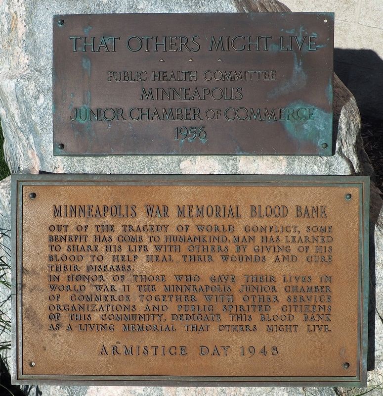
Minneapolis War Memorial Blood Bank
That Others Might Live
Photographed by McGhiever, May 29, 2021
1. Minneapolis War Memorial Blood Bank marker
In honor of those who gave their lives in World War II the Minneapolis Junior Chamber of Commerce together with other service organizations and public spirited citizens of this community, dedicate this blood bank as a living memorial that others might live.
Armistice Day 1948
That Others Might Live
Public Health Committee
Minneapolis
Junior Chamber of Commerce
1956
Erected 1948 by Minneapolis Junior Chamber of Commerce.
Topics. This memorial is listed in these topic lists: Charity & Public Work • Science & Medicine • War, World II.
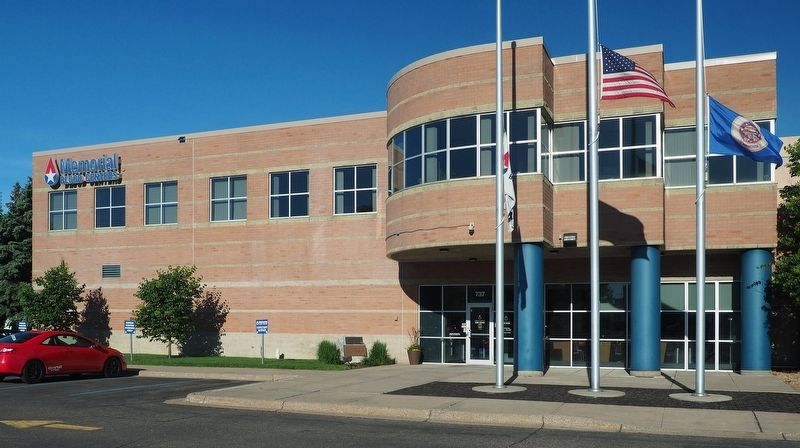
Location. 44° 57.791′ N, 93° 12.048′ W. Memorial is in Saint Paul, Minnesota, in Ramsey County. It is in Saint Anthony Park. It is at the intersection of Pelham Boulevard and Myrtle Avenue, on the right when traveling south on Pelham Boulevard. Mounted on a boulder by the front door of St. Paul's Memorial Blood Center. Touch for map.
this page online

Regionally, this memorial is in the Twin Cities Metropolitan Area. It is also in the American Midwest, in the Corn Belt, and in the Great River Road Region. Globally, it is in North America, the Western Hemisphere, the Western World, and the Anglosphere. Historically, it finds itself in what was once Rupert’s Land, the territory of the Mississippian Culture, and the Louisiana Purchase.
Other nearby markers. At least 8 other markers are within one mile of this marker, measured as the crow flies: The Red River Ox Cart Trail (approx. half a mile away); Meeker Island Lock and Dam Historic Site (approx. 0.7 miles away); Meeker Island Lock and Dam (approx. 0.7 miles away); Prospect Park Water Tower (approx. 0.7 miles away); Mississippi River (approx. 0.9 miles away); Bridging the Mississippi (approx. 0.9 miles away); Roar of Waterfall, Rush of Rapids (approx. 0.9 miles away); Sri Chinmoy Peace Bridge (approx. one mile away). Touch for a list and map of all markers in Saint Paul.
Photographed by McGhiever, May 29, 2021
2. Marker is just to the left of the entrance of the Memorial Blood Center
Credits. This page was last revised on February 12, 2023. It was originally submitted on October 10, 2021, by McGhiever of Minneapolis, Minnesota. This page has been viewed 391 times since then and 34 times this year. Photos: 1, 2. submitted on October 10, 2021, by McGhiever of Minneapolis, Minnesota. • Mark Hilton was the editor who published this page.
