Peoria in Peoria County, Illinois — The American Midwest (Great Lakes)
Camp Peoria
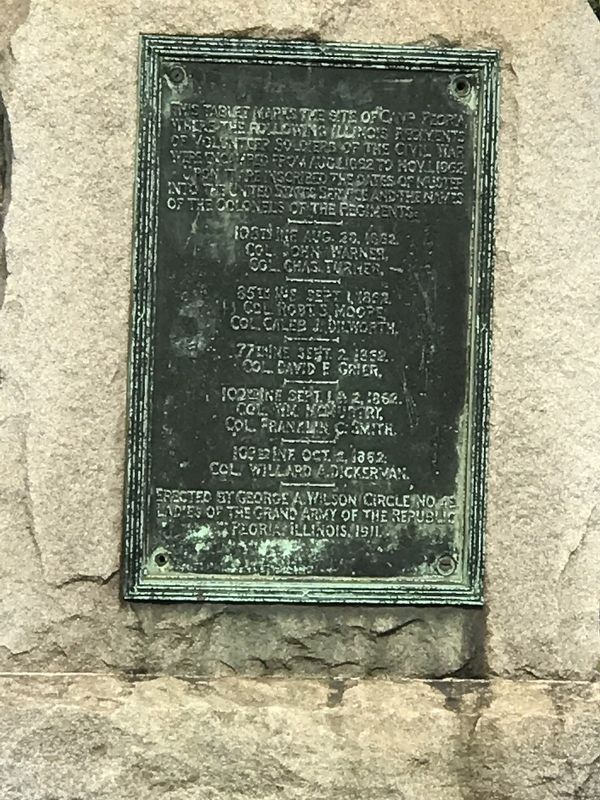
Photographed by Duane and Tracy Marsteller, October 10, 2021
1. Camp Peoria Marker
• 108th Inf. Aug. 20, 1862, Col. John Warner, Col. Chas. Turner
• 85th Inf. Sept. 1, 1862, Col. Robt. S. Moore, Col. Caleb J. Dilworth
• 77th Inf. Sept. 2, 1862, Col. David F. Grier
• 102nd Inf. Sept. 1 &2, 1862, Col. Wm. McMurtry, Col. Franklin C. Smith
• 103rd Inf. Oct. 2, 1862, Col. Willard A. Dickerman
Erected 1911 by George A. Wilson Circle No. 48, Ladies of the Grand Army of the Republic.
Topics and series. This memorial is listed in this topic list: War, US Civil. In addition, it is included in the The Grand Army of the Republic series list.
Location. 40° 42.194′ N, 89° 34.302′ W. Memorial is in Peoria, Illinois, in Peoria County. It is at the intersection of Northeast Adams Street and Mary Street, on the left when traveling north on Northeast Adams Street. Touch for map. Memorial
this page online

Regionally, this memorial is in the Illinois River Valley. It is also in the American Midwest and in the Corn Belt. Globally, it is in North America, the Western Hemisphere, the Western World, and the Anglosphere. Historically, it finds itself in what was once the Viceroyalty of New France, the territory of the Mississippian Culture, and the Northwest Territory.
Other nearby markers. At least 8 other markers are within 2 miles of this marker, measured as the crow flies: Peoria Settlement Site (about 700 feet away, measured in a direct line); Memorial Trees (approx. 0.4 miles away); 1776 Cannon (approx. ¾ mile away); Father Marquette and Louis Jolliet (approx. ¾ mile away); Camp Lyon (approx. 0.9 miles away); Military Services Memorial Plaza (approx. one mile away); Bell & Cornerstone (approx. 1.2 miles away); Peoria County World Wars I and II Memorial (approx. 1.2 miles away). Touch for a list and map of all markers in Peoria.
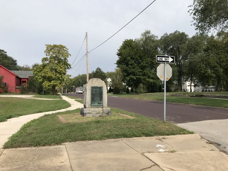
Photographed by Duane and Tracy Marsteller, October 10, 2021
2. Camp Peoria Marker
Credits. This page was last revised on October 12, 2021. It was originally submitted on October 12, 2021, by Duane and Tracy Marsteller of Murfreesboro, Tennessee. This page has been viewed 1,001 times since then and 73 times this year. Photos: 1, 2. submitted on October 12, 2021, by Duane and Tracy Marsteller of Murfreesboro, Tennessee.
