
Near Longwood in Clarke County, Virginia — The American South (Mid-Atlantic)
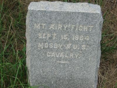
Mt. Airy Fight
Photographed by Craig Swain, June 18, 2007
1. Mt. Airy Fight Marker
Sept. 15, 1864
Mosby * U.S.
Cavalry
Erected by J.E.B. Stuart Chapter of the Confederate Veterans.
Topics and series. This memorial is listed in this topic list: War, US Civil. In addition, it is included in the Sons of Confederate Veterans/United Confederate Veterans series list.
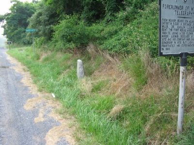
Location. 39° 6.983′ N, 77° 50.81′ W. Memorial is near Longwood, Virginia, in Clarke County. It is at the intersection of Harry Byrd Highway (Virginia Route 7) and Blueridge Mountain Road ( Route 601), on the right when traveling west on Harry Byrd Highway. The marker is at the foot of VA State Marker T 11. Touch for map. Memorial is at or near this postal address: 232 Harry Byrd Hwy, Bluemont VA 20135, United States of America. Touch for directions.

Regionally, this memorial is in the Washington Metropolitan Area and in Northern Virginia. It is also in the American South, specifically in the Upper South, and in the Mid-Atlantic. Globally, it is in North America, the Western Hemisphere, the Western World, and the Anglosphere. Historically, it finds itself in
this page online
Other nearby markers. At least 8 other markers are within 2 miles of this marker, measured as the crow flies: Appalachian Trail and Bears Den (approx. 0.3 miles away); The Lives And Times Of The Snickersville Academy (approx. 0.7 miles away); The Snickersville Academy (approx. 0.7 miles away); Bluemont (approx. ¾ mile away); Snickersville Turnpike (approx. ¾ mile away); Bluemont Historic District (approx. ¾ mile away); a different marker also named Snickersville Turnpike (approx. 1.2 miles away); Lt. Col. Roger Preston Chew (1843-1921) (approx. 1.3 miles away). Touch for a list and map of all markers in Longwood.
Other markers no longer nearby. Crook and Early (was here, next to this marker but has been confirmed missing); Forerunner of Wireless Telegraphy (was here, next to this marker but has been confirmed missing); Clark County / Loudoun County (was here, next to this marker but has been confirmed missing).
More about this memorial. This is one in
Photographed by Craig Swain, June 18, 2007
2. The Mt. Airy Marker at the Foot of VA T 11
Also see . . . Mt. Airy Fight - Snickers Gap - Sept. 15, 1864. Welcome to Bluemont website entry (Submitted on August 4, 2022, by Larry Gertner of New York, New York.)
Credits. This page was last revised on August 6, 2022. It was originally submitted on June 19, 2007, by Craig Swain of Leesburg, Virginia. This page has been viewed 2,676 times since then and 27 times this year. Last updated on July 22, 2007, by Craig Swain of Leesburg, Virginia. Photos: 1, 2. submitted on June 19, 2007, by Craig Swain of Leesburg, Virginia. • J. J. Prats was the editor who published this page.
