
Near Chamberlain in Brule County, South Dakota — The American Midwest (Upper Plains)
The Making & Meaning of Dignity
October 15, 2021
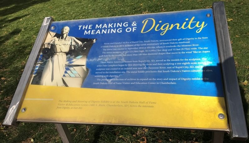
1. The Making & Meaning of Dignity Marker
Norm and Eunabel McKie of Rapid City, South Dakota, announced their gift of Dignity to the State of South Dakota in 2014, in honor of the 125th anniversary of South Dakota statehood.
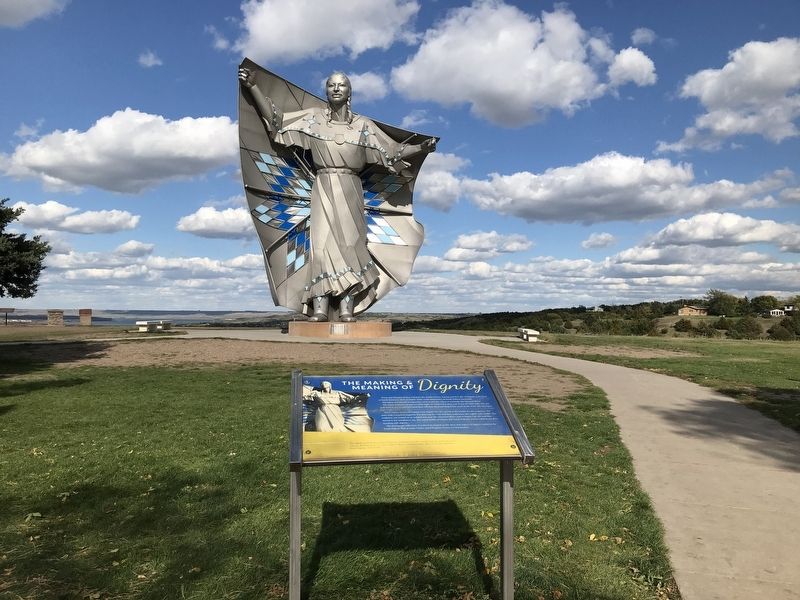
The statue was erected in September 2016 at this site, where it overlooks the Missouri River.
The statue measures 50 feet (15.24m) high, 16 (4.88m) feet deep and 32 feet (9.75m) wide. The star quilt held by the woman has more than 100 blue diamond shapes that move in the wind "like an Aspen leaf".
Three Native American women from Rapid City, SD, served as the models for the sculpture. The artist Dale Lamphere began by first drawing the form and then sculpting a one-eighth-scale model. The sculpture was created in an isolated area near the Cheyenne River, east of Rapid City, SD, and later moved to the installation site. The statue boldly proclaims that South Dakota's Native cultures are alive, standing with dignity.
The permanent collection of archives to expand on the story and impact of Dignity resides at the South Dakota Hall of Fame Visitor and Education Center in Chamberlain.
The Making and Meaning of Dignity Exhibit is
this page online
Topics. This historical marker is listed in these topic lists: Arts, Letters, Music • Indigenous Peoples and Communities. A significant historical month for this entry is July 2016.
Location. This marker has been replaced by another marker nearby. It was located near 43° 47.202′ N, 99° 20.305′ W. Marker was near Chamberlain, South Dakota, in Brule County. It could be reached from U.S. 90 at milepost 263. Located at the Dignity Statue at the Chamberlain rest area. Touch for map. Marker was in this post office area: Chamberlain SD 57325, United States of America. Touch for directions.

Regionally, this marker was in East River. It was also in the American Lewis & Clark Corridor, on the prairies, and on the Northern Plains. Globally, it was in North America, the Western Hemisphere, the Western World, and the Anglosphere. Historically, it found itself in what was once Rupert’s Land and also the Louisiana Purchase.
Other nearby markers. At least 8 other markers are within walking distance
October 15, 2021
2. The Making & Meaning of Dignity Marker & Dignity Statue
Other markers no longer nearby. World's Only Corn Palace - Mitchell (was about 300 feet away, measured in a direct line but has been permanently removed); State Capitol - Pierre (was about 300 feet away but has been permanently removed); Mount Rushmore National Memorial (was about 300 feet away but has been permanently removed).
Related marker. Click here for another marker that is related to this marker.
Credits. This page was last revised on September 25, 2025. It was originally submitted on October 16, 2021. This page has been viewed 2,155 times since then and 90 times this year. Last updated on September 1, 2025. Photos: 1, 2. submitted on October 16, 2021. • Devry Becker Jones was the editor who published this page.
