Holly Springs in Marshall County, Mississippi — The American South (East South Central)
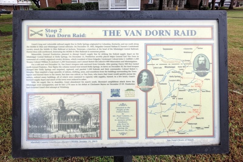
The Van Dorn Raid
Stop 2 Van Dorn Raid:
Meanwhile, General Pemberton planned to disrupt Grant's supply line by striking the supply depot on the Mississippi Central Railroad at Holly Springs. On December 15, Pemberton secretly placed Major General Earl Van Dorn in command a newly organized cavalry division, which consisted of three brigades: Lieutenant Colonel John S. Griffith's 1,500 Texans; Colonel William H. Jackson's 1,200 Tennesseans; and Colonel Robert McCulloch's 800 Missourians and Mississippians.
On a cold and wet December 16, Van Dorn's troopers rode eastward from Grenanda. After passing Cherry Hill they turned north toward Pontotoc. Near Ripley the column turned west toward Holly Springs. At dawn on December 20, the tired troopers charged into Holly Springs and surprised, captured, and paroled 1,500 Federals and their commander, Colonel Robert C. Murphy. They emptied a huge quantity of rations, clothing, arms, and munitions from the buildings surrounding the Town Square and burned them in the streets. But time was critical, so Van Dorn, who knew that Grant would quickly pursue his raiders, ordered many buildings, all of which were crammed to capacity with supplies, burned. In a few hours, Grant's forward supply depot and much of the town were reduced to ashes.
With his supply lines in shambles, Grant abandoned his march south. Sherman's amphibious attack down the Mississippi went unsupported, and he lost 1,776 men in defeat at Chickasaw Bayou on December 27-29. Pemberton had thwarted Grant's first attempt at Vicksburg.
Donated to the People of the United States by Mr. Paul Calame, Jr., of Tennessee, in memory of his forebears, who lived in Holly Springs during the War Between the States.
(captions)
Marshall County Courthouse (Harper's Weekly, January 10, 1863)
Van Dorn's Route of March
Erected 2005 by Blue & Gray Education Society, Holly Springs Tourism & Recreation Bureau. (Marker Number 2.)
Topics. This historical marker is listed in this topic list: War, US Civil. A significant historical date for this entry is December 20, 1862.
Location. 34° 46.063′ N, 89° 26.897′ W. Marker is in Holly Springs, Mississippi, in Marshall County. Marker is at the intersection of South Memphis Street and East Van Dorn Avenue, on the left when traveling south on South Memphis Street. Touch for map. Marker is at or near this postal address: 128 E Van Dorn Ave, Holly Springs MS 38635, United States of America. Touch for directions.
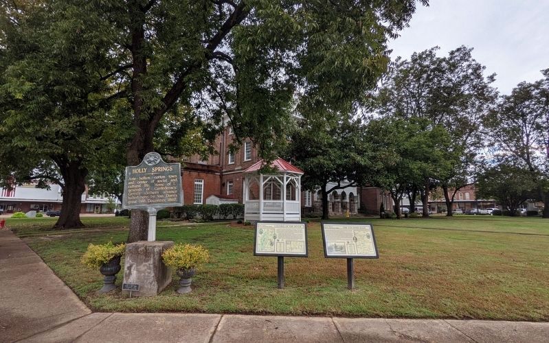
Other nearby markers. At least 8 other markers are within walking distance of this marker. Holly Springs (here, next to this marker); Control Of The River (here, next to this marker); Mississippi Central R.R. Campaign (within shouting distance of this marker); Osborne Bell (within shouting distance of this marker); Ida B. Wells-Barnett (about 300 feet away, measured in a direct line); Hill Country Blues (about 300 feet away); General Order #11 (about 300 feet away); Van Dorn Captures Holly Springs (about 400 feet away). Touch for a list and map of all markers in Holly Springs.
Credits. This page was last revised on October 16, 2021. It was originally submitted on October 16, 2021, by Bernard Fisher of Richmond, Virginia. This page has been viewed 326 times since then and 25 times this year. Photos: 1, 2. submitted on October 16, 2021, by Bernard Fisher of Richmond, Virginia.

