
Near Tompkinsville in Monroe County, Kentucky — The American South (East South Central)
Revolutionary War Veterans
Photographed by Darren Jefferson Clay, August 21, 2021
1. Revolutionary War Veterans Marker
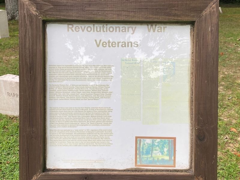
The Kentucky Pension Roll of 1835 and oral histories reveal 37 Revolutionary War veterans settled in Monroe County. They include Ambrose Barlow, William Thomas Bartley, J.T. Beals, Nathan Breed, Thomas Brown Sr., Charles Browning, James Campbell, James Chism, Fielding Curtis, Hardin Denham, William Depp, Ephraim Dicken, Solomon Dickerson, James
this page online
The majority of these men came to the area from Virginia, some from North and South Carolina and still others from as far away as Maryland. A study of Revolutionary veterans in Kentucky shows these men as a rule became the leaders of their communities; taking active roles in the governmental, commercial and spiritual development of their new homelands. For example Joseph Gist and Nathan Breed were commissioned by the county to survey a road. John Rasner was a shoemaker, Matthew Kidwell a land dealer and Ephraim Dicken started the Cumberland River Ferry in Turkey Neck Bend, which continues to this day. Several of these veterans would serve their country again either in the War of 1812 or in battles with Native Americans. Six of these veterans were members of Mill Creek Baptist Church
Photographed by Darren Jefferson Clay, August 21, 2021
2. Revolutionary War Veterans Marker
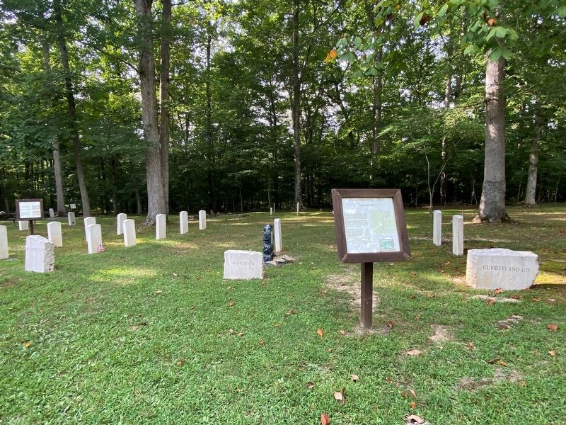
When this site was dedicated as a "state shrine” in 1931, organizers of the event invited the D.A.R. (Daughters of the American Revolution) of Glasgow to participate. According to reports in the local newspaper, this participation continued over the next several years and led to the development of the memorial section of this cemetery. Notice the location markers near here; they face south and are simply engraved with a Kentucky county name. The D.A.R. obtained the military markers for these Revolutionary War veterans. They placed them here in line with the county marker where each veteran lived when he applied for his pension. These men may or may not have actually been buried in this cemetery, and they may or may not have attended church here. The most recent addition to this part of the cemetery was in 2008 when a marker was added for Ephraim Dicken.
Topics. This historical marker is listed in these topic lists: Cemeteries & Burial Sites • Patriots & Patriotism • War, US Revolutionary.
Location. 36° 40.671′ N, 85° 42.44′ W. Marker is near Tompkinsville, Kentucky, in Monroe County. It can be reached from Old Mulkey Park Road. Located at the Old Mulkey Meetinghouse State Historic Site. Touch for map. Marker is at or near this postal address: 38 Old Mulkey Park Rd, Tompkinsville KY 42167, United States of America. Touch for directions.

Regionally, this marker is in Kentucky’s Pennyroyal Region. It is also in the American South and specifically in the Upper South. Globally, it is in North America, the Western Hemisphere, the Western World, and the Anglosphere. Historically, it finds itself in what was once the territory of the Mississippian Culture and also the Antebellum South.
Other nearby markers. At least 8 other markers are within walking distance of this marker: Five Generations of Gospel Preachers (here, next to this marker); Ephraim Dicken (here, next to this marker); Hannah Boone (here, next to this marker); William & Jane (Hart) Howard (here, next to this marker); The Meetinghouse (within shouting distance of this marker); The Book of Records (within shouting distance of this marker); James & Mary Howard Chism (within shouting distance of this marker); William & Jane Hart Howard (within shouting distance of this marker). Touch for a list and map of all markers in Tompkinsville.
Credits. This page was last revised on October 20, 2021. It was originally submitted on October 17, 2021, by Darren Jefferson Clay of Duluth, Georgia. This page has been viewed 892 times since then and 81 times this year. Photos: 1, 2. submitted on October 17, 2021, by Darren Jefferson Clay of Duluth, Georgia. • Mark Hilton was the editor who published this page.
