
Near Culpeper in Culpeper County, Virginia — The American South (Mid-Atlantic)
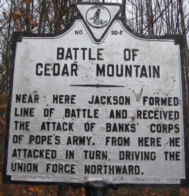
Battle of Cedar Mountain
Photographed by Craig Swain, December 22, 2007
1. Battle of Cedar Mountain Marker
Erected 1927 by Conservation & Development Commission. (Marker Number F-20.)
Topics and series. This historical marker is listed in this topic list: War, US Civil. In addition, it is included in the Virginia Department of Historic Resources (DHR) series list.
Location. 38° 24.303′ N, 78° 4.135′ W. Marker is near Culpeper, Virginia, in Culpeper County. It is at the intersection of General Winder Road (County Route 657) and James Madison Highway (U.S. 15), on the right when traveling west on General Winder Road. Located at the pull-off and trail head for the Civil War Preservation Trust's Cedar Mountain Battlefield walking trail. Touch for map. Marker is in this post office area: Culpeper VA 22701, United States of America. Touch for directions.

Regionally, this marker is in the Washington Metropolitan Area and in Northern Virginia. It is also in the American South, specifically in the Upper South, and
this page online
Other nearby markers. At least 8 other markers are within walking distance of this marker: Hand-to-Hand Fighting (a few steps from this marker); a different marker also named Battle of Cedar Mountain (a few steps from this marker); a different marker also named The Battle of Cedar Mountain (a few steps from this marker); a different marker also named Battle of Cedar Mountain (within shouting distance of this marker); a different marker also named Battle of Cedar Mountain (about 400 feet away); a different marker also named Battle of Cedar Mountain (approx. 0.2 miles away); a different marker also named Battle of Cedar Mountain (approx. 0.2 miles away); a different marker also named Battle of Cedar Mountain (approx. 0.2 miles away). Touch for a list and map of all markers in Culpeper.
Other markers no longer
Photographed by Craig Swain, December 22, 2007
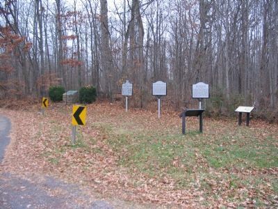
2. Several Markers at the Cedar Mountain Battlefield
Also see . . . Friends of Cedar Mountain Battlefield.
Photographed by Craig Swain, December 22, 2007
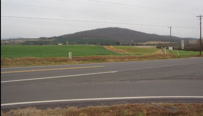
3. Initial Confederate Line
From the intersection of modern James Madison Highway (US 15) and General Winder Road (CR 657) looking east toward Cedar Mountain. The original Crittenden Farm Lane ran from the marker's location through this point, continuing down the present day dirt road to the Crittenden House about half way to the mountain. Initially, Ewell's Confederate Division held this line, with Early's Brigade posted directly along the farm lane here.
Photographed by Craig Swain, December 22, 2007
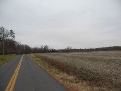
4. Looking North toward Crittenden Gate
One of the objectives of the Federal infantry attacks was Confederate artillery posted diagonally in the field to the right, between the road and the stand of trees in the distance. This road, General Winder Road (CR 657), runs the path of what was Crittenden Farm Lane at the time of the battle. Where the modern road turns (and takes up the historical route of the Orange and Culpeper Road), was a gated entrance to the Crittenden farm.
Credits. This page was last revised on October 21, 2021. It was originally submitted on December 30, 2007, by Craig Swain of Leesburg, Virginia. This page has been viewed 2,473 times since then and 34 times this year. Last updated on October 18, 2021, by Bradley Owen of Morgantown, West Virginia. Photos: 1, 2. submitted on December 30, 2007, by Craig Swain of Leesburg, Virginia. 3, 4. submitted on January 1, 2008, by Craig Swain of Leesburg, Virginia. • Bernard Fisher was the editor who published this page.
