
San Mateo in San Mateo County, California — The American West (Pacific Coastal)
Mission Hospice
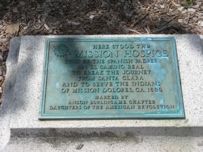
Photographed by Syd Whittle, April 24, 2009
1. Mission Hospice Marker
Here stood the MISSION HOSPICE built around 1800 by the Spanish Padres on El Camino Real to break the journey from Santa Clara and serve the Indians of Mission Dolores. (Marker Number 393.)
Topics and series. This historical marker is listed in these topic lists: Indigenous Peoples and Communities • Landmarks • Notable Places • Religion & Religious Structures. In addition, it is included in the California Historical Landmarks, and the El Camino Real, “The King's Highway” (California) series lists. A significant historical year for this entry is 1800.
Location. 37° 33.923′ N, 122° 19.684′ W. Marker is in San Mateo, California, in San Mateo County. It is on El Camino Real (Highway 82) south of Baywood Avenue, on the right when traveling south. Touch for map. Marker is at or near this postal address: 22 South El Camino Real, San Mateo CA 94402, United States of America. Touch for directions.

Regionally, this marker is in California’s San Francisco Bay Area and on the Coast Ranges. It is also on the American Pacific Coast. Globally, it is in North America, on the Ring of Fire, in the Pacific
this page online
Other nearby markers. At least 8 other markers are within walking distance of this marker: First Business Structure (about 800 feet away, measured in a direct line); Higurashi-en (approx. 0.2 miles away); Historic Camp Site (approx. ¼ mile away); Morse’s Corners (approx. ¼ mile away); Central Park Veterans Memorial (approx. 0.4 miles away); Central Park Veterans Memorial - Screaming Eagles Grove (approx. 0.4 miles away); Central Park Veterans Memorial – World War I (approx. 0.4 miles away); Central Park Veterans Memorial – Japanese American Combat Team (approx. 0.4 miles away). Touch for a list and map of all markers in San Mateo.
Regarding Mission Hospice. This site was designated as California Registered Historical Landmark No.393 on March 8, 1948.
Also see . . . Anza Trail Historic Sites in California. National Parks Service Juan Bautista de Anza National Historic Trail website entry (Submitted on February 6, 2021, by Larry Gertner of New York, New York.)
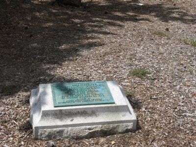
Photographed by Syd Whittle, April 24, 2009
2. Mission Hospice Marker
Credits. This page was last revised on February 6, 2021. It was originally submitted on April 28, 2009, by Syd Whittle of Mesa, Arizona. This page has been viewed 1,773 times since then and 30 times this year. Photos: 1, 2. submitted on April 28, 2009, by Syd Whittle of Mesa, Arizona.
