Laguna in Cibola County, New Mexico — The American Mountains (Southwest)
Post World War II
Laguna Pueblo & Route 66
Economic Impacts
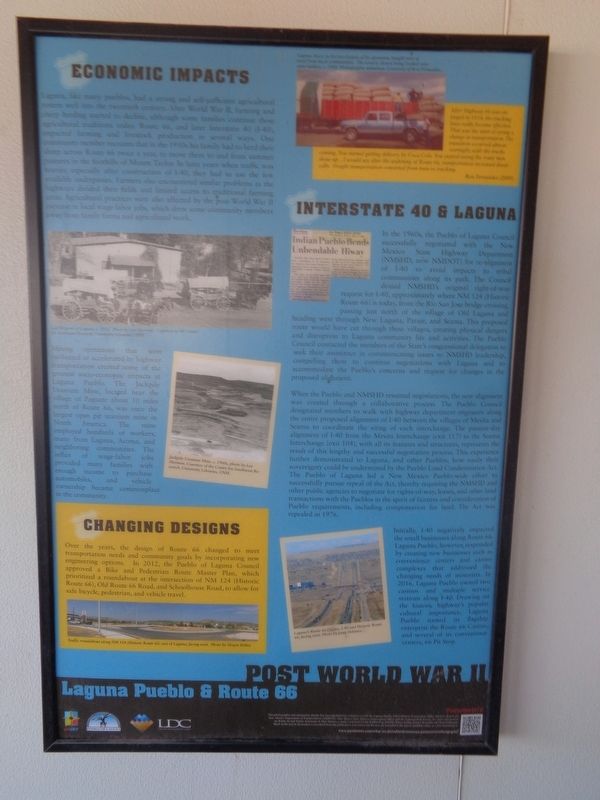
Laguna, like many pueblos, had a strong and self-sufficient agricultural system well into the twentieth century. After World War II, farming and sheep herding started to decline, although some families continue these agricultural traditions today. Route 66, and later Interstate 40 (I-40), impacted farming and livestock production in several ways. One community service member recounts that in the 1950s his family had to herd their sheep across Route 66 twice a year, to move them to and from summer pastures in the foothills of Mount Taylor. In later years when traffic was heavier, especially after construction of I-40, they had to use the few available underpasses. Farmers also encountered similar problems as the highways divided their fields and limited access to traditional farming areas. Agricultural practices were also affected by the post-World War II increase in local wage-labor jobs, which drew some community members away from family farms and agricultural work.
Mining operations that were facilitated or accelerated by highway transportation created some of the greatest socio-economic impacts at Laguna Pueblo. The Jackpile Uranium Mine, located near the village of Paguate about 10 miles north of Route 66, was once the largest open pit uranium mine in North America. The mine employed hundreds of workers, many from Laguna, Acoma, and neighboring communities. The influx of wage-labor jobs provided many families with enough income to purchase automobiles, and vehicle ownership became commonplace in the communities.
Interstate 40 & Laguna
In the 1960s, the Pueblo of Laguna Council successfully negotiated with the New Mexico State Highway Department (NMSHD, now NMDOT) for re-alignment of I-40 to avoid impacts to tribal communities along its path. The Council denied NMSHD's original right-of-way request for I-40, approximately where NM 124 (Historic Route 66) is today, from the Rio San Jose bridge crossing, passing just north of the village of Old Laguna and heading west through New Laguna, Paraje, and Seama. This proposed route would have cut through these villages, creating physical dangers and disruption to Laguna community life and activities. The Pueblo Council contacted the members of the State's congressional delegation to seek their assistance in communicating issues to NMSHD leadership, compelling them to continue negotiations with Laguna and to accommodate the Pueblo's concerns and request for changes in the proposed alignment.
When the Pueblo and NMSHD resumed negotiations, the new alignment was created through a collaborative process. The Pueblo Council designated members to walk with highway department engineers
along the entire proposed alignment of I-40 between the villages of Mesita and Seama to coordinate the siting of each interchange. The present-day alignment of I-40 from the Mesita Interchange (exit 117) to the Seama Interchange (exit 104), with all its features and structures, represents the result of this lengthy and successful negotiation process. This experience further demonstrated to Laguna, and other Pueblos, how easily their sovereignty could be undermined by the Pueblo Land Condemnation Act. The Pueblo of Laguna led a New Mexico Pueblo-wide effort to successfully pursue repeal of the Act, thereby requiring the NMSHD and other public agencies to negotiate for rights-of-way, leases, and other land transactions with the Pueblos in the spirit of fairness and consideration of Pueblo requirements, including compensation for land. The Act was repealed in 1976.
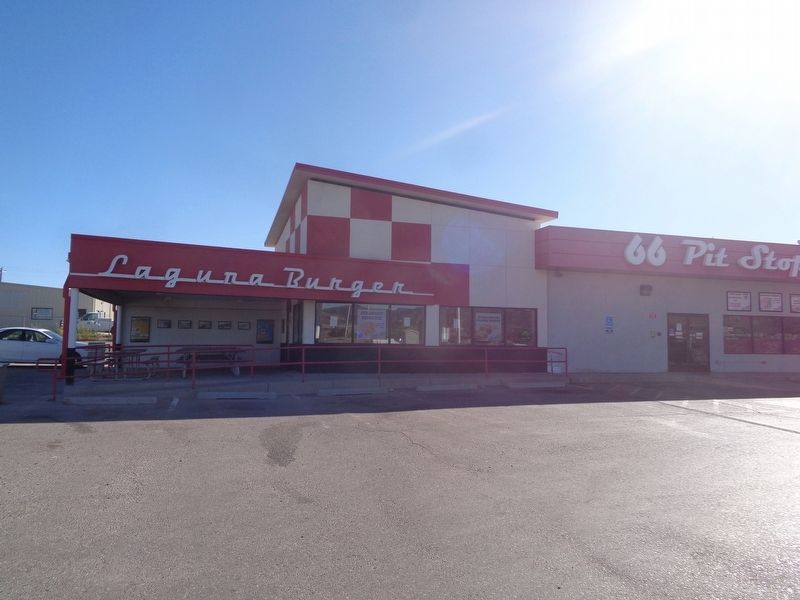
Initially, I-40 negatively impacted the small businesses along Route 66. Laguna Pueblo, however, responded by creating new businesses such as convenience centers and casino complexes that addressed the changing needs of motorists. In 2016, Laguna Pueblo owned two casinos and multiple service stations along I-40. Drawing on the historic highway's popular cultural importance, Laguna Pueblo named its flagship enterprise the Route 66 Casino, and several of its convenience centers, 66 Pit Stop.
(sidebar:)
Changing Designs
Over the years, the design of Route 66 changed to meet transportation needs and community goals by incorporating new engineering options. In 2012, the Pueblo of Laguna Council approved a Bike and Transportation Route Master Plan, which prioritized a roundabout at the intersection of NM 124 (Historic Route 66), Old Route 66 Road, and Schoolhouse Road, to allow for safe bicycle, pedestrian, and vehicle travel.
Erected by New Mexico Department of Transportation, Pueblo of Laguna and the Laguna Development Corporation.
Topics and series. This historical marker is listed in these topic lists: Agriculture • Industry & Commerce • Roads & Vehicles • War, World II. In addition, it is included in the U.S. Route 66 series list. A significant historical year for this entry is 1976.
Location. 35° 2.243′ N, 107° 22.432′ W. Marker is in Laguna, New Mexico, in Cibola County. Marker can be reached from the intersection of New Mexico Route 124 and Old Route 66 Road. Marker is located off a roundabout that connects to the two roads, plus Schoolhouse Road and Interstate 40. Touch for map. Marker is at or near this postal address: 2544 NM-124, Laguna NM 87026, United States of America. Touch for directions.
Other nearby markers. At least 8 other markers are within 11 miles of this marker, measured as the crow flies. Trade - Tourism - Economy (here, next to this marker); San José De La Laguna Mission (approx. 0.6 miles away); a different marker also named San José De La Laguna Mission (approx. 0.6 miles away); Susie Rayos Marmon - Ga-wa goo maa (Early Riser) (approx. 0.6 miles away); Pueblo of Laguna (approx. 0.7 miles away); a different marker also named Pueblo of Laguna (approx. 0.7 miles away); The Battle of Khe Sanh Vietnam, 1968 (approx. 7.9 miles away); a different marker also named Pueblo of Laguna (approx. 10½ miles away). Touch for a list and map of all markers in Laguna.
Credits. This page was last revised on October 19, 2021. It was originally submitted on October 19, 2021, by Jason Voigt of Glen Carbon, Illinois. This page has been viewed 194 times since then and 17 times this year. Photos: 1, 2. submitted on October 19, 2021, by Jason Voigt of Glen Carbon, Illinois.

