Hickman in Fulton County, Kentucky — The American South (East South Central)
Where Dixie Begins
City of Hickman
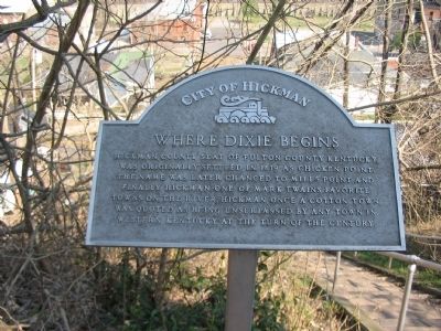
Photographed by Craig Swain, March 17, 2009
1. Where Dixie Begins Marker
Topics. This historical marker is listed in this topic list: Agriculture. A significant historical year for this entry is 1819.
Location. 36° 34.325′ N, 89° 11.645′ W. Marker is in Hickman, Kentucky, in Fulton County. It is at the intersection of East Moulton Street and West Wellington Street, on the right when traveling east on East Moulton Street. Located on the courthouse steps leading to Cumberland Street. Touch for map. Marker is in this post office area: Hickman KY 42050, United States of America. Touch for directions.

Regionally, this marker is in the Jackson Purchase. It is also in the American Midwest, in the South, in the Upper South, and in the Great River Road Region. Globally, it is in North America, the Western Hemisphere, the Western World, and the Anglosphere. Historically,
this page online
Other nearby markers. At least 8 other markers are within 12 miles of this marker, measured as the crow flies: Courthouse Steps (within shouting distance of this marker); Fulton County (within shouting distance of this marker); Hickman Bluff Stabilization Project (approx. half a mile away); Elvis J. Stahr, Jr. (approx. half a mile away); Rufus B. Atwood (approx. half a mile away); New Madrid Earthquake (approx. 8.9 miles away); Casey Jones (approx. 9.1 miles away); Mule-drawn Sorghum Mill (approx. 11.4 miles away in Tennessee). Touch for a list and map of all markers in Hickman.
Another marker is no longer nearby. Confederate Bivouac (was approx. 9.1 miles away but has been confirmed missing).
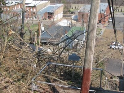
Photographed by Craig Swain, March 17, 2009
2. Where Dixie Begins Marker
Credits. This page was last revised on October 30, 2020. It was originally submitted on April 29, 2009, by Craig Swain of Leesburg, Virginia. This page has been viewed 1,913 times since then and 29 times this year. Photos: 1, 2. submitted on April 29, 2009, by Craig Swain of Leesburg, Virginia.
