Near Culpeper in Culpeper County, Virginia — The American South (Mid-Atlantic)
Battle of Cedar Mountain
The Jaws of Defeat
Photographed by Bradley Owen, October 16, 2021
1. Battle of Cedar Mountain Marker
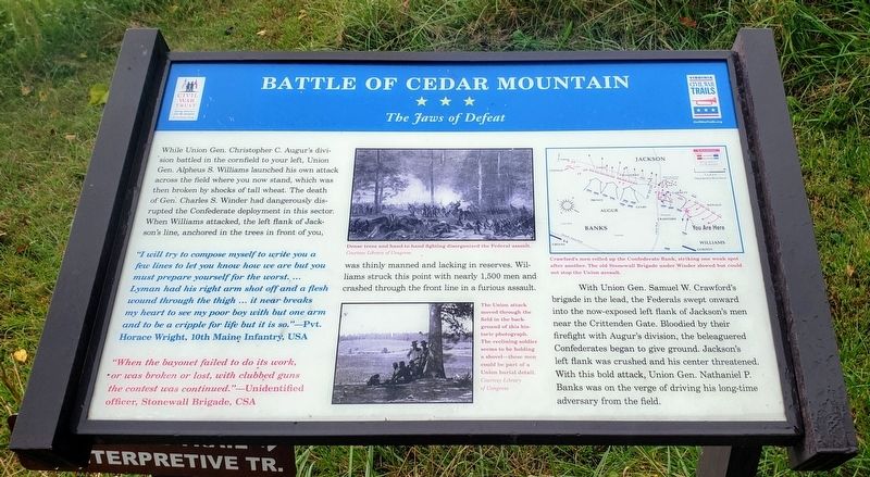
With Union Gen. Samuel W. Crawford's brigade in the lead, the Federals swept onward into the now-exposed left flank of Jackson's men near the Crittenden Gate. Bloodied by their firefight with Augur's division, the beleaguered Confederates began to give ground. Jackson's left flank was crushed and his center threatened. With this bold attack, Union Gen. Nathaniel P. Banks was on the verge of driving his long-time adversary.
"I will try to compose myself to write you a few lines to let you know how we are but you must prepare yourself for the worst. ... Lyman had his right arm shot off and a flesh wound through the thigh ... it near breaks my heart to see my poor boy with but one arm and to be a cripple for life but it is so."—Pvt. Horace Wright, 10th Maine Infantry, USA
"When the bayonet failed to do its work, or was broken or lost, with clubbed guns the contest was continued."—Unidentified officer, Stonewall Brigade, CSA
(Captions)
Dense trees and hand-to-hand fighting disorganized the Federal assault.
Courtesy Library of Congress
The Union attack moved through the field in the background of this historic photograph. The reclining soldier seems to be holding a shovel—these men could be part of a Union burial detail.
Courtesy Library of Congress
Crawford's men rolled up the Confederate flank, striking one weak spot after another. The old Stonewall Brigade under Winder slowed but could not stop the Union assault.
Erected by Civil
this page online
Topics and series. This historical marker is listed in this topic list: War, US Civil. In addition, it is included in the Virginia Civil War Trails series list. A significant historical date for this entry is August 9, 1862.
Location. This marker has been replaced by another marker nearby. It was located near 38° 24.428′ N, 78° 4.021′ W. Marker was near Culpeper, Virginia, in Culpeper County. It could be reached from General Winder Road (Virginia Route 657) 0.3 miles north of James Madison Highway (U.S. 15), on the right when traveling west. Marker is located at Stop 6 on the Cedar Mountain Battlefield Interpretive Trail. Touch for map. Marker was at or near this postal address: 9465 General Winder Road, Culpeper VA 22701, United States of America. Touch for directions.

Regionally, this marker was in the Washington Metropolitan Area and in Northern Virginia. It was also in the American South, specifically in the Upper South, and in the Mid-Atlantic. Globally, it was in North America, the Western Hemisphere, the Western World, and the Anglosphere. Historically, it found itself in what was once
Photographed by Bradley Owen, October 16, 2021
2. Battle of Cedar Mountain Marker
Other nearby markers. At least 8 other markers are within walking distance of this location: A different marker also named Battle of Cedar Mountain (here, next to this marker); a different marker also named Battle of Cedar Mountain (about 400 feet away); a different marker also named Battle of Cedar Mountain (about 500 feet away); a different marker also named Battle of Cedar Mountain (about 600 feet away); a different marker also named The Battle of Cedar Mountain (approx. 0.2 miles away); a different marker also named Battle of Cedar Mountain (approx. 0.2 miles away); Hand-to-Hand Fighting (approx. 0.2 miles away); Tenth Maine (approx. 0.2 miles away). Touch for a list and map of all markers in Culpeper.
Other markers no longer nearby. The Battle of Cedar Mountain (was within shouting distance of this marker but has been permanently removed); a different marker also named The Battle of Cedar Mountain (was about 400 feet away, measured in a direct line but has been permanently removed); a different marker also named Battle of Cedar Mountain (was about 600 feet away but has been replaced with another marker now near it); a different marker also named The Battle of Cedar Mountain (was about 600 feet away but has been permanently removed); a different marker also named The Battle of Cedar Mountain (was about 600 feet away but has been permanently removed); a different marker also named The Battle of Cedar Mountain (was approx. 0.2 miles away but has been permanently removed); Cedar Mountain (was approx. 0.2 miles away but has been permanently removed); a different marker also named Battle of Cedar Mountain (was approx. 0.2 miles away but has been reported to have been replaced with another marker now near it).
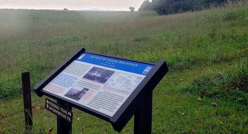
More about this marker. Marker is located at the intersection of the Main Interpretive Trail and the Federal Trail.
Related marker. Click here for another marker that is related to this marker. New Marker At This Location also titled "Battle of Cedar Mountain".
Credits. This page was last revised on August 12, 2022. It was originally submitted on October 22, 2021, by Bradley Owen of Morgantown, West Virginia. This page has been viewed 392 times since then and 25 times this year. Photos: 1, 2. submitted on October 22, 2021, by Bradley Owen of Morgantown, West Virginia. • Bernard Fisher was the editor who published this page.
