Hardeeville in Jasper County, South Carolina — The American South (South Atlantic)
Hardeeville United Methodist Church
Photographed by Brandon D Cross, September 26, 2021
1. Hardeeville United Methodist Church Marker
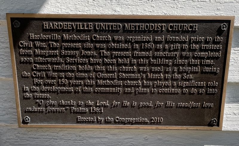
Hardeeville Methodist Church was organized and founded prior to the Civil War. The present site was obtained in 1860 as a gift to the trustees from Margaret Saussy Jones. The present framed sanctuary was completed soon afterwards. Services have been held in this building since that time.
Church tradition holds that this church was used as a hospital during the Civil War at the time of General Sherman’s March to the Sea.
For over 150 years this Methodist church has played a significant role in the development of this community and plans to continue to do so into the future.
“O give thanks to the Lord, for he is good, for his steadfast love endures forever.” Psalms 136:1
Erected 2010 by Hardeeville United Methodist Church congregation.
Topics. This historical marker is listed in these topic lists: Religion & Religious Structures • War, US Civil. A significant historical year for this entry is 1860.
Location. 32° 17.055′ N, 81° 4.622′ W. Marker is in Hardeeville, South Carolina, in Jasper County. It can be reached from the intersection of Main Street (State Highway 46) and Epps Avenue, on the left when
this page online

Regionally, this marker is in the Lowcountry. It is also in the American South, specifically in the Deep South, and on the Eastern Seaboard. Globally, it is in the North Atlantic Region, North America, the Western Hemisphere, the Western World, and the Anglosphere. Historically, it finds itself in what was once New Spain, the territory of the Mississippian Culture, one of the original Thirteen Colonies, one of the Confederate States of America, and the Antebellum South.
Other nearby markers. At least 8 other markers are within 3 miles of this marker, measured as the crow flies: Narrow Gauge Locomotive No. 7 (approx. 0.2 miles away); Nearby Skirmish (approx. 2.4 miles away); Purrysburg Township (approx. 2.4 miles away); Battle of Purrysburg (approx. 2.4 miles away); Maroons of the Savannah River During the Revolutionary War (approx. 2.4 miles away); Sherman's Troops in Purrysburg During the Civil War (approx. 2.4 miles away); Savannah National Wildlife Refuge
Photographed by Brandon D Cross, September 26, 2021
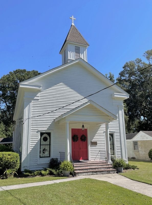
2. Hardeeville United Methodist Church Marker
Also see . . . Hardeeville United Methodist Church. (Submitted on October 22, 2021, by Brandon D Cross of Flagler Beach, Florida.)
Credits. This page was last revised on October 23, 2021. It was originally submitted on October 22, 2021, by Brandon D Cross of Flagler Beach, Florida. This page has been viewed 1,231 times since then and 299 times this year. Photos: 1, 2. submitted on October 22, 2021, by Brandon D Cross of Flagler Beach, Florida. • Bernard Fisher was the editor who published this page.
