
Near Hill City in Pennington County, South Dakota — The American Midwest (Upper Plains)
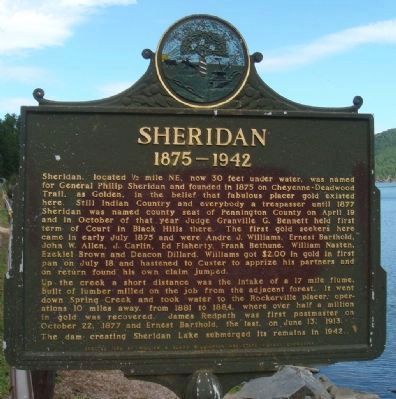
Sheridan
1875–1942
Photographed by William J. Toman, August 8, 2010
1. Sheridan Marker
The marker is topped by the Dakota Territorial Seal: "Liberty and Union, One and Inseparable Now and Forever"
Up the creek a short distance was the intake of a 17 mile flume, built of lumber milled on the job from the adjacent forest. It went down Spring Creek and took water to the Rockerville placer operations 10 miles away, from 1881 to 1884, where over half a million in gold was recovered. James Redpath was first postmaster on October 22, 1877 and Ernest Barthold,
this page online
The dam creating Sheridan Lake submerged its remains in 1942.
Erected 1958 by William & Clara Williamson and State Highway Commission. (Marker Number 255.)
Topics and series. This historical marker is listed in these topic lists: Man-Made Features • Settlements & Settlers. In addition, it is included in the South Dakota State Historical Society Markers series list. A significant historical year for this entry is 1875.
Location. 43° 58.075′ N, 103° 29.092′ W. Marker is near Hill City, South Dakota, in Pennington County. It is on U.S. 385 0.3 miles north of Calumet Road, on the left when traveling south. The marker is at a Highway 385 pull-off next to Sheridan Lake. Touch for map. Marker is in this post office area: Hill City SD 57745, United States of America. Touch for directions.

Regionally, this marker is in South Dakota’s West River, in the Badlands, and in Greater Rapid City. It is also in the American Black Hills, in the Lewis & Clark Corridor, on the prairies, and on the Northern Plains. Globally, it is in North America, the Western Hemisphere, the Western World, and the
Photographed by William J. Toman, August 8, 2010
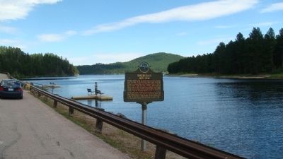
2. Sheridan Marker
With Sheridan Lake in the background.
Other nearby markers. At least 8 other markers are within 5 miles of this marker, measured as the crow flies: Civilian Conservation Corps Camp (approx. 2.4 miles away); "Work Call" (approx. 4.3 miles away); Black Hills Central Railroad's Famous Engine #7 (approx. 5 miles away); The Steam Locomotive (approx. 5 miles away); Water Tank (approx. 5 miles away); The Black Hills Central Railroad (approx. 5 miles away); Hill City Depot (approx. 5.1 miles away); Semaphore & Telegraph (approx. 5.1 miles away). Touch for a list and map of all markers in Hill City.
October 17, 2021
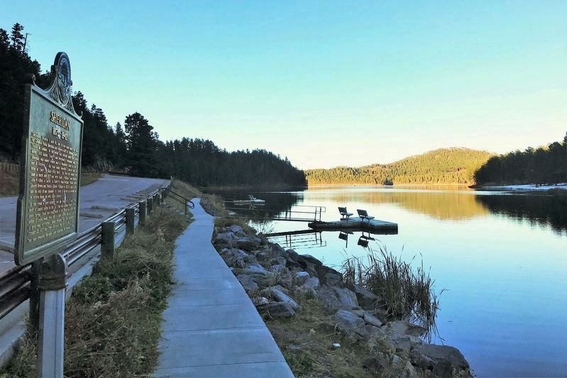
3. Sheridan Marker and Lake
Credits. This page was last revised on October 28, 2021. It was originally submitted on August 10, 2010, by William J. Toman of Green Lake, Wisconsin. This page has been viewed 1,820 times since then and 55 times this year. Last updated on October 22, 2021. Photos: 1, 2. submitted on August 10, 2010, by William J. Toman of Green Lake, Wisconsin. 3. submitted on October 28, 2021. • J. Makali Bruton was the editor who published this page.
