Centro histórico de Morelia , Michoacán, Mexico — The Pacific Coast (and Central Highlands)
Temple of San José
Photographed by J. Makali Bruton, September 28, 2021
1. Temple of San José Marker

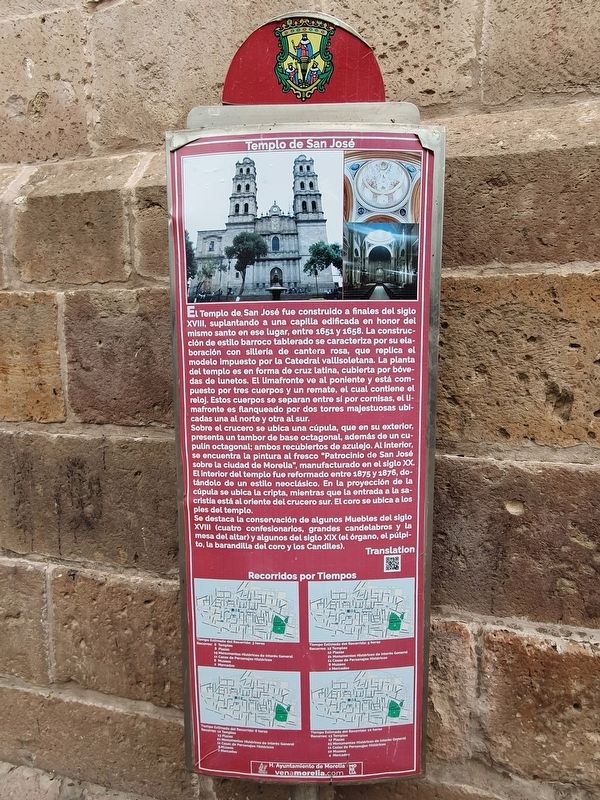
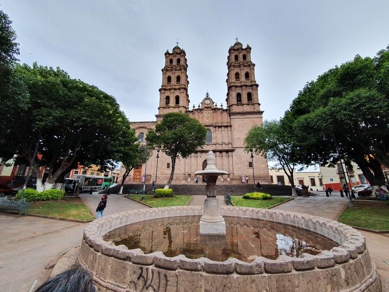
El Templo de San José fue construido a finales del siglo XVIII, suplantando a una capilla edificada en honor del mismo santo en ese lugar, entre 1651 y 1658. La construcción de estilo barroco tablerado se caracteriza por su elaboración con sillería de cantera rosa, que replica el modelo impuesto por la Catedral vallisoletana. La planta del templo es en forma de cruz latina, cubierta por bovedas de lunetos. El limafronte ve al poniente y está compuesto por tres cuerpos y un remate, el cual contiene el reloj. Estos cuerpos se separan entre si por cornisas, el limafronte es flanqueado por dos torres majestuosas ubi- cadas una al norte y otra al sur.
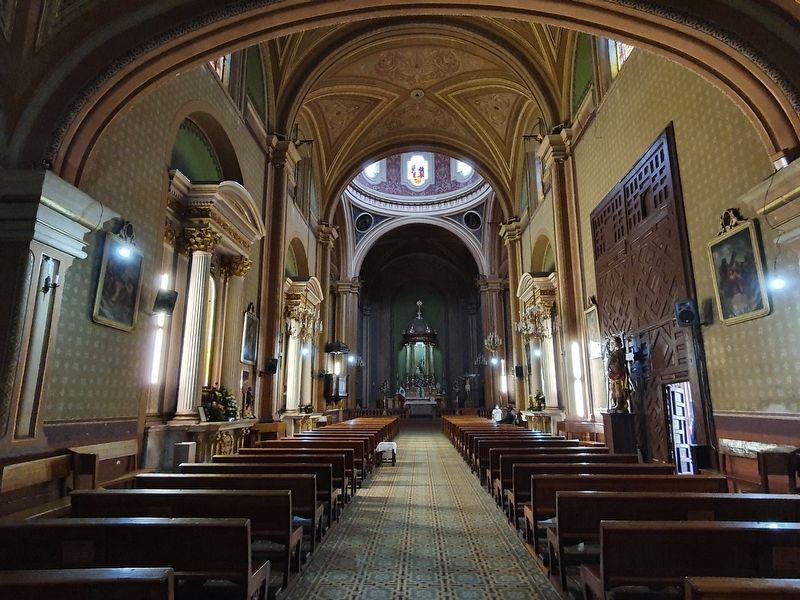
Sobre el crucero se ubica una cúpula, que en su exterior, presenta un tambor de base octagonal, además de un cupulin octagonal; ambos recubiertos de azulejo. Al interior, se encuentra la pintura al fresco "Patrocinio de San José sobre la ciudad de Morella", manufacturado en el siglo XX. El interior del templo fue reformado entre 1875 y 1876, dotándolo de un estilo neoclásico. En la proyección de la cúpula se ubica la cripta, mientras que la entrada
this page online
Se destaca la conservación de algunos Muebles del siglo XVIII (cuatro confesionarlos, grandes candelabros y la mesa del altar) y algunos del siglo XIX (el órgano, el púlpito, la barandilla del coro y los Candiles).
Temple of San José
The Temple of San José was built in the late eighteenth century, supplanting a chapel built in honor of the same saint here, between 1651 and 1658. The construction of baroque style is characterized by its elaboration with pink quarried stone, which replicates the Valladolid Cathedral. The plan of the temple is in the form of a Latin cross, covered by vaults of lunettes. The limafronte faces the west and is composed of three bodies and a finial, which contains the clock. These bodies are separated from each other by cornices, the limafronte is flanked by two majestic towers located one to the north and one to the south.
Above the transept is a dome, which on the outside, has an octagonal base drum, in addition to a small, octagonal cupula, both covered with tile. Inside, there is the fresco painting
Photographed by J. Makali Bruton, September 28, 2021
2. Temple of San José Marker
It highlights the conservation of some furniture of the eighteenth century (four confessionals, large chandeliers and the altar table) and some of the nineteenth century (the organ, the pulpit, the railing of the choir and the candles).
Erected by Honorable Ayuntamiento de Morelia.
Topics. This historical marker is listed in these topic lists: Architecture • Colonial Era • Religion & Religious Structures. A significant historical year for this entry is 1651.
Location. 19° 42.325′ N, 101° 11.333′ W. Marker is in Morelia, Michoacán. It is in Centro histórico de Morelia. It is on Emiliano Zapata just east of Heroé de Nacozari, on the left when traveling east. Touch for map. Marker is in this post office area: Morelia MIC 58000, Mexico. Touch for directions.

Regionally, this marker
Photographed by J. Makali Bruton, September 28, 2021
3. Temple of San José and Marker
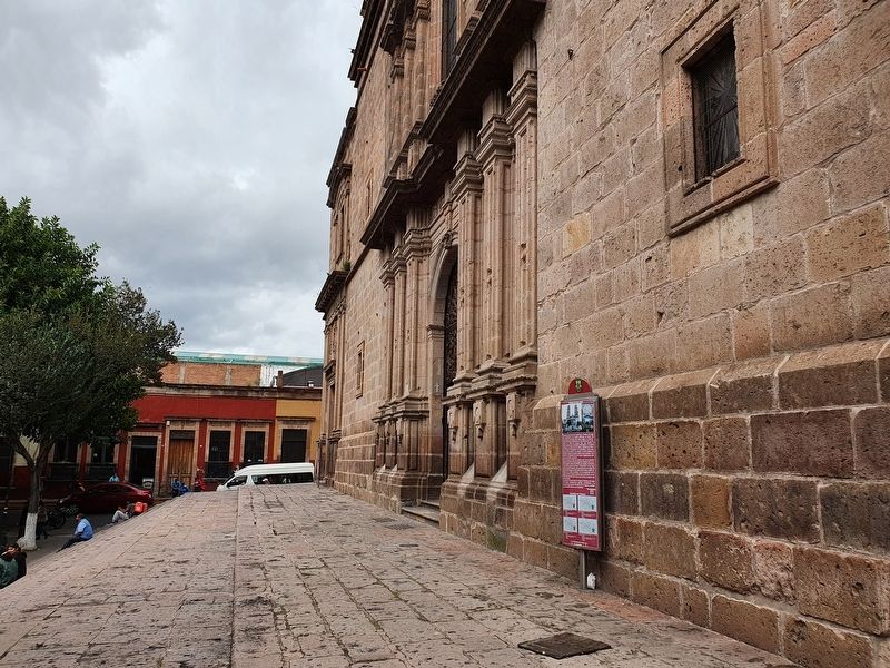
The marker is to the right of the main entrance to the Temple of San José.
Other nearby markers. At least 8 other markers are within walking distance of this marker: The San José Garden (a few steps from this marker); Foundation of Morelia (about 210 meters away, measured in a direct line); House of the Advisor Terán (approx. 0.3 kilometers away); Del Carmen Square (approx. 0.3 kilometers away); General Santos Degollado (approx. 0.3 kilometers away); Temple of the Cross (approx. 0.3 kilometers away); Plaza de la República (approx. 0.3 kilometers away); Del Carmen Church (approx. 0.4 kilometers away). Touch for a list and map of all markers in Morelia.
Photographed by J. Makali Bruton, September 28, 2021
4. An interior view of the Temple of San José
Credits. This page was last revised on April 4, 2025. It was originally submitted on October 23, 2021, by J. Makali Bruton of Washington, District of Columbia. This page has been viewed 474 times since then and 104 times this year. Photos: 1, 2, 3, 4. submitted on October 23, 2021, by J. Makali Bruton of Washington, District of Columbia.
