
Near Sevierville in Sevier County, Tennessee — The American South (East South Central)
Wheatlands
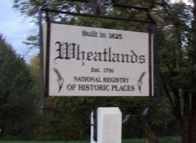
Photographed by Duane and Tracy Marsteller, October 23, 2021
1. Wheatlands Marker
Wheatlands
Est. 1791
National Registry
of Historic Places
Topics. This historical marker is listed in these topic lists: Agriculture • Architecture. A significant historical year for this entry is 1825.
Location. 35° 55.133′ N, 83° 40.081′ W. Marker is near Sevierville, Tennessee, in Sevier County. It is at the intersection of Boyds Creek Highway (Tennessee Route 338) and Cedar Springs Valley Road, on the right when traveling east on Boyds Creek Highway. Touch for map. Marker is in this post office area: Sevierville TN 37876, United States of America. Touch for directions.

Regionally, this marker is in East Tennessee and in the Great Smoky Mountains. It is also in the American South, specifically in the Upper South, in Appalachia, and specifically in Southern Appalachia. Globally, it is in North America, the Western Hemisphere, the Western World, and the Anglosphere. Historically, it finds itself in what was once the original Cherokee Nation, the territory of the Mississippian Culture, one of the Confederate States of America, the State of Franklin, and the Antebellum South.
Other nearby markers. At
this page online
Regarding Wheatlands. Excerpt from the National Register nomination:
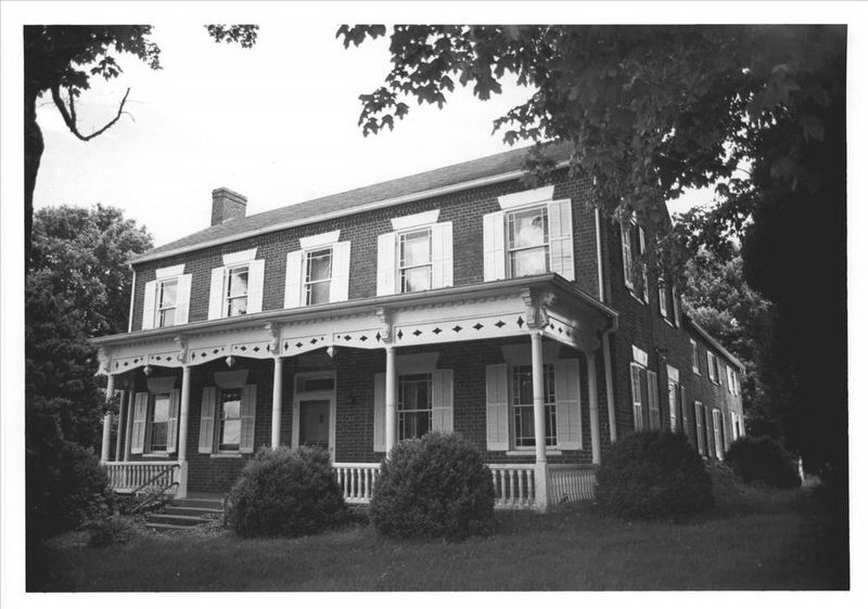
The original owner of Ler-Mac was John Chandler who came to the Boyd's Creek vicinity from the Rocky Springs Community in 1791. Chandler added various tracts of land to this original land grant and eventually accumulated about 4600 acres. His original home burned in 1824 and the home Wheatlands (later known as Ler-Mac) was built of handmade brick, heart pine floors and plastered walls and ceilings; the tin roof, now covered with shingles, was imported from England. The name Wheatlands was derived from Chandler's extensive wheatfields. The farm also included a commissary, tannery and distillery. Chandler was a slave owner, but deplored the practice of breaking up families and selling individuals to different owners. By the outbreak of the Civil War he had accumulated 188 slaves.via NPS, unknown2. WheatlandsNational Register of Historic Places Digital Archive on NPGallery website entry
Click for more information.
The name of the home Ler-Mac is derived from taking syllables from the family names of Chandler and McMahon who married into the original owner's family. …
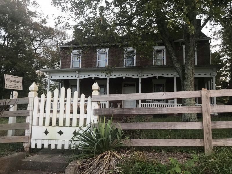
Photographed by Duane and Tracy Marsteller, October 23, 2021
3. Wheatlands
Credits. This page was last revised on April 16, 2022. It was originally submitted on October 25, 2021, by Duane and Tracy Marsteller of Murfreesboro, Tennessee. This page has been viewed 768 times since then and 56 times this year. Photos: 1. submitted on October 25, 2021, by Duane and Tracy Marsteller of Murfreesboro, Tennessee. 2. submitted on April 16, 2022, by Larry Gertner of New York, New York. 3. submitted on October 25, 2021, by Duane and Tracy Marsteller of Murfreesboro, Tennessee.
