Sioux Falls in Minnehaha County, South Dakota — The American Midwest (Upper Plains)
The Amidon Affair
Photographed by Roger Dean Meyer, January 1, 2007
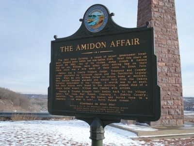
1. The Amidon Affair Marker
Amidon was a County Probate Judge, Treasurer and Commissioner appointed by Governor Jayne and the Territorial Legislature. When he and William failed to return home at sundown, Mrs. Amidon became alarmed and sought help from the Dakota Calvalry detachment in the village. A search was to no avail, but their bodies were found in the morning. Joseph died of a single bullet wound, William was riddled with arrows.
George B. Trumbo brought their bodies back to the village. Later, Sgt. Jesse Buel Watson, Company A, Dakota Cavalry, reported, “we picked up the bodies and buried them in a cemetery…(on what is now)…North Duluth Avenue.”
this page online
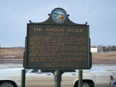
Two days later, orders came by courier from Governor William Jayne to abandon Sioux Falls and seek shelter at the Territorial Capitol at Yankton. Settlers and soldiers together hastily set out in a wagon train before sundown.
Following the settlers flight to Yankton, Sioux Falls remained abandoned until the establishment of Fort Dakota by federal troops in 1865, when settlement was resumed.
Joseph B Amidon was born in Connecticut in 1801. He came to Sioux Falls from Saint Paul, Minnesota, with his wife Mahala, son William and daughter Eliza, sometime before 1860.
Erected 1991 by Minnehaha County Historical Society, The Souoth Dakota State Historical Society, South Dakota Department of Transportation. (Marker Number 537.)
Topics and series. This historical marker is listed in this topic list: Wars, US Indian. In addition, it is included in the South Dakota State Historical Society Markers
Photographed by Roger Dean Meyer, January 1, 2007
2. The Amidon Affair Marker, side 2
Location. 43° 34.45′ N, 96° 42.704′ W. Marker is in Sioux Falls, South Dakota, in Minnehaha County. It is on North Street 0.2 miles north of Maple Avenue, on the right when traveling north. Marker is in a cul de sac .2 miles past Maple Avenue. Touch for map. Marker is in this post office area: Sioux Falls SD 57101, United States of America. Touch for directions.

Regionally, this marker is in East River. It is also in the American Midwest, in the Lewis & Clark Corridor, in the Corn Belt, on the prairies, and on the Northern Plains. Globally, it is in North America, the Western Hemisphere, the Western World, and the Anglosphere. Historically, it finds itself in what was once Rupert’s Land and also the Louisiana Purchase.
Other nearby markers. At least 8 other markers are within 2 miles of this marker, measured as the crow flies: Memorial to the Pioneers of Minnehaha County (here, next to this marker); The Dakota War of 1862 (a few steps from this marker); Amidon Graves Mystery (about 700 feet away, measured in a direct line); Magma (approx. 0.4 miles away); Albert M. Mansor
Photographed by Roger Dean Meyer, January 1, 2007
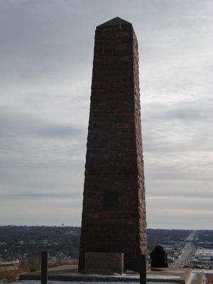
3. The Pioneer Memorial
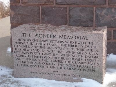
Honors the early settlers who faced the harsh and lonely prairie, the ferocity of the elements, and the uncertainty of their fate in this new land. Between 1856 when Sioux Falls City was platted and 1889 when South Dakota achieved statehood, they built homes, farms and businesses and planted their family roots in Minnehaha County. This Sioux quartzite obelisk was erected in their memory in 1949.
Photographed by Roger Dean Meyer, January 1, 2007
4. The Pioneer Memorial Block
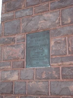
Photographed by Roger Dean Meyer, January 1, 2007
5. Plaque on Pioneer Memorial
Memorial to the Pioneers of Minnehaha County, 1856-1889, Erected by the Minnehaha County Historical Society, 1949.
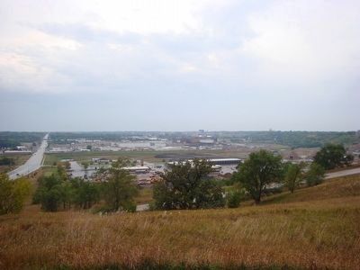
Photographed by Roger Dean Meyer, October 5, 2008
6. View of Sioux Falls from the Amidon Marker site
Credits. This page was last revised on January 5, 2025. It was originally submitted on June 5, 2016, by Roger Dean Meyer of Yankton, South Dakota. This page has been viewed 4,054 times since then and 326 times this year. Last updated on October 27, 2021. Photos: 1, 2, 3, 4, 5, 6. submitted on June 5, 2016, by Roger Dean Meyer of Yankton, South Dakota. • J. Makali Bruton was the editor who published this page.
