DeLand in Volusia County, Florida — The American South (South Atlantic)
Bartram in Volusia County
Volusia County Bartram Trail
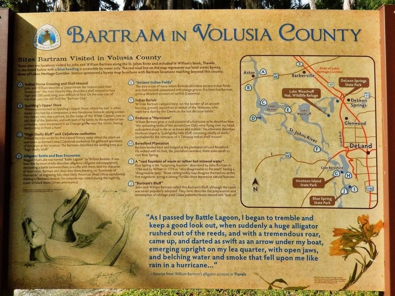
Sites Bartram Visited in Volusia County
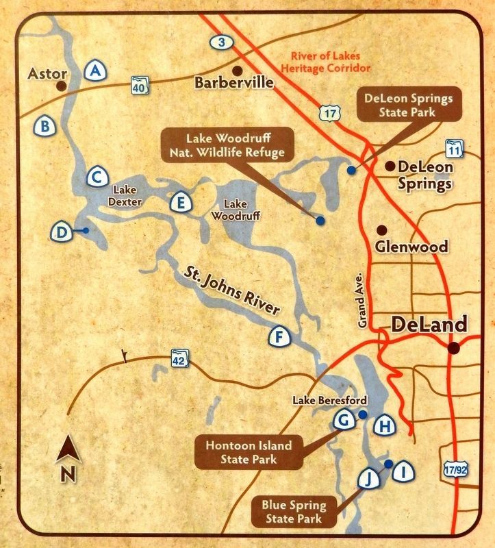
These sites are locations visited by John and William Bartram along the St. Johns River and included in William's book, Travels. A site listed below with a blue heading is accessible by water only. The red road line on the map represents our local scenic byway, River of Lakes Heritage Corridor. Stetson sponsored a byway map brochure with Bartram locations reaching beyond this county.
A • Indian Horse Crossing and Shell Mound
John and William describe a "place where the Indians swim their horses over" the river. Nearby they describe a shell mound six feet high and 200 yards long, now difficult to find. On the east side of the river you can still find the "Bartram Oak."
B • Spalding’s Upper Store
William provisioned at Spalding's Upper Store, where he met "a white trader, who had for a companion, a very handsome Siminole young woman. Her father, who was a prince, by the name of the White Captain, was an old chief of the Siminoles, and with part of his family, to the number of ten or twelve, were encamped in an Orange grove near the stores, having lately come in from a hunt."
C • "High Shelly Bluff" and Calydorea coelestina
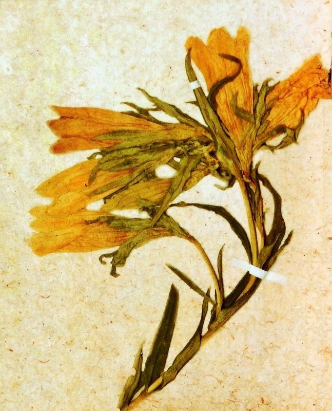
William Bartram wrote his first natural history essay about the plant we now know as Bartram's Ixea (Calydorea coelestina). He gathered specimens of this plant at this location. The Bartrams described the landing here as a "high shelly bluff."
D • Alligator Battle and Bear Encounter
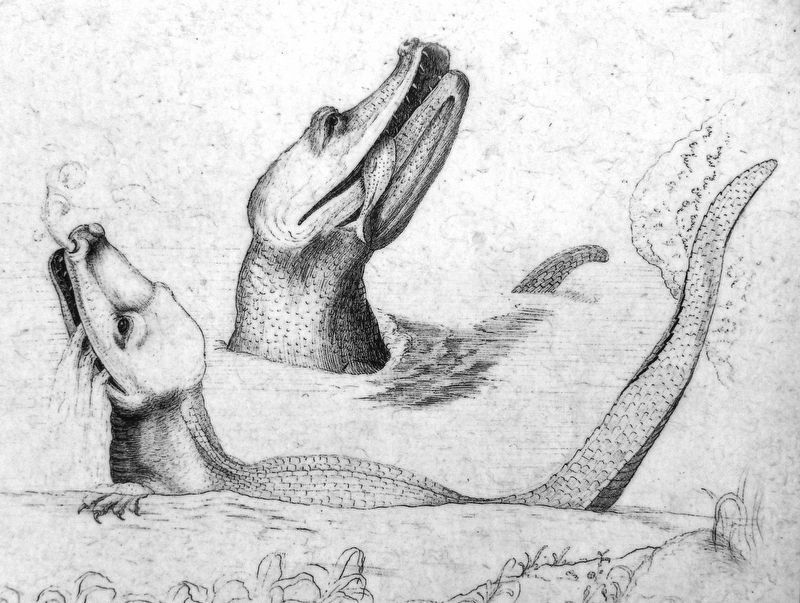
Stagger Mud Lake was named "Battle Lagoon" by William Bartram. It was here that he most vividly describes alligators (Alligator mississippiensis), recounting a battle between them, a scuffle with them, and the character of their nests. Bartram also describes them feeding on "hundreds of thousands" of migrating fish, most likely American Shad (Alosa sapidissima). Adding to Bartram's tension, his campsite was visited during the night by a pair of black bears (Ursus americanus).
E • "Ancient Indian Fields"
This area is one of many where Bartram describes ancient Indian fields and shell mounds juxtaposed with orange groves. It is here that Bartram gives a detailed account of sunfish (Lepomis).
F • Indian Burials
William Bartram camped here "on the border of an ancient burying ground; sepulchres or tumuli of the Yamasees, who were here slain by the Creeks in the last decisive battle."
G • Endures a "Hurricane"
William Bartram gives a vivid account of a hurricane as he describes how "the spreading limbs of the ancient Live Oaks were flying over my head and carried about in the air as leaves and stubble." He otherwise describes Hontoon Island as "a delightful little bluff, consisting chiefly of shells," undoubtedly the remnants of a Timucua Indian shell mound.
H • Beresford Plantation
Bartram landed here and lodged at the plantation of Lord Beresford. He walked with his host, the plantation caretaker, three miles south to visit Blue Spring.
I • A "vast fountain of warm or rather hot mineral water"
Blue Spring is the "surprising fountain" described by John Bartram in 1766 and by William in 1774 as "very disagreeable to the smell," having a "disagreeable taste." Those visiting today may disagree themselves, as this first magnitude spring is among Florida's most impressive natural features.
J • "Bartram's Bluff"
John and William Bartram called this Bartram's Bluff, although the name was never popularly adopted. They here describe the preparation and consumption of cabbage palm (Sabal palmetto) hearts stewed with "bear oil."
"As I passed by Battle Lagoon, I began to tremble and keep a good look out, when suddenly a huge alligator rushed out of the reeds, and with a tremendous roar, came up, and darted as swift as an arrow under my boat, emerging upright on my lea quarter, with open jaws, and belching water and smoke that fell upon me like rain in a hurricane…"
—Excerpt from William Bartram's
alligator account in Travels
Topics and series. This historical marker is listed in these topic lists: Animals • Exploration • Native Americans • Waterways & Vessels. In addition, it is included in the William Bartram Trails series list.
Location. 29° 0.044′ N, 81° 21.345′ W. Marker is in DeLand, Florida, in Volusia County. Marker can be reached from Kalua Way just north of Alhambra Avenue, on the right when traveling north. Marker is located along the Bartram Gardens Trail at the Sandra Stetson Aquatic Center. Touch for map. Marker is at or near this postal address: 2636 Alhambra Avenue, Deland FL 32720, United States of America. Touch for directions.
Other nearby markers. At least 8 other markers are within 2 miles of this marker, measured as the crow flies. Bartram Gardens & Trail (here, next to this marker); Bartram's Plants (a few steps from this marker); Who was William Bartram? (a few steps from this marker); Bartram's Birds (a few steps from this marker); Red Cedar (within shouting distance of this marker); Bartram's Fish (within shouting distance of this marker); Southern Magnolia (within shouting distance of this marker); William Bartram Trail (approx. 1.7 miles away). Touch for a list and map of all markers in DeLand.
Related markers. Click here for a list of markers that are related to this marker. Bartram Gardens & Trail
Also see . . .
William Bartram. From 1773-77, William Bartram explored the American Southeast to record the region’s plants, animals, and Indian peoples. Published in Philadelphia, Pennsylvania, in 1779 Bartram’s Travels has become a classic, in large part because of Bartram’s descriptions of Florida. Nature’s variety inspired Bartram, and his drawings and records introduced readers on both sides of the Atlantic Ocean to East Florida. (Submitted on October 27, 2021, by Cosmos Mariner of Cape Canaveral, Florida.)
Credits. This page was last revised on October 27, 2021. It was originally submitted on October 27, 2021, by Cosmos Mariner of Cape Canaveral, Florida. This page has been viewed 188 times since then and 27 times this year. Photos: 1, 2, 3, 4, 5. submitted on October 27, 2021, by Cosmos Mariner of Cape Canaveral, Florida.


