Near Edgemont in Fall River County, South Dakota — The American Midwest (Upper Plains)
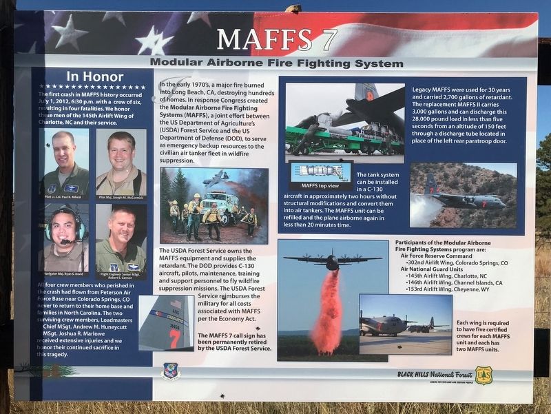
MAFFS 7
Modular Airborne Fire Fighting System
The USDA Forest Service owns the MAFFS equipment and supplies the retardant. The DOD provides C-130 aircraft, pilots, maintenance, training and support personnel to fly wildfire suppression missions. The USDA Forest Service reimburses the military for all costs associated with MAFFS per the Economy Act.
The MAFFS 7 call sign has been permanently retired by the USDA Forest Service.
Left Sidebar:
Pilot Lt. Col. Paul K. Mikeal
Pilot Maj. Joseph M. McCormick
Navigator Maj. Ryan S. David
Flight Engineer Senior MSgt. Robert S. Cannon
All four crew members who perished in the crash had flown from Peterson Air Force Base near Colorado Springs, CO never to return to their home base and families in North Carolina. The two surviving crew members, Loadmasters
Chief MSgt. Andrew M. Huneycutt
MSgt. Joshua R. Marlowe
received extensive injuries and we honor their continued sacrifice in this tragedy.
Right:
Legacy MAFFS were used for 30 years and carried 2,700 gallons of retardant. The replacement MAFFS II carries 3,000 gallons and can discharge this 28,000 pound load in less than five seconds from an altitude of 150 feet through a discharge tube located in place of the left rear paratroop door.
The tank system can be installed in a C-130 aircraft in approximately two hours without structural modifications and convert them into air tankers. The MAFFS unit can be refilled and the plane airborne again in less than 20 minutes time.
Participants of the Modular Airborne Fire Fighting Systems program are:
Air Force Reserve Command
·302nd Airlift Wing, Colorado Springs, CO
Air National Guard Units
·145th Airlift Wing, Charlotte, NC
·146th Airlift Wing, Channel Islands, CA
·153rd Airlift Wing, Cheyenne, WY
Each wing is required to have five certified crews for each MAFFS unit and each has two MAFFS units.
Erected by Black Hills National Forest.
Topics. This historical marker is listed in these topic lists: Air & Space • Disasters • Environment • Horticulture & Forestry. A significant historical year for this entry is 1970.
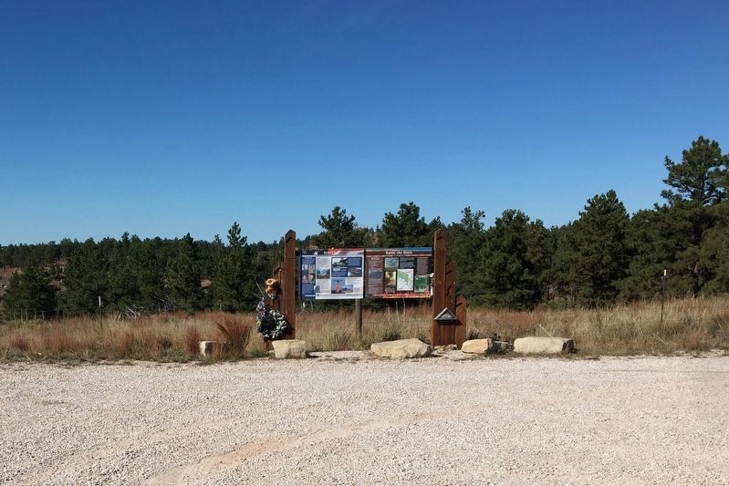
Location. 43° 23.232′ N, 103° 45.316′ W. Marker is near Edgemont, South Dakota, in Fall River County. Marker is on U.S. 18, 0.9 miles south of County Road 18S, on the right when traveling south. Located at a National Forest Interpretive Site on US-18, north of Edgemont. Touch for map. Marker is in this post office area: Edgemont SD 57735, United States of America. Touch for directions.
Other nearby markers. At least 8 other markers are within 11 miles of this marker, measured as the crow flies. Battle the Blaze (here, next to this marker); Camp Collier (approx. 3˝ miles away); Cheyenne River Crossing (approx. 6.4 miles away); Siding 7 (approx. 6˝ miles away); Teddy Roosevelts's Visit to Edgemont (approx. 7.1 miles away); Edgemont: Where the Trail Begins (approx. 7.1 miles away); John Stevenson Robertson: Pioneer Horticulturalist (approx. 10.1 miles away); Fire on the Edge (approx. 10.9 miles away). Touch for a list and map of all markers in Edgemont.
Credits. This page was last revised on October 28, 2021. It was originally submitted on October 28, 2021. This page has been viewed 219 times since then and 18 times this year. Photos: 1, 2. submitted on October 28, 2021. • J. Makali Bruton was the editor who published this page.

