Bardwell in Carlisle County, Kentucky — The American South (East South Central)
Demonstration - 1862
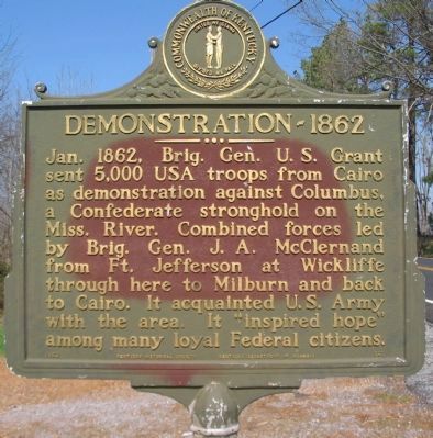
Photographed by Craig Swain, March 17, 2009
1. Demonstration - 1862 Marker
Erected 1962 by Kentucky Historical Society - Kentucky Department of Highways. (Marker Number 563.)
Topics and series. This historical marker is listed in this topic list: War, US Civil. In addition, it is included in the Former U.S. Presidents: #18 Ulysses S. Grant, and the Kentucky Historical Society series lists. A significant historical year for this entry is 1862.
Location. 36° 52.688′ N, 89° 0.893′ W. Marker is in Bardwell, Kentucky, in Carlisle County. It is on Elm Street (U.S. 51/62), on the right when traveling south. Touch for map. Marker is in this post office area: Bardwell KY 42023, United States of America. Touch for directions.

Regionally, this marker is in the Jackson Purchase. It is also in the American Midwest, in the South, and specifically
this page online
Other nearby markers. At least 8 other markers are within 7 miles of this marker, measured as the crow flies: County Named, 1886 (approx. 0.9 miles away); Blandville Courthouse (approx. 5.3 miles away); a different marker also named Blandville Courthouse (approx. 5.3 miles away); Union Supply Base (approx. 6.8 miles away); Lewis and Clark in Kentucky Fort Jefferson (approx. 6.8 miles away); Fort Jefferson Site / Indian Massacre (approx. 6.8 miles away); Fort Jefferson (approx. 6.8 miles away); Purpose of Fort Jefferson & Town of Clarksville (approx. 6.8 miles away).
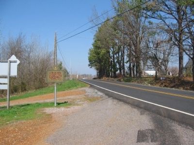
Photographed by Craig Swain, March 17, 2009
2. Demonstration - 1862 Marker
Credits. This page was last revised on June 16, 2016. It was originally submitted on April 30, 2009, by Craig Swain of Leesburg, Virginia. This page has been viewed 2,130 times since then and 30 times this year. Photos: 1, 2. submitted on April 30, 2009, by Craig Swain of Leesburg, Virginia.
