Near Dunkirk in Hardin County, Ohio — The American Midwest (Great Lakes)
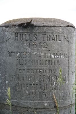
Hullís Trail 1812
Fort Necessity
1812
——ē——
Fort Necessity, 400 Ft. N., 150 Ft. E.
Old Spring, 700 Ft. N.
Erected 1915 by Fort McArthur & Fort Findlay Chapters Daughters of the American Revolution.
Topics and series. This historical marker is listed in these topic lists: Forts and Castles • Military • Roads & Vehicles • War of 1812. In addition, it is included in the Daughters of the American Revolution series list. A significant historical year for this entry is 1812.
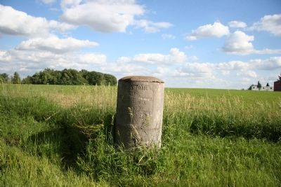
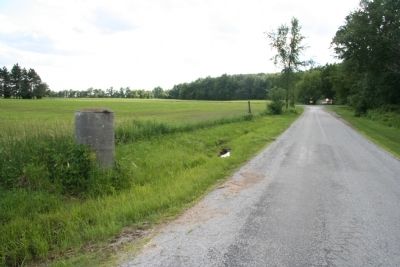
Location. 40° 49.172′ N, 83° 40.151′ W. Marker is near Dunkirk, Ohio, in Hardin County. Marker is on County Road 2. This historical marker is located in northern Hardin County, just south of the Hardin-Hancock countyline, in the midst of a very remote and peaceful country setting. It is situated about 1.5 miles, as the crow flies, to the southwest of the intersection of US 30 and US 68. Touch for map. Marker is in this post office area: Dunkirk OH 45836, United States of America. Touch for directions.
Other nearby markers. At least 8 other markers are within 5 miles of this marker, measured as the crow flies. Williamstown (approx. 1.4 miles away); To Remember Veterans Of All Wars (approx. 2.4 miles away); a different marker also named To Remember Veterans Of All Wars (approx. 2Ĺ miles away); Hull's Trail, 1812 (approx. 2.8 miles away); Dunkirk Veterans Memorial (approx. 3.4 miles away); Hog-Creek Marsh (approx. 4.2 miles away); Shipwreck History (approx. 4.6 miles away); Ellis School Bell (approx. 4.9 miles away). Touch for a list and map of all markers in Dunkirk.
Regarding Hullís Trail 1812. Just prior to the start of the War of 1812 General William Hull had traveled to southern Ohio, seeking to raise an army. Once he had raised an army of soldiers, he began to march northward from Urbana, Ohio. Since much of the territory between Urbana and Detroit was a hostile wilderness through both territory controlled by pro-British Native Americans and an inhospitable region know as the Black Swamp, General Hull built a string of military fortifications, along his route, in order to protect his lines of supply and communication. One of those fortifications was located in the vicinity of this historical marker and it's name was Fort Necessity.
Related markers. Click here for a list of markers that are related to this marker. To better understand the relationship, study each marker in the order shown.
Also see . . .
Hull's Road. This is a link to information provided by Ohio History Central, an online encyclopedia of Ohio History. (Submitted on August 13, 2010, by Dale K. Benington of Toledo, Ohio.)
Credits. This page was last revised on June 28, 2016. It was originally submitted on April 30, 2009, by Dale K. Benington of Toledo, Ohio. This page has been viewed 1,947 times since then and 66 times this year. Photos: 1, 2, 3, 4. submitted on April 30, 2009, by Dale K. Benington of Toledo, Ohio. • Bill Pfingsten was the editor who published this page.


