Near Wickliffe in Ballard County, Kentucky — The American South (East South Central)
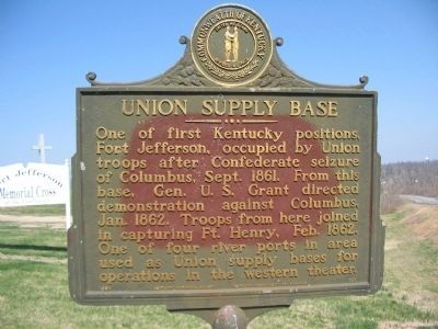
Union Supply Base
Erected 1964 by Kentucky Historical Society and Kentucky Department of Highways. (Marker Number 757.)
Topics and series. This historical marker is listed in this topic list: War, US Civil. In addition, it is included in the Former U.S. Presidents: #18 Ulysses S. Grant, and the Kentucky Historical Society series lists. A significant historical year for this entry is 1861.
Location. 36° 57.337′ N, 89° 5.469′ W. Marker is near Wickliffe, Kentucky, in Ballard County. Marker is on Westvaco Road (U.S. 51/62), on the right when traveling south. Located at the entrance to Fort Jefferson Memorial Cross Park. Touch for map. Marker is in this post office area: Wickliffe KY 42087, United States of America. Touch for directions.
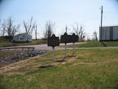
Other nearby markers. At least 8 other markers are within one mile of this marker, measured as the crow flies. Fort Jefferson Site / Indian Massacre (here, next to this marker); Lewis and Clark in Kentucky Fort Jefferson (here, next to this marker); Fort Jefferson (a few steps from this marker); Fort Jefferson Memorial Cross at the Confluence (about 700 feet away, measured in a direct line); Lewis & Clark at Old Fort Jefferson (approx. 0.2 miles away); County Named, 1842 (approx. 0.7 miles away); Private First Class Robert Monroe Hammonds (approx. 0.7 miles away); The Prince of the French Explorers (approx. one mile away). Touch for a list and map of all markers in Wickliffe.
Credits. This page was last revised on June 3, 2021. It was originally submitted on May 2, 2009, by Craig Swain of Leesburg, Virginia. This page has been viewed 1,390 times since then and 24 times this year. Photos: 1, 2. submitted on May 2, 2009, by Craig Swain of Leesburg, Virginia.

