Franz Josef / Waiau in Westland District, West Coast, New Zealand — Southwestern Pacific Ocean
Peter's Pool
Reflections of the past
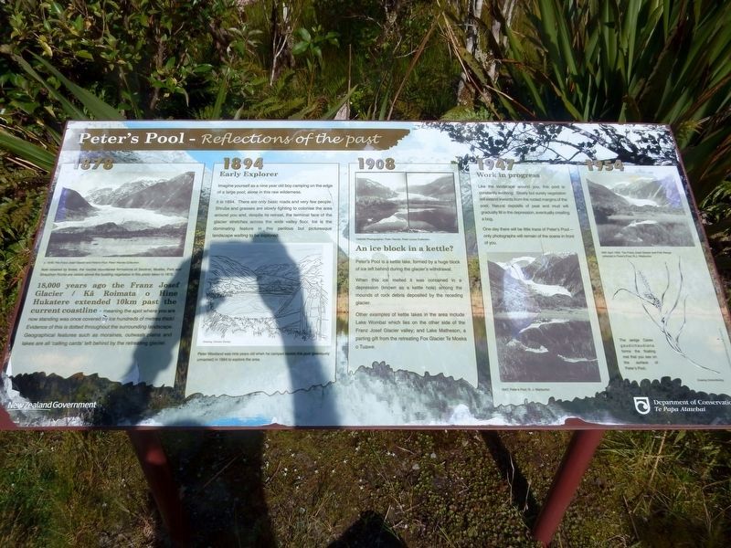
18,000 years ago the Franz Josef Glacier / Ka Roimata o Hine Hukatere extended 10km past the current coastline — meaning the spot where you are now standing was once covered by ice hundreds of metres thick! Evidence of this is dotted throughout the surrounding landscape. Geographical features such as moraines, outwash plains and lakes are all 'calling cards' left behind by the retreating glacier.
[Photo] Now covered by forest, the rouche mountanee formations of Sentinel, Mueller, Park and Strauchon Rocks are visible above the budding vegetation in this photo taken in 1878. c. 1878. The Franz Josef Glacier and Peter's Pool. Peter Wardie Collection
1894
Early Explorer
Imagine yourself as a nine year old boy camping on the edge of a large pool, alone in this raw wilderness.
It is 1894. There are only basic roads and very few people. Shrubs and grasses are slowly fighting to colonise the area around you and, despite its retreat, the terminal face of the glacier stretches across the wide valley floor. Ice is the dominating feature in this perilous but picturesque landscape waiting to be explored.
[Illustration] Peter Westland was nine years old when he camped beside this pool (previously unnamed) in 1894 to explore the area. Drawing: Damian Stones
1908
An ice block in a kettle?
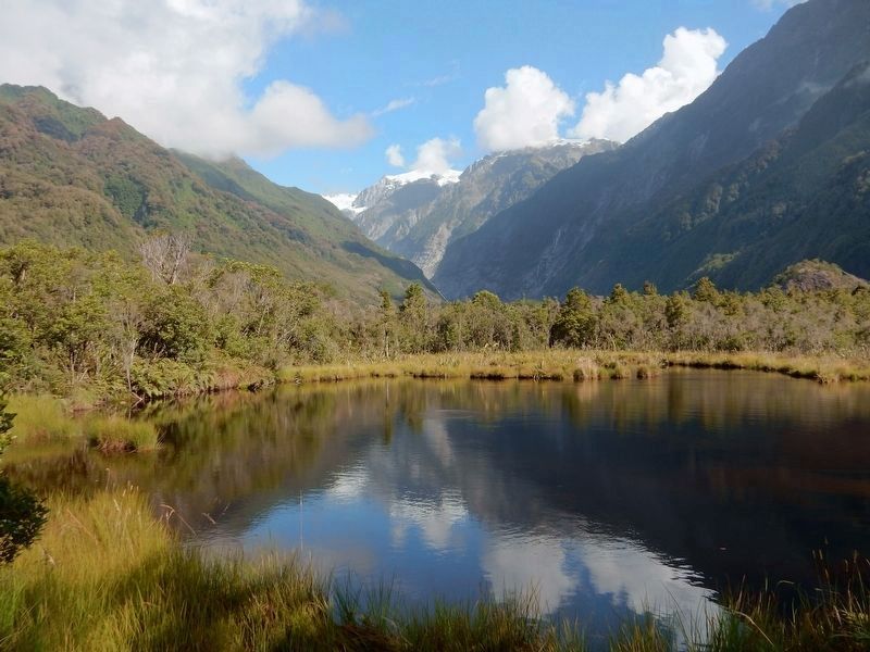
Peter's Pool is a kettle lake, formed by a huge block of ice left behind during the glacier's withdrawal.
When this ice melted it was contained in a depression (known as a kettle hole) among the mounds of rock debris deposited by the receding glacier.
Other examples of kettle lakes in the area include Lake Wombat which lies on the other side of the Franz Josef Glacier valley; and Lake Matheson, a parting gift from the retreating Fox Glacier Te Moeka o Tuawe.
[Photo] 1906/09 Photographer: Peter Hende, Peter Lucas Collection.
1947
Work in progress
Like the landscape around you, this pool is constantly evolving. Slowly but surely vegetation will extend inwards from the rooted margins of the pool. Natural deposits of peat and mud will gradually fill in the depression, eventually creating a bog. One day there will be little trace of Peter's Pool — only photographs will remain of the scene in front of you.
[Photo] 1947; Peter's Pool; R. J. Warburton
1954
[Photo] 30th April 1954; The Fran Josef Glacier and Fit Range reflected in Peter's Pool, R.J. Warburton
[Illustration] The sedge Carex gaudichaudiana forms the floating mat that you see on the surface of Peter's Pool.
Erected by
New Zealand Department of Conservation.
Topics. This historical marker is listed in these topic lists: Environment • Exploration • Waterways & Vessels. A significant historical year for this entry is 1894.
Location. 43° 25.172′ S, 170° 10.327′ E. Marker is in Franz Josef / Waiau, West Coast, in Westland District. Marker is on a trail approximately 0.6 kilometers from the Frank Joseph Glacier parking lot in Westland/Tai Poutini National Park. Touch for map. Marker is in this post office area: Franz Josef / Waiau, West Coast 7886, New Zealand. Touch for directions.
Other nearby markers. At least 1 other marker is within 23 kilometers of this marker, measured as the crow flies. Frontier Building … Legendary Man (approx. 22 kilometers away).
Credits. This page was last revised on February 12, 2022. It was originally submitted on November 4, 2021, by Duane and Tracy Marsteller of Murfreesboro, Tennessee. This page has been viewed 173 times since then and 11 times this year. Photos: 1, 2. submitted on November 4, 2021, by Duane and Tracy Marsteller of Murfreesboro, Tennessee.

