North Newport News , Virginia — The American South (Mid-Atlantic)
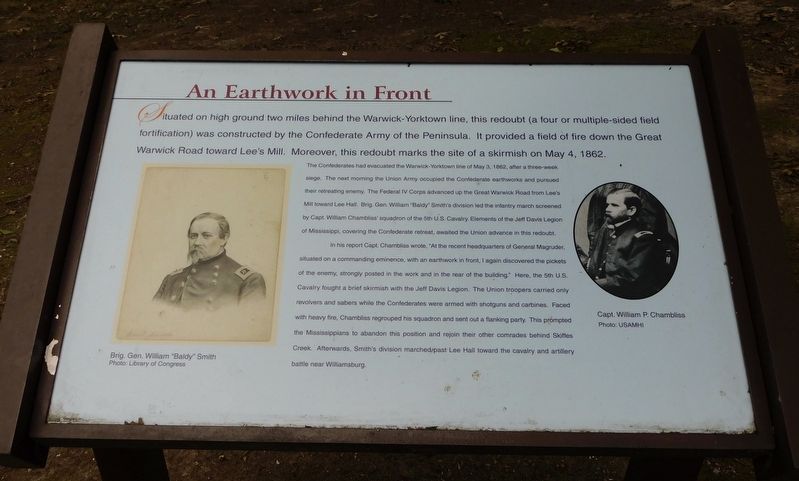
An Earthwork In Front
Photographed by Bradley Owen, October 17, 2021
1. An Earthwork In Front Marker
The Confederates had evacuated the Warwick-Yorktown line on May 3, 1862, after a three-week siege. The next morning the Union Army occupied the Confederate earthworks and pursued their retreating enemy. The Federal IV Corps advanced up the Great Warwick Road from Lee’s Mill toward Lee Hall. Brig. Gen. William “Baldy” Smith’s division led the infantry march screened by Capt. William Chambliss’ squadron of the 5th U.S. Cavalry. Elements of the Jeff Davis Legion of Mississippi, covering the Confederate retreat, awaited the Union advance in this redoubt.
In his report Capt. Chambliss wrote, “At the recent headquarters of General Magruder, situated on a commanding eminence, with an earthwork in front, I again discovered the pickets of the enemy, strongly posted in the work and in the rear of the building.”
this page online
(Photo Captions)
Brig. Gen. William “Baldy” Smith
Photo: Library of Congress
Capt. William P. Chambliss
Photo: USAMHI
Topics. This historical marker is listed in this topic list: War, US Civil. A significant historical date for this entry is May 4, 1862.
Location. 37° 11.984′ N, 76° 34.497′ W. Marker is in Newport News, Virginia. It is in North Newport News. It can be reached from Yorktown Road (Virginia Route 238) 0.7 miles north of Warwick Boulevard (U.S. 60), on the left when traveling north. Marker is located on the grounds of Lee Hall Mansion. Touch for map. Marker is at or near this postal address: 163 Yorktown Road, Newport News VA
Photographed by Bradley Owen, October 17, 2021
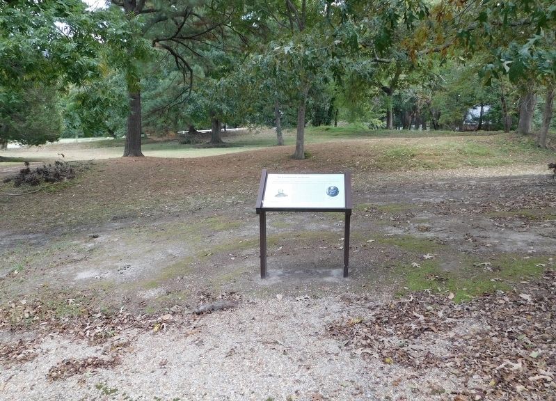
2. An Earthwork In Front Marker
Remains of the multiple sided redoubt can be seen beyond the marker.

Regionally, this marker is on Virginia’s Peninsula, in Hampton Roads, in Coastal Virginia, and in the Hampton Roads Metropolitan Area. It is also in the American South, specifically in the Upper South, in the Tidewater, and on the Eastern Seaboard. Globally, it is in the North Atlantic Region, North America, the Western Hemisphere, the Western World, and the Anglosphere. Historically, it finds itself in what was once the territory of the Mississippian Culture, one of the original Thirteen Colonies, one of the Confederate States of America, and the Antebellum South.
Other nearby markers. At least 8 other markers are within walking distance of this marker: Largest and Most Valuable Estate in the County (within shouting distance of this marker); Lee Hall (within shouting distance of this marker); A Large Brick Kitchen (within shouting distance of this marker); Master and Slaves (about 300 feet away, measured in a direct line); Homestead by the Main Road (about 300 feet away); a different marker also named Lee Hall (about 600 feet away); Chessie System Caboose (approx. 0.4 miles away); a different marker also named Lee Hall (approx. 0.4 miles away). Touch for a list and map of all markers in Newport News.
Other markers no longer nearby. An Earthwork in Front (was here, next to this marker but has been replaced with another marker now near it); a different marker also named Lee Hall (was about 400 feet away but has been replaced with another marker now near it).
Related marker. Click here for another marker that is related to this marker. Old Marker At This Location also titled "An Earthwork in Front".
Also see . . . Lee Hall Mansion. Historic Newport News (Submitted on November 9, 2021.)
Credits. This page was last revised on February 1, 2023. It was originally submitted on November 6, 2021, by Bradley Owen of Morgantown, West Virginia. This page has been viewed 396 times since then and 20 times this year. Photos: 1, 2. submitted on November 6, 2021, by Bradley Owen of Morgantown, West Virginia. • Bernard Fisher was the editor who published this page.
