Santa Rita, Guam — Pacific Ocean (Marianas Archipelago)
Japanese Two-Man Submarine
Courtesy of Thomas P. Martin
1. Japanese Two-Man Submarine Marker
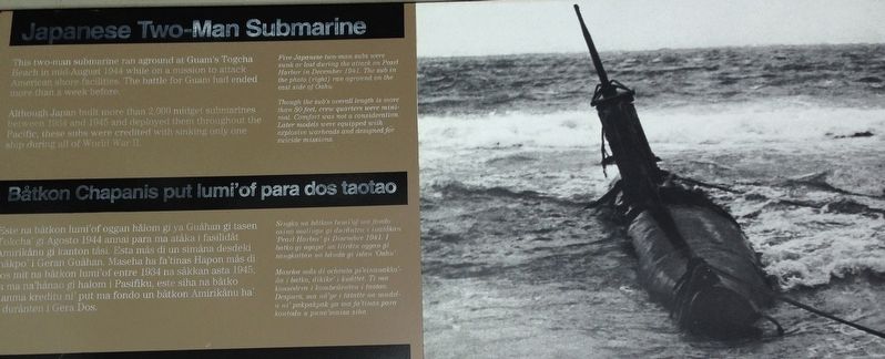
This two-man submarine ran aground at Guam's Togcha Beach in mid-August 1944 while on a mission to attack American shore facilities. The battle for Guam had ended more than a week before.
Although Japan built more than 2,000 midget submarines between 1934 and 1945 and deployed them throughout the Pacific, these subs were credited with sinking only one ship during all of World War II.
[Captions:]
Five Japanese two-man subs were sunk or lost during the attack on Pearl Harbor in December 1941. The sub in the photo (right) ran aground on the east side of Oahu.
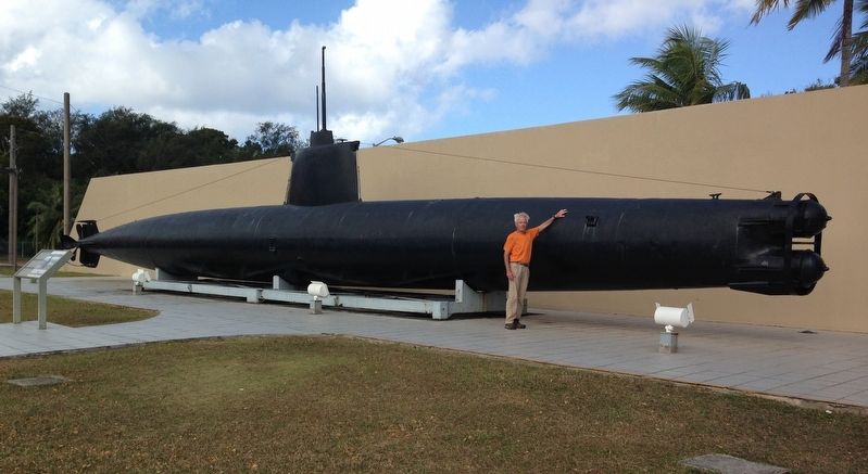
Though the sub's overall length is more than 80 feet, crew quarters were minimal. Comfort was not a consideration. Later models were equipped with explosive warheads and designed for suicide missions.
Erected by National Park Service, U.S. Department of the Interior.
Topics. This historical marker is listed in these topic lists: War, World II • Waterways & Vessels. A significant historical month for this entry is August 1944.
Location. 13° 25.337′ N, 144° 40.535′ E. Marker is in Santa Rita, Guam. It can be reached from the intersection of Marine Corps Drive
this page online

Regionally, it is in North America, in Oceania, in Micronesia, in the Pacific Ocean, in North Pacific, on the Pacific Rim, in the Western Hemisphere, in the Western World, and in the Anglosphere.
Other nearby markers. At least 8 other markers are within 5 miles of this marker, measured as the crow flies: Hidden Defenses (approx. 1.6 miles away); Japanese Anti-Aircraft Gun (approx. 2.7 miles away); Silent Guns (approx. 3 miles away); Attack, Occupation, Liberation (approx. 3.7 miles away); Guam 1941-1944 (approx. 3.8 miles away); The Inland Offensive (approx. 3.8 miles away); Banzai Charges (approx. 3.8 miles away); War in the Pacific National Historical Park (approx. 4.2 miles away).
Also see . . .
1. Ha. 62-76 Japanese Midget Attack Submarine. Wikipedia entry on this unit (Submitted on October 15, 2024, by Larry Gertner of New York, New York.)
2. Type A Kō-hyōteki-class submarine.
Courtesy of Thomas P. Martin
2. Japanese Two-Man Submarine Marker
3. Japanese Two Man Submarine. February 16, 1942 British Movietone clip of U.S. sailors examining the sub that ran ashore at Pearl Harbor. (Submitted on November 11, 2021, by Duane and Tracy Marsteller of Murfreesboro, Tennessee.)
Credits. This page was last revised on October 15, 2024. It was originally submitted on November 11, 2021, by Duane and Tracy Marsteller of Murfreesboro, Tennessee. This page has been viewed 1,338 times since then and 71 times this year. Photos: 1, 2. submitted on November 11, 2021, by Duane and Tracy Marsteller of Murfreesboro, Tennessee.
