Umatac, Guam — Pacific Ocean (Marianas Archipelago)
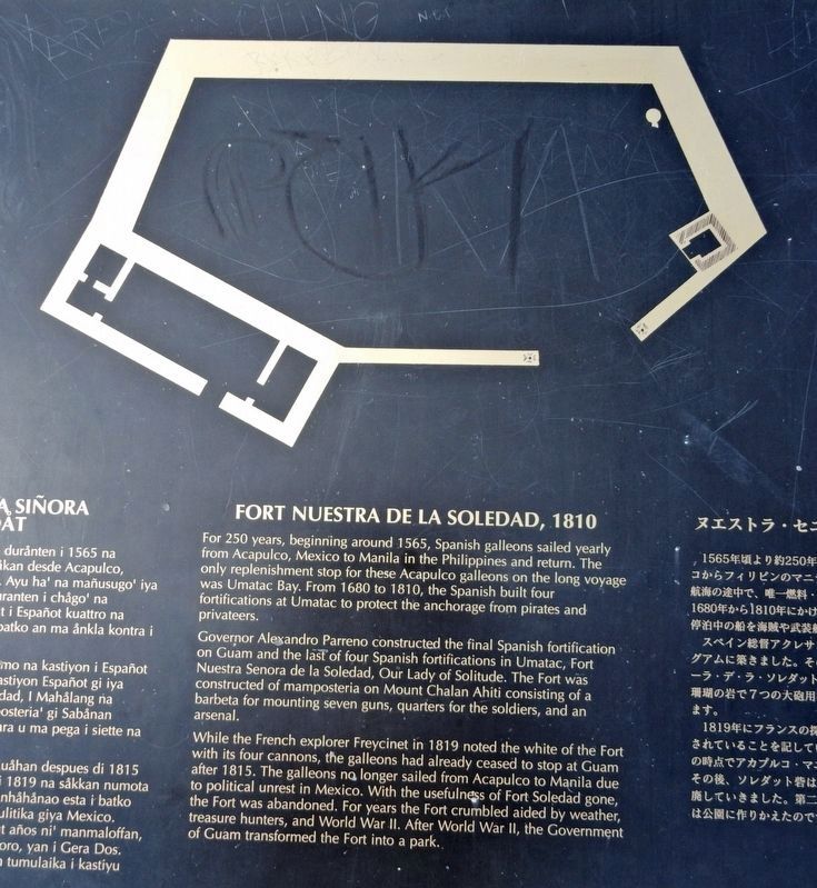
Fort Nuestra de la Soledad, 1810
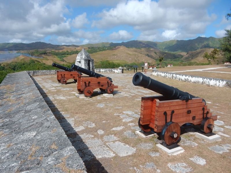
Governor Alexandro Parreno constructed the final Spanish fortification on Guam and the last of four Spanish fortifications in Umatac, Fort Nuestra Señora de la Soledad, Our Lady of Solitude. The Fort was constructed of mamposteria on Mount Chalan Ahiti consisting of a barbeta for mounting seven guns, quarters for the soldiers, and an arsenal.
While the French explorer Freycinet in 1819 noted the white of the Fort with its four cannons, the galleons had already ceased to stop at Guam after 1815. The galleons no longer sailed from Acapulco to Manila due to political unrest in Mexico. With the usefulness of Fort Soledad gone, the Fort was abandoned. For years the Fort crumbled aided by weather, treasure hunters, and World War II. After World War II, the Government of Guam transformed the Fort into a park.
[Non-English portion of marker not transcribed.]
Topics. This historical marker is listed in these topic lists: Forts and Castles • Parks & Recreational Areas • Waterways & Vessels. A significant historical year for this entry is 1810.
Location. 13° 17.713′ N, 144° 39.603′ E. Marker is in Umatac, Guam. Marker can be reached from Soledad Drive, 0.2 miles west of Highway 2 when traveling west. Touch for map. Marker is in this post office area: Santa Rita GU 96915, United States of America. Touch for directions.
Other nearby markers. At least 8 other markers are within 12 miles of this marker, measured as the crow flies. Magellan's Landing (approx. 0.3 miles away); Japanese Anti-Aircraft Gun (approx. 6.4 miles away); Hidden Defenses (approx. 7.4 miles away); Japanese Two-Man Submarine (approx. 8.9 miles away); Silent Guns (approx. 11.7 miles away); Attack, Occupation, Liberation (approx. 12 miles away); Guam 1941-1944 (approx. 12 miles away); The Inland Offensive (approx. 12 miles away).
Also see . . .
1. Fort Soledad. Guampedia entry on the historic fort. (Submitted on November 14, 2021, by Duane and Tracy Marsteller of Murfreesboro, Tennessee.)
2. Asset Detail | Fort Nuestra Señora de la Soledad. National Register of Historic Places nomination (PDF) and photograph (PDF) submitted for the fort. (Submitted on November 14, 2021, by Duane and Tracy Marsteller of Murfreesboro, Tennessee.)
Credits. This page was last revised on November 26, 2021. It was originally submitted on November 14, 2021, by Duane and Tracy Marsteller of Murfreesboro, Tennessee. This page has been viewed 196 times since then and 24 times this year. Photos: 1, 2. submitted on November 14, 2021, by Duane and Tracy Marsteller of Murfreesboro, Tennessee.

