Kingfisher in Kingfisher County, Oklahoma — The American South (West South Central)
The Chisholm Trail
Photographed by Jason Armstrong, July 4, 2021
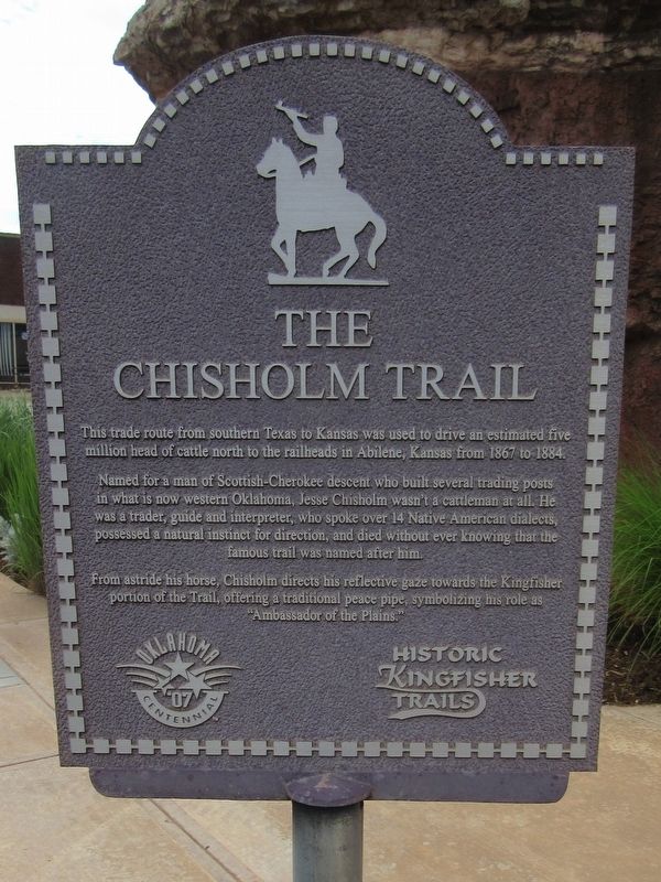
1. The Chisholm Trail Marker
This trade route from southern Texas to Kansas was used to drive an estimated five million head of cattle north to the raiheads in Abilene, Kansas from 1867 to 1884.
Named for a man of Scottish-Cherokee descent who built several trading posts in what is now western Oklahoma, Jesse Chisholm wasn't a cattleman at all. He was a trader, guide and interpreter, who spoke over 14 Native American dialects, possessed a natural instinct for direction, and died without ever knowing that the famous trail was named after him.
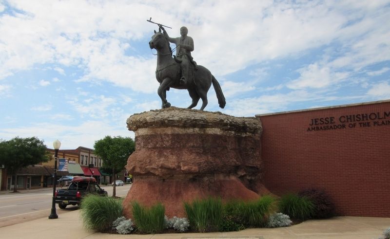
From astride his horse, Chisholm directs his reflective gaze towards the Kingfisher portion of the Trail, offering a traditional peace pipe, symbolizing his role as "Ambassador of the Plains."
Oklahoma '07 Centennial
Historic Kingfisher Trails
Topics. This historical marker is listed in these topic lists: Animals • Indigenous Peoples and Communities • Industry & Commerce • Roads & Vehicles. A significant historical year for this entry is 1867.
Location. 35° 51.669′ N, 97° 55.945′ W. Marker is in Kingfisher, Oklahoma, in Kingfisher County. It is at the intersection of State Highway 33 and U.S.
this page online

Regionally, this marker is in Central Oklahoma — Frontier Country. It is also in the American South, specifically on the prairies, and on the Southern Plains. Globally, it is in North America, the Western Hemisphere, the Western World, and the Anglosphere. Historically, it finds itself in what was once the territory of the Mississippian Culture, the Louisiana Purchase, and Cherokee Outlet.
Other nearby markers. At least 8 other markers are within walking distance of this marker: Lame Bull of the Cheyenne (here, next to this marker); Historical Society Birthplace (within shouting distance of this marker); Kingfisher County Memorial (within shouting distance of this marker); Bracken Building Downtown Hospital (about 300 feet away, measured in a direct line); Pappe Building Grand Opera House (about 400 feet away); First Drug Store in Oklahoma (about 600 feet away); T.G. & Y. (about 600 feet away); "Apostle Paul Sykes" / Lt. Keith Lowry (about 800
Photographed by Jason Armstrong, July 4, 2021
2. Statue of Jesse Chisholm

Photographed by James Hulse, September 16, 2025
3. Closeup of Jesse Chisholm Statue
Credits. This page was last revised on September 21, 2025. It was originally submitted on November 15, 2021, by Jason Armstrong of Talihina, Oklahoma. This page has been viewed 858 times since then and 53 times this year. Photos: 1, 2. submitted on November 15, 2021, by Jason Armstrong of Talihina, Oklahoma. 3. submitted on September 21, 2025, by James Hulse of Medina, Texas. • J. Makali Bruton was the editor who published this page.
