Fort Edward in Washington County, New York — The American Northeast (Mid-Atlantic)
Welcome To The Feeder Canal Historic Locks
Inscription.
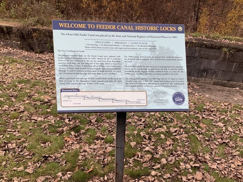
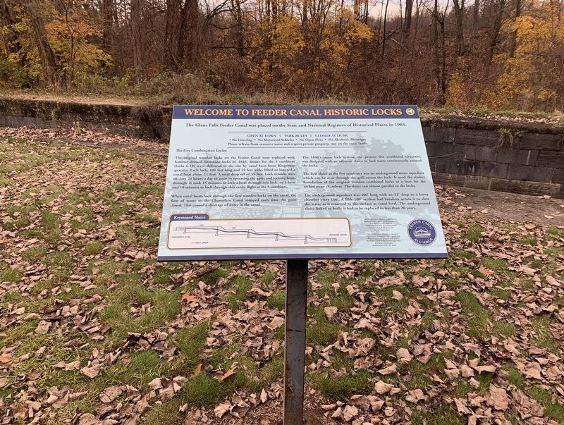
Welcome to the Feeder Canal Historic Locks
The Glens Falls Feeder Canal was placed on the State and National Registers of Historical Places in 1985.
The Five Combination Locks:
The original wooden locks on the Feeder Canal were replaced with hammer-dressed limestone locks by 1845. Stones for the 5 combines (locks 6-10) were delivered to the site by canal boat from Kingsbury quarries. Each lock, 100 feet long and 15 feet wide, lifted or lowered a canal boat about 11 feet. A total drop off of 55 feet. Lock tenders were on duty 24 hours a day to assist in operating the gates and locking boats through. It took 15 minutes to lock a boat through one lock, or 1 hour and 10 minutes to lock through this entire flight at the 5 combines.
When canal boats lock through the first wooden locks on the canal, the flow of water to the Champlain Canal stopped each time the gates closed. This caused a shortage of water in the canal. The 1840's stone lock system, the present five combined structure, was designed with an adjacent sluice to feed water continuously around the locks.
The first sluice at the five combines was an underground stone aqueduct which can be seen through the grill across the lock. It used the timber foundation of the original wooden combined locks as a base for the arched stone chambers. The sluice ran almost parallel to the locks.
The underground aqueduct was 400' long with an 11' drop to a lower chamber every 100'. A fifth 100' section had breakers across it to slow the water as it returned to the surface at canal level. The underground sluice leaked so badly it had to be replaced in less than 20 years.
The Feeder Canal Alliance would like to thank the NYS Canal Corporation and the Leo Cox Beach Philanthropic Foundation for providing funding for this interpretative sign.
The Feeder Canal Alliance, a volunteer organization founded in 1987, spearheads efforts to preserve, promote and protect the Feeder Canal Parks and Heritage Trail. For mare information contact us at (518) 792-5363.
Erected by Feeder Canal Alliance.
Topics. This historical marker is listed in this topic list: Waterways & Vessels. A significant historical year for this entry is 1985.
Location. 43° 17.803′ N, 73° 34.12′ W. Marker is in Fort Edward, New York, in Washington County. The marker is on the feeder canal trail about 0.1 of a mile south of Burgoyne Avenue. Touch for map. Marker is in this post office area: Fort Edward NY 12828, United States of America. Touch for directions.
Other nearby markers. At least 8 other markers are within walking distance of this marker. Headquarters (about 700 feet away, measured in a direct line); Kenyon Lumber (approx. 0.3 miles away); Coal Silos (approx. 0.6 miles away); Martindale Boat Basin (approx. 0.9 miles away); Sandy Hill (approx. 0.9 miles away); Gen. Henry Knox Trail (approx. 0.9 miles away); Townsend Harris (approx. 0.9 miles away); Military Road (approx. 0.9 miles away).
Also see . . . Feeder Canals (Wikipedia). (Submitted on November 16, 2021, by Steve Stoessel of Niskayuna, New York.)
Credits. This page was last revised on November 17, 2021. It was originally submitted on November 16, 2021, by Steve Stoessel of Niskayuna, New York. This page has been viewed 187 times since then and 25 times this year. Photos: 1, 2, 3. submitted on November 16, 2021, by Steve Stoessel of Niskayuna, New York. • Bill Pfingsten was the editor who published this page.


