Auburn in Androscoggin County, Maine — The American Northeast (New England)
Hydroelectric Power
⎯⎯⎯
L'Énergie Hydraulique
Auburn, Maine
| — | The Museum in the Streets | — |
Photographed by Devry Becker Jones (CC0), November 11, 2021
1. Hydroelectric Power / L'Énergie Hydraulique Marker

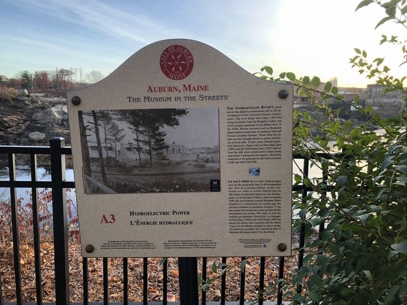
The Androscoggin River's great power has played a tremendous role in the development of the Lewiston-Auburn communities. The river drops more than 1,500 feet along its journey from the Rangeley Lakes, one of the steepest gradients of any Maine river. In the 1850s, Boston investors such as Benjamin Bates funded construction of canals by Iris and French Canadian laborers. Water from the canals traveled through wheels to power machinery in local mills. In later years, turbines generated electricity. Dams such as Deer Rips Dam (1905) and the Gulf Island Dam (1927) upriver from the falls were constructed to retain water and release it during the dry seasons. Electricity continues to be generated in the brick structure on the east side of the falls.
this page online
Erected 2019 by The Museum in the Streets. (Marker Number A3.)
Topics and series. This historical marker is listed in these topic lists: Charity & Public Work • Industry & Commerce • Waterways & Vessels. In addition, it is included in the The Museum in the Streets: Auburn-Lewiston, Maine series list. A significant historical year for this entry is 1850.
Location. 44° 5.968′ N, 70° 13.463′ W. Marker is in Auburn, Maine, in Androscoggin County. It is on Auburn Riverwalk just north of Great Falls Plaza, on the right when traveling north. Touch for map. Marker is at or near this postal address: 20 Great Falls Plaza, Auburn ME 04210, United States of America. Touch for directions.

Regionally, this marker is in the
Photographed by Devry Becker Jones (CC0), November 11, 2021
2. Hydroelectric Power / L'Énergie Hydraulique Marker
Other nearby markers. At least 8 other markers are within walking distance of this marker: Auburn, Maine (a few steps from this marker); Great Falls Geology / La Géologie des Grandes Chutes (within shouting distance of this marker); Knight House / La Maison Knight (about 400 feet away, measured in a direct line); The Knight House (about 400 feet away); Maine's Loss of Farmland & Rise of Small Farms (about 400 feet away); Amitgonpontook (about 400 feet away); Androscoggin Log Drives / Les Draves Sur L'Androscoggin (about 500 feet away); Auburn L.L. Bean Store / Le Magasin L.L. Bean À Auburn (approx. 0.2 miles away). Touch for a list and map of all markers in Auburn.
Credits. This page was last revised on August 26, 2026. It was originally submitted on November 16, 2021, by Devry Becker Jones of Washington, District of Columbia. This page has been viewed 291 times since then and 23 times this year. Photos: 1, 2. submitted on November 16, 2021, by Devry Becker Jones of Washington, District of Columbia.
