Chatsworth in Murray County, Georgia — The American South (South Atlantic)
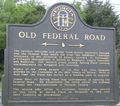
Old Federal Road
The earliest vehicular and postal route from northwest Georgia was the Federal Road, which led from the southeast Cherokee boundary, in the direction of Athens, Georgia to Tennessee; a Y-shaped thoroughfare, it forked at Ramhurst toward Knoxville and Nashville. The western prong passed Spring Place, running northwestward by Ringgold and Rossville.
Rights of the white people to use this way were formally granted by the Cherokees in the 1805 Treaty of Tellico. Prior to that time the trace had served as a trading path to Augusta.
James Vann of Spring Place was instrumental in opening the Federal Road. he established the ferry where the highway crossed the Chattahoochee in Forsyth County.
The second post office in northwest Georgia was opened on this route at Spring Place on November 15, 1819 with John Gambold as postmaster.
Erected 2000 by Georgia Historical Marker. (Marker Number 105-8.)
Topics and series. This historical marker is listed in these topic lists: Native Americans • Roads & Vehicles. In addition, it is included in the Georgia Historical Society series list. A significant historical month for this entry is November 2004.
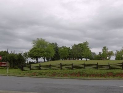
Location. 34° 45.701′ N, 84° 49.328′ W. Marker is in Chatsworth, Georgia, in Murray County. Marker is at the intersection of Georgia Route 225 and Georgia Route 52, on the right when traveling north on State Route 225. Touch for map. Marker is in this post office area: Chatsworth GA 30705, United States of America. Touch for directions.
Other nearby markers. At least 8 other markers are within walking distance of this marker. John Howard Payne (within shouting distance of this marker); Chief Vann House (approx. 0.2 miles away); Springplace Moravian Mission & School (approx. 0.3 miles away); The Moravian Mission to the Cherokee Indians (approx. 0.3 miles away); Anna Rosina Kliest Gambold (approx. 0.3 miles away); "God's Acre" (approx. 0.3 miles away); Principal Chief Charles Renatus Hicks (approx. 0.3 miles away); Springplace Mission (approx. 0.3 miles away). Touch for a list and map of all markers in Chatsworth.
Also see . . . Federal Road. New Georgia Encyclopedia website entry (Submitted on May 3, 2009, by David Tibbs of Resaca, Georgia.)
Credits. This page was last revised on November 2, 2021. It was originally submitted on May 3, 2009, by David Tibbs of Resaca, Georgia. This page has been viewed 1,610 times since then and 64 times this year. Photos: 1, 2. submitted on May 3, 2009, by David Tibbs of Resaca, Georgia. • Bill Pfingsten was the editor who published this page.

