Salem in Essex County, Massachusetts — The American Northeast (New England)
Wharves in the late 1800's
Salem Maritime National Historic Site
| — | National Park Service, U.S. Department of the Interior | — |
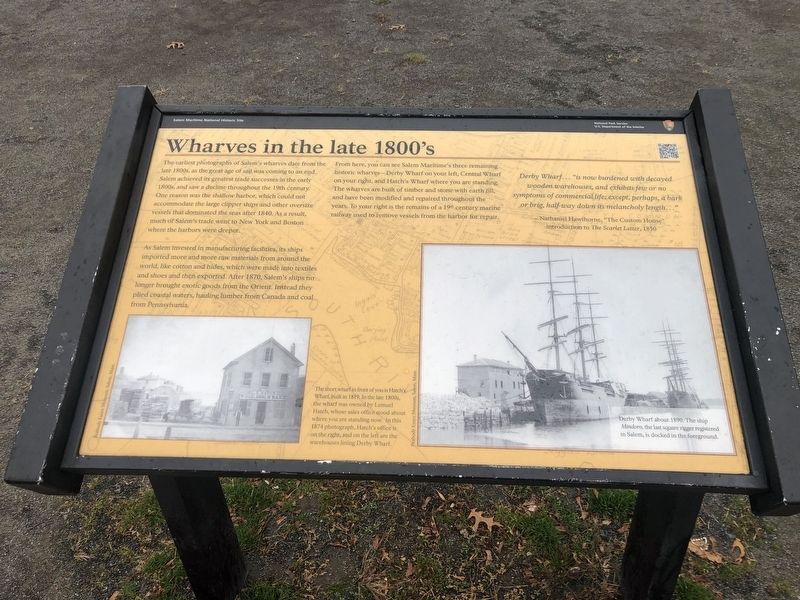
The earliest photographs of Salem's wharves date from the late 1800s, as the great age of sail was coming to an end. Salem achieved its greatest trade successes in the early 1800, and saw a decline throughout the 19th century. One reason was the shallow harbor, which could not accommodate the large clipper ships and other oversize vessles that dominated the seas after 1840. As a result, much of Salem's trade went to New York and Boston where the harbors were deeper.
As Salem invested in manufacturing facilities, its ships imported more and more raw materials from around the world, like cotton and hides, which were made into textiles and shoes and then exported. After 1870, Salem's ships no longer brought exotic goods from the Orient. Instead they plied coastal waters, hauling lumber from Canada and coal from Pennsylvania.
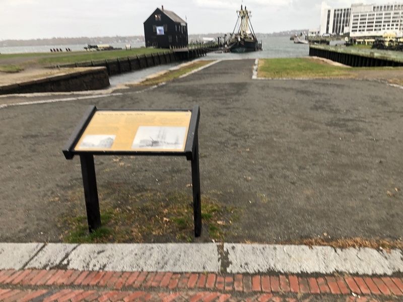
From here, you can see Salem Maritime's three remaining historic wharves—Dery Wharf on your left, Central Wharf on your right, and Hatch's Wharf where you are standing. The wharves are built of timber and stone with earth fill, and have been modified and repaired throughout the years. To your right
this page online
Derby Wharf… "is now burdened with decayed wooden warehouses, and exhibits few or no symptoms of commercial life; except, perhaps, a bark or brig, half-way down its melancholy length…"
— Nathaniel Hawthorne, "The Custom House" introduction to The Scarlet Letter, 1850
[Captions:]
The short wharf in front of you is Hatch's Wharf, built in 1819. In the late 1800s, the wharf was owned by Lemuel Hatch, whose sales office stood about hwere you are standing now. In this 1874 photograph, Hatch's office is on the right, and on the left are the warehouses lining Derby Wharf.
Derby Wharf about 1890. The ship Mindoro, the last square rigger registered in Salem is docked in the foreground.
Erected by National Park Service, U.S. Department of the Interior.
Topics. This historical marker is listed in these topic lists: Industry & Commerce • Waterways & Vessels. A significant historical year for this entry is 1800.
Location. 42° 31.27′ N, 70° 53.237′ W. Marker is in Salem, Massachusetts, in Essex County. It is at the intersection

Regionally, this marker is on Massachusetts’ North Shore, in Greater Boston, and in the Merrimack Valley. It is also in the American Northeast, in New England, and on the Eastern Seaboard. Globally, it is in the North Atlantic Region, North America, the Western Hemisphere, the Western World, and the Anglosphere. Historically, it finds itself in what was once one of the original Thirteen Colonies.
Other nearby markers. At least 8 other markers are within walking distance of this marker: Home for Aged Women (within shouting distance of this marker); Central Wharf (within shouting distance of this marker); a different marker also named Salem Maritime National Historic Site (within shouting distance of this marker); a different marker also named The Custom House (within shouting distance of this marker); a different marker also named Derby Wharf (within shouting distance of this marker); Public Stores (within shouting distance of this marker); a different marker also named Derby House (within shouting distance of this marker); Wharves in the Early 1800s (within shouting distance of this marker). Touch for a list and map of all markers in Salem.
Other markers no longer nearby. Salem Maritime National Historic Site (was a few steps from this marker but has been confirmed missing); Wharves in the Late 1800s (was a few steps from this marker but has been replaced with another marker now near it); Derby Wharf (was within shouting distance of this marker but has been confirmed missing); The Custom House (was within shouting distance of this marker but has been replaced with another marker now near it); Privateer Warehouse (was within shouting distance of this marker but has been permanently removed); Derby House (was within shouting distance of this marker but has been replaced with another marker now near it); a different marker also named Central Wharf (was within shouting distance of this marker but has been confirmed missing); The Pedrick Store House (was within shouting distance of this marker but has been permanently removed).
Related marker. Click here for another marker that is related to this marker. This marker has replaced the linked marker.
Credits. This page was last revised on February 14, 2023. It was originally submitted on November 19, 2021, by Devry Becker Jones of Washington, District of Columbia. This page has been viewed 637 times since then and 80 times this year. Photos: 1, 2. submitted on November 19, 2021, by Devry Becker Jones of Washington, District of Columbia.
