Near Smithfield in Isle of Wight County, Virginia — The American South (Mid-Atlantic)
Welcome to Fort Boykin Historic Park
Captain John Smith’s Adventures on the James
— www.johnsmithtrail.org —
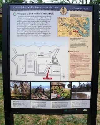
Fort Boykin was named after Francis Marshall Boykin who was a Virginia state senator, general in the state militia and owner of the property on which the fort was built. The topography at Fort Boykin provided the best possible location for monitoring river traffic to Richmond. Laid out by Col. Andrew Talcott of the Confederate Engineers, Fort Boykin fronts the James River on the highest point of land in the area. In addition, shallow areas in the river here bring the navigable channel close to the shoreline, which would have forced all vessels traveling the river within firing range. Although built as a river defense, Fort Boykin was also designed to withstand assault from land. The ground on the back and sides of the fort slopes naturally away, a condition that afforded the Confederates a commanding view in all directions.
(right sidebar)
Captain John Smith’s Trail
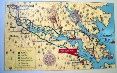
John Smith knew the James River by its Algonquian name: Powhatan, the same as the region’s paramount chief. Smith traveled the river many times between 1607 and 1609, trading with Virginia Indians to ensure survival at Jamestown. What he saw of Virginia’s verdant woodlands and pristine waters inspired him to explore the greater Chesapeake Bay, chronicling its natural wonders.
Trail Markers
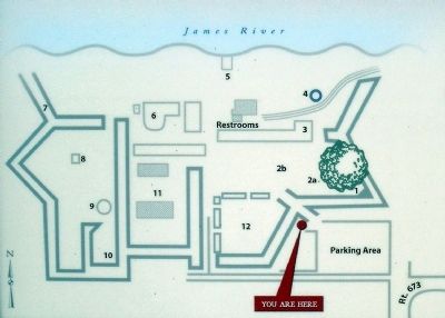
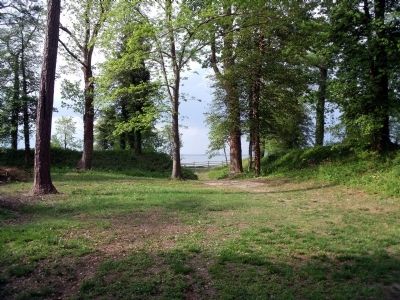
1. Gun Salient – This gun salient protected the fort from attack over land. The construction is typical of the Civil War period. It is believed that an Army Columbarium was used at this position.
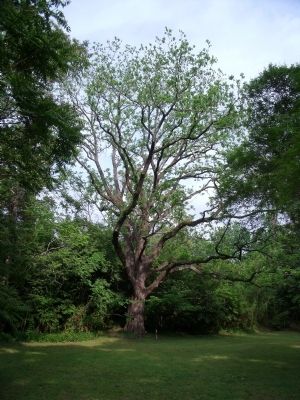
2a. Black Walnut – It is believed to be the second largest Black Walnut in the state. This tree dominates the parade ground. The approximate age of the tree is 200 years plus.
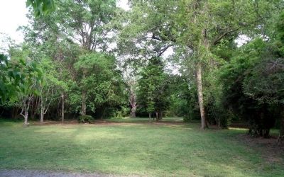
2b. Parade Ground – The parade ground was used to assemble troops and perform all ceremonial activities.
3. Magazine A – Built in 1861-1862, this magazine was destroyed by a Union landing party. Fragments of brick are still found throughout Fort Boykin.
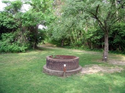
4. Well – The date of this well is unknown. It is believed to have been built before 1860. Many artifacts, which were thrown in by Confederate troops before they abandoned the fort, were excavated from the well.
5. James River – Passage to Richmond by water is possible by the James River. Protection of Richmond was the Confederates’ primary reason for locating here.
6. Magazine B – The bricks that remain are all that is left of this magazine. It was also destroyed by the Union landing party. Take note how the bricks were pushed back by the explosion.
7. Beach Access
8. Chimney Base – The brick fireplace was used to prepare food and as a place to gather. Around this area were living quarters and the headquarters for Confederate troops.
9. Flag Mound – Each morning and evening, the Confederate flag was raised and lowered at this mound.
10. Gun Salient
11. Barn Area
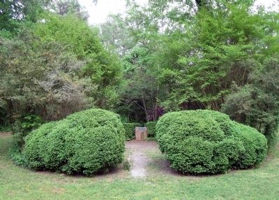
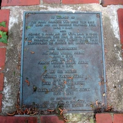
12. Greer Garden – This garden was designed by Mr. and Mrs. Herbert Greer, who lived at the fort from 1908-1931.
(bottom sidebar)
Walnut Tree. Eagles fishing offshore can sometimes be seen roosting on the massive branches of the old trees that grace the property at Fort Boykin. This black walnut is reputed to be the second largest specimen in the state.
Cannon. A replica of a Confederate cannon rests silently above the Burwell Bay. The commanding bluff overlooking the river was the highest promontory in the area and provided a strategic view in all directions.
Picnicking. A blooming camellia welcomes wintertime visitors to the picnic area near the bluff. A shelter provides shade for guests in the summer as they look out over the bay where Union ironclad vessels pounded Confederate defenses in May of 1862.
Beach. Visitors stroll along the beach for a better view of the land generally known as Day’s Neck. The shoreline has retreated about 260 feet since 1873. This area once formed part of a plantation known as The Rocks.
Erected by Captain
John Smith’s Trail, James River Association, Virginia Department of Conservation and Recreation, Chesapeake Bay Gateways Network. (Marker Number 35.)
Topics. This historical marker is listed in these topic lists: Colonial Era • Forts and Castles • Settlements & Settlers • War, US Civil. A significant historical month for this entry is May 1862.
Location. 37° 2.026′ N, 76° 37.067′ W. Marker is near Smithfield, Virginia, in Isle of Wight County. Marker can be reached from the intersection of Fort Boykin Trail (Virginia Route 705) and Mogarts Beach Road (Virginia Route 673), on the left when traveling north. This marker is in the parking lot of Fort Boykin Historic Park. Touch for map. Marker is at or near this postal address: 7410 Fort Boykin Trail, Smithfield VA 23430, United States of America. Touch for directions.
Other nearby markers. At least 8 other markers are within walking distance of this marker. Welcome to Fort Boykin (a few steps from this marker); Fort Boykin (a few steps from this marker); Fort Boykin Memorial (within shouting distance of this marker); Camp Eustis Attacks Fort Boykin (about 300 feet away, measured in a direct line); The Well (about 300 feet away); The Fort's Last Private Owners (about 400 feet away); Fort Boykin during the Civil War (about 600 feet away); The Historic James and its Tributaries (about 800 feet away). Touch for a list and map of all markers in Smithfield.
Related marker. Click here for another marker that is related to this marker. Old Marker At This Location titled Fort Boykin Historic Park.
Also see . . .
1. Captain John Smith’s Trail. (Submitted on May 4, 2009.)
2. Smithfield & Isle of Wight Convention and Visitors Bureau. Fort Boykin Historic Park. (Submitted on May 4, 2009.)
3. Virginia Birding and Wildlife Trail. Site CTW03: Fort Boykin Historic Park. (Submitted on May 4, 2009.)
4. Fort Boykin. National Register of Historic Places (Submitted on November 9, 2021.)
Credits. This page was last revised on April 7, 2024. It was originally submitted on May 4, 2009, by Bernard Fisher of Richmond, Virginia. This page has been viewed 3,115 times since then and 59 times this year. Photos: 1, 2, 3. submitted on May 4, 2009, by Bernard Fisher of Richmond, Virginia. 4. submitted on April 5, 2024, by Bernard Fisher of Richmond, Virginia. 5, 6, 7, 8, 9, 10. submitted on May 4, 2009, by Bernard Fisher of Richmond, Virginia.
