Lebanon in Laclede County, Missouri — The American Midwest (Upper Plains)
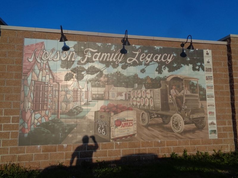
Nelson Family Legacy
Photographed by Jason Voigt, April 25, 2021
1. Nelson Family Legacy Marker
The information tiles are on the right of the mural
(each subject has its own square tile)
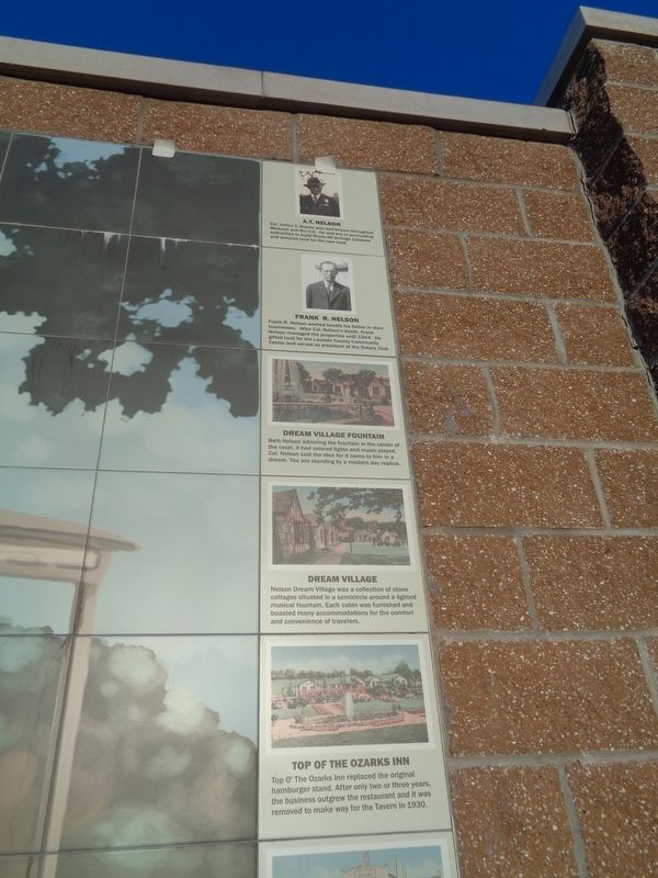
A.T. Nelson
Col. Arthur T. Nelson was well-known throughout Missouri and the U.S. He was key in persuading authorities to built Route 66 through Lebanon and donated land for the new road.
Frank R. Nelson
Frank R. Nelson worked beside his father in their businesses. After Col. Nelson's death, Frank Nelson managed the properties until 1944. He gifted land for the Laclede County Community Center and served as president of the Rotary Club.
Dream Village Fountain
Beth Nelson admiring the fountain in the center of the court. It had colored lights and music played. Col. Nelson said the idea for it came to him in a dream. You are standing by a modern day replica.
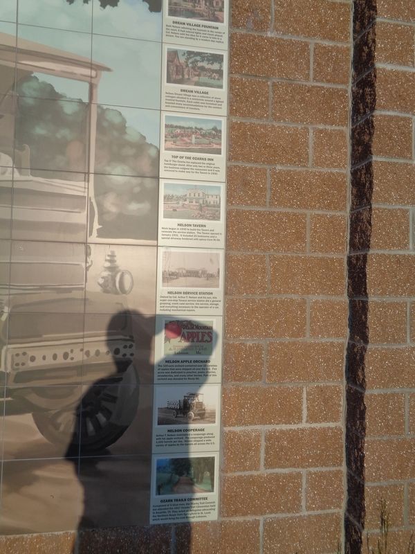
Dream Village
Nelson Dream Village was a collection of stone cottages situated in a semicircle around a lighted musical fountain. Each cabin was furnished and boasted many accommodations for the comfort and convenience of travelers.
Top of the Ozarks Inn
Top O' The Ozarks Inn replaced the original hamburger stand. After only two or three years, the business outgrew the restaurant and it was removed
this page online
Nelson Tavern
Work began in 1930 to build the Tavern and renovate the service station. The Tavern opened in January 1931. It included 20 bedrooms and a special driveway bordered with spirea from Rt 66.
Nelson Service Station
Owned by Col. Arthur T. Nelson and his son, this super one-stop Texaco service station did a general greasing, crank case service, tire service, store, and everything necessary to the operator of a car, including mechanical repairs.
Nelson Apple Orchard
The 100-acre orchard contained over 10 varieties of apples that were shipped all over the U.S. Five acres was dedicated to peaches, pears, cherries, strawberries, and many other berries. Part of this orchard was donated for Route 66.
Nelson Cooperage
Arthur T. Nelson maintained a cooperage along with his apple orchard. The cooperage produced 1,000 barrels each day. Nelson shipped a wide variety of apples by the barrels all across the U.S.
Ozark Trails Committee
Composed of 5 local men, the Ozarks Trail Committee attended the 1917 Ozarks Trail Convention held in Amarillo, TX. They acted as
Photographed by Jason Voigt, April 25, 2021
2. Nelson Family Legacy Marker
close-up of the top tiles
Erected 2018.
Topics and series. This historical marker is listed in these topic lists: Industry & Commerce • Roads & Vehicles. In addition, it is included in the U.S. Route 66 series list. A significant historical month for this entry is January 1931.
Location. 37° 40.166′ N, 92° 39.927′ W. Marker is in Lebanon, Missouri, in Laclede County. It is on West Elm Street (Business Interstate 44) west of Kent Drive, on the right when traveling west. Marker is located at Boswell Park. Touch for map. Marker is at or near this postal address: 679 W Elm St, Lebanon MO 65536, United States of America. Touch for directions.

Regionally, this marker is in South-Central Missouri. It is also in the American Ozarks, in the Lewis & Clark Corridor, and in the Corn Belt. Globally, it is in North America, the Western Hemisphere, the Western World, and the Anglosphere. Historically, it finds itself in what was once the territory of the Mississippian Culture, the Louisiana Purchase, and the Antebellum South.
Other nearby markers. At
Photographed by Jason Voigt, April 25, 2021
3. Nelson Family Legacy Marker
close-up of the bottom tiles
Photographed by Jason Voigt, April 25, 2021
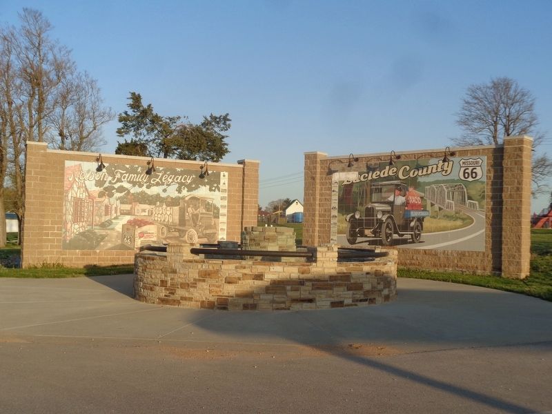
4. Nelson Family Legacy Marker
Credits. This page was last revised on December 13, 2021. It was originally submitted on November 23, 2021, by Jason Voigt of Glen Carbon, Illinois. This page has been viewed 990 times since then and 44 times this year. Photos: 1, 2, 3, 4. submitted on November 23, 2021, by Jason Voigt of Glen Carbon, Illinois.
