
Experiment in Spalding County, Georgia — The American South (South Atlantic)
Camp Stephens
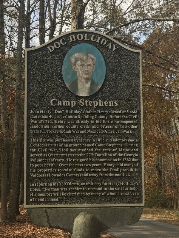
Photographed by Duane and Tracy Marsteller, November 21, 2021
1. Camp Stephens Marker
This site was purchased by Henry in 1855 and later became a Confederate training ground named Camp Stephen. During the Civil War, Holliday attained the rank of Major and served as Quartermaster to the 27th Battalion of the Georgia Volunteer Infantry. He resigned his commission in 1862 due to poor health. Over the next two years, Henry sold many of his properties to raise funds to move the family south to Valdosta (Lowndes County) and away from the conflict.
In reporting his 1893 death, an obituary for Henry Holliday's notes, “No man was readier to respond to the call for help. His memory will be cherished by many of whom he has been a friend in need.”
Topics. This historical marker is listed in this topic list: War, US Civil. A significant historical year for this entry is 1855.
Location. 33° 16.721′ N, 84° 16.515′ W. Marker is in Experiment,
this page online

Regionally, this marker is in Georgia’s Piedmont and in Metro Atlanta. It is also in the American South and specifically in the Deep South. Globally, it is in North America, the Western Hemisphere, the Western World, and the Anglosphere. Historically, it finds itself in what was once the territory of the Mississippian Culture, one of the original Thirteen Colonies, one of the Confederate States of America, and the Antebellum South.
Other nearby markers. At least 8 other markers are within 2 miles of this marker, measured as the crow flies: Confederate Camp (approx. ¼ mile away); a different marker also named Confederate Camp (approx. half a mile away); Old McIntosh Road (approx. 0.6 miles away); Georgia Experiment Station (approx. 1.1 miles away); Holliday Family Home (approx. 1.8 miles away); The Griffin School / Rosenwald Schools (approx. 1.8 miles away); Presbyterian Church

Photographed by Duane and Tracy Marsteller, November 21, 2021
2. Camp Stephens Marker
Regarding Camp Stephens. The marker is part of a self-guided driving tour focusing on John Henry “Doc” Holliday, a Griffin native best known for his involvement with Wyatt Earp and the 1881 gunfight at the OK Corral in Tombstone, Ariz.
Credits. This page was last revised on November 30, 2021. It was originally submitted on November 27, 2021, by Duane and Tracy Marsteller of Murfreesboro, Tennessee. This page has been viewed 994 times since then and 71 times this year. Photos: 1, 2. submitted on November 27, 2021, by Duane and Tracy Marsteller of Murfreesboro, Tennessee.
