Riverdale Park in Prince George's County, Maryland — The American Northeast (Mid-Atlantic)
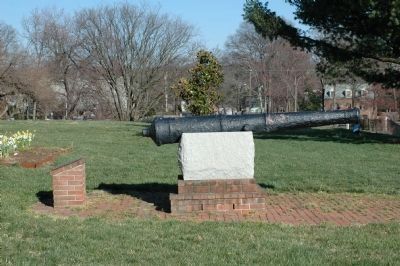
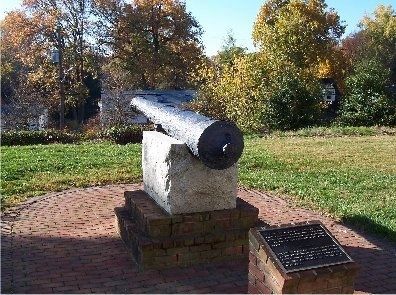
This Demiculverin
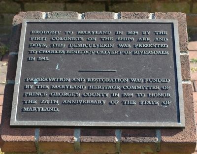
Brought to Maryland in 1634 by the first colonists on the ships Ark and Dove, this demiculverin was presented to Charles Benedict Calvert of Riversdale in 1845. — Preservation and restoration was funded by the Maryland Heritage Committee of Prince George's County in 1984 to honor the 350th Anniversary of the State of Maryland.
Topics. This historical marker is listed in these topic lists: Colonial Era • Military • Settlements & Settlers. A significant historical year for this entry is 1634.
Location. 38° 57.604′ N, 76° 55.91′ W. Marker is in Riverdale Park, Maryland, in Prince George's County. Marker can be reached from Riverdale Road west of Taylor Road. Riverdale Road is parallel to East-West Highway (State Route 410). Taylor Road has an intersection with East-West Highway two blocks north of Riverdale Road. Touch for map. Marker is at or near this postal address: 4811 Riverdale Road, Riverdale MD 20737, United States of America. Touch for directions.
Other nearby markers. At least 5 other markers are within walking distance of this marker. The Riversdale Dependency (within shouting distance of this marker); Betty's Garden (within shouting distance of this marker); Signs of War (within shouting distance of this marker); Welcome to the Riversdale Garden (within shouting distance of this marker); Welcome to Riversdale (about 300 feet away, measured in a direct line). Touch for a list and map of all markers in Riverdale Park.
More about this marker. The demiculverin is on the grounds of Riversdale, on the south side of the mansion. Park at the mansion's parking lot on 48th Avenue at Oliver Street.
Related marker. Click here for another marker that is related to this marker. This Cannon - another cannon from the ships
Also see . . . Historical Forward to Naval Ordnance and Gunnery, Volume 1. “The seagoing demiculverin weighed 3,600 pounds and could shoot 1,950 yards, although its effective battle range (point-blank) was about 80 yards.” This page is on Gene Slover's US Navy Pages website. (Submitted on March 20, 2006.)
Credits. This page was last revised on March 16, 2022. It was originally submitted on March 20, 2006, by Tom Fuchs of Greenbelt, Maryland. This page has been viewed 2,634 times since then and 18 times this year. Photos: 1, 2. submitted on March 20, 2006, by Tom Fuchs of Greenbelt, Maryland. 3. submitted on March 21, 2006, by Tom Fuchs of Greenbelt, Maryland. 4. submitted on March 6, 2008, by M. A. Pimentel of Waldorf, Maryland. • J. J. Prats was the editor who published this page.


