Winder in Barrow County, Georgia — The American South (South Atlantic)
Explore the Unique History of Fort Yargo
A Changing Landscape
Between the Oconee & Ocmulgee
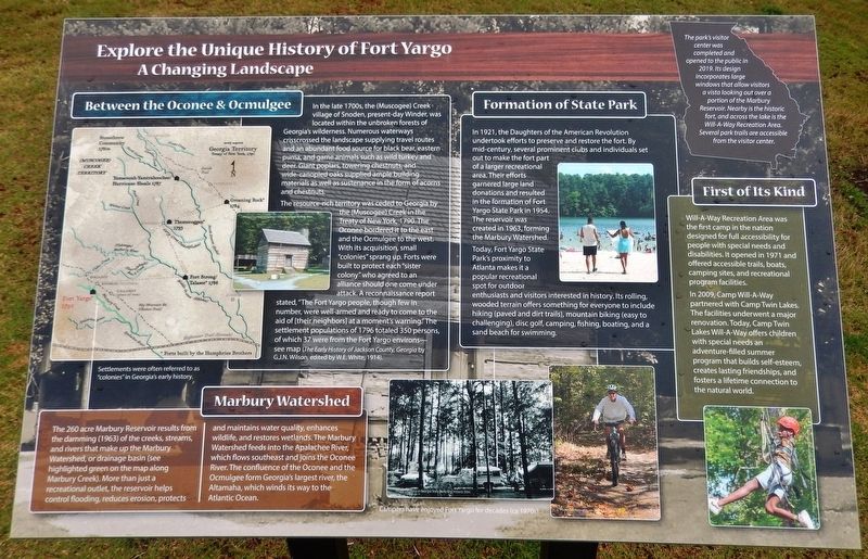
In the late 1700s, the (Muscogee) Creek village of Snoden, present-day Winder, was located within the unbroken forests of Georgia's wilderness. Numerous waterways crisscrossed the landscape supplying travel routes and an abundant food source for black bear, eastern puma, and game animals such as wild turkey and deer. Giant poplars, towering chestnuts, and wide-canopied oaks supplied ample building materials as well as sustenance in the form of acorns and chestnuts.
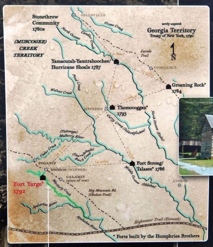
The resource-rich territory was ceded to Georgia by the (Muscogee) Creek in the Treaty of New York, 1790. The Oconee bordered it to the east and the Ocmulgee to the west. With its acquisition, small "colonies" sprang up. Forts were built to protect each "sister colony" who agreed to an alliance should one come under attack. A reconnaissance report stated, "The Fort Yargo people, though few in number, were well-armed and ready to come to the aid of [their neighbors] at a moment's warning." The settlement populations of 1796 totaled 350 persons, of which 37 were from the Fort Yargo environs — see map (The Early History of Jackson County, Georgia by G.J.N. Wilson, edited by W.E. White, 1914).
Marbury Watershed
The 260 acre Marbury Reservoir results from the damming (1963) of the creeks, streams, and rivers that make up the Marbury Watershed, or drainage basin (see highlighted green on the map along Marbury Creek). More than just a recreational outlet, the reservoir helps control flooding, reduces erosion, protects and maintains water quality, enhances wildlife, and restores wetlands. The Marbury Watershed feeds into the Apalachee River, which flows southeast and joins the Oconee River. The confluence of the Oconee and the Ocmulgee form Georgia's largest river, the Altamaha, which winds its way to the Atlantic Ocean.
Formation of State Park
In 1921, the Daughters of the American Revolution undertook efforts to preserve and restore the fort. By mid-century, several prominent clubs and individuals set out to make the fort part of a larger recreational area. Their efforts garnered large land donations and resulted in the formation of Fort Yargo State Park in 1954. The reservoir was created in 1963, forming the Marbury Watershed.
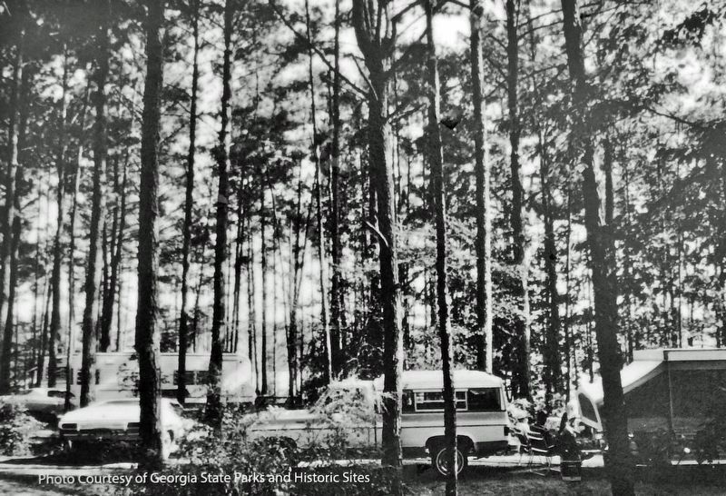
Today, Fort Yargo State Park's proximity to Atlanta makes it a popular recreational spot for outdoor enthusiasts and visitors interested in history. Its rolling, wooded terrain offers something for everyone to include hiking (paved and dirt trails), mountain biking (easy to challenging), disc golf, camping, fishing, boating, and a sand beach for swimming.
First of Its Kind
Will-A-Way
Recreation Area was the first camp in the nation designed for full accessibility for people with special needs and disabilities. It opened in 1971 and offered accessible trails, boats, camping sites, and recreational program facilities. In 2009, Camp Will-A-Way partnered with Camp Twin Lakes. The facilities underwent a major renovation. Today, Camp Twin Lakes Will-A-Way offers children with special needs an adventure-filled summer program that builds self-esteem, creates lasting friendships, and fosters a lifetime connection to the natural world.
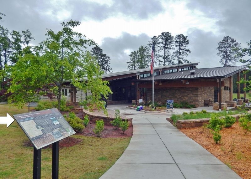
The park's visitor center was completed and opened to the public in 2019. Its design incorporates large windows that allow visitors a vista looking out over a portion of the Marbury Reservoir. Nearby is the historic fort, and across the lake is the Will-A-Way Recreation Area. Several park trails are accessible from the visitor center.
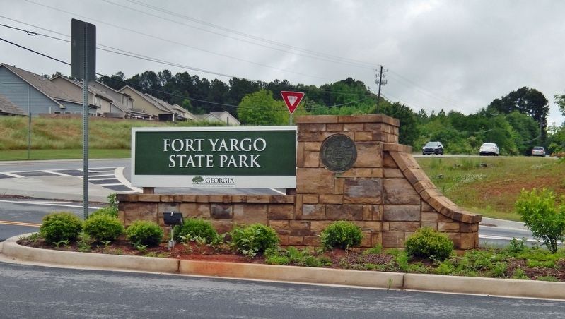
Erected by Fort Yargo State Park.
Topics. This historical marker is listed in these topic lists: Forts and Castles • Parks & Recreational Areas • Settlements & Settlers • Waterways & Vessels. A significant historical year for this entry is 1792.
Location. 33° 58.731′ N, 83° 44.078′ W. Marker is in Winder, Georgia, in Barrow County. Marker is on Fort Yargo Road, 0.2 miles east of South Broad Street
(State Highway 81), on the left when traveling south. Marker is located within Fort Yargo State Park, beside the sidewalk in front of the Visitor Center. Touch for map. Marker is at or near this postal address: 210 South Broad Street, Winder GA 30680, United States of America. Touch for directions.
Other nearby markers. At least 8 other markers are within walking distance of this marker. Will-A-Way Recreation Area (about 400 feet away, measured in a direct line); Fort Yargo's Early History (approx. 0.2 miles away); Fort Yargo (approx. 0.2 miles away); Fort Yargo's Living History Society (approx. 0.2 miles away); Fort Yargo's Frontier Fences (approx. 0.2 miles away); Fort Yargo's Cabin (approx. 0.2 miles away); Fort Yargo's Log Structure (approx. 0.2 miles away); Fort Yargo's Beehive Oven (approx. 0.2 miles away). Touch for a list and map of all markers in Winder.
Related markers. Click here for a list of markers that are related to this marker. Fort Yargo State Park
Also see . . .
1. Fort Yargo State Park.
The State of Georgia contracted with the Humphries brothers – George, Shadrack, and Uriah, the three sons of Revolutionary War captain and Jackson County delegate to 1798 Georgia Constitutional Convention, Joseph Humphries – to build four forts across Georgia. Fort Yargo was constructed in 1793. Its location was given as three miles SW of "Jug Tavern," the original name for Winder. In 1927, the Daughters of the American Revolution took on the project to restore and preserve Fort Yargo. Mildred Pledger and the DAR placed a marker on the grounds which was later destroyed.(Submitted on December 1, 2021, by Cosmos Mariner of Cape Canaveral, Florida.)
2. Fort Yargo State Park.
Located between Atlanta and Athens, this popular park features a 1792 log fort built by settlers for protection against Creek and Cherokee Indians.(Submitted on December 1, 2021, by Cosmos Mariner of Cape Canaveral, Florida.)
Credits. This page was last revised on December 4, 2021. It was originally submitted on November 29, 2021, by Cosmos Mariner of Cape Canaveral, Florida. This page has been viewed 692 times since then and 120 times this year. Photos: 1, 2, 3, 4, 5. submitted on December 1, 2021, by Cosmos Mariner of Cape Canaveral, Florida.
