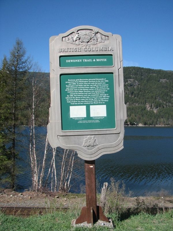
Moyie in East Kootenay, British Columbia — Canada’s West Coast (North America)
Dewdney Trail & Moyie

B.C. Ministry of Transportation and Infrastructure via Flickr (CC BY-NC-ND 2.0), April 11, 2016
1. Dewdney Trail & Moyie Marker
Captions:
(left) Crew building the Dewdney Trail BCARS photo
(right) Hotel Kootenay patrons and staff c/o Moyie Community Assoc.
Erected by Province of British Columbia.
Topics. This historical marker is listed in these topic lists: Roads & Vehicles • Settlements & Settlers. A significant historical year for this entry is 1865.
Location. 49° 16.92′ N, 115° 49.922′ W. Marker is in Moyie, British Columbia, in East Kootenay. Marker is on Crowsnest Highway (Provincial Highway 3/95) 0.4 kilometers south of Half Moon Avenue, on the right when traveling south. Marker is in a pulloff on the eastbound side. Touch for map. Marker is in this post office area: Moyie BC V0B 2A0, Canada. Touch for directions.
Other nearby markers. At least 1 other marker is within walking distance of this marker. St. Eugene Mine (within shouting distance of this marker).
Also see . . .
1. Dewdney Trail. The Canadian Encyclopedia entry on the wilderness path, which was quickly made obsolete by railroads. (Submitted on February 23, 2022, by Duane and Tracy Marsteller of Murfreesboro, Tennessee.)
2. Moyie, British Columbia. Wikipedia entry on the community, which boasted a population of 1,200 at its peak. (Submitted on February 23, 2022, by Duane and Tracy Marsteller of Murfreesboro, Tennessee.)
Credits. This page was last revised on February 23, 2022. It was originally submitted on December 10, 2021, by Duane and Tracy Marsteller of Murfreesboro, Tennessee. This page has been viewed 168 times since then and 26 times this year. Photo 1. submitted on December 10, 2021, by Duane and Tracy Marsteller of Murfreesboro, Tennessee.
Editor’s want-list for this marker. Wide shot of marker and surrounding area in context. • Can you help?