Moyie in East Kootenay, British Columbia — Canada’s West Coast (North America)
St. Eugene Mine
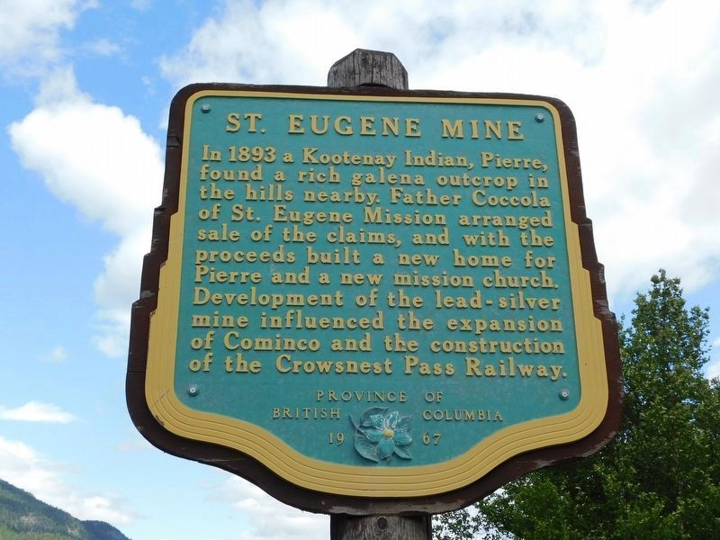
Photographed by Jimmy Emerson, June 14, 2017
1. St. Eugene Mine Marker
Erected 1967 by Province of British Columbia.
Topics. This historical marker is listed in these topic lists: Indigenous Peoples and Communities • Industry & Commerce • Railroads & Streetcars • Religion & Religious Structures. A significant historical year for this entry is 1893.
Location. 49° 16.934′ N, 115° 49.912′ W. Marker is in Moyie, British Columbia, in East Kootenay. It is on Crowsnest Highway (Provincial Highway 3/95) 0.3 kilometers south of Half Moon Avenue, on the right when traveling south. Touch for map. Marker is at or near this postal address: 323 BC-95, Moyie BC V0B 2A0, Canada. Touch for directions.

Regionally, this marker is in the BC Interior and in the Kootenay Rockies. Globally, it is in North America, in the Rocky Mountains, on
this page online
Other nearby markers. At least one other marker is within walking distance of this marker: Dewdney Trail & Moyie (within shouting distance of this marker).
Also see . . . St. Eugene Mission Church. The church that Father Nicolas Coccola built from his claim's proceeds is one of only a few Victorian wooden structures still standing in British Columbia. (Heritage BC) (Submitted on February 22, 2022, by Duane and Tracy Marsteller of Murfreesboro, Tennessee.)

B.C. Ministry of Transportation and Infrastructure via Flickr (CC BY-NC-ND 2.0), April 11, 2016
2. St. Eugene Mine Marker

Unknown via British Columbia Archives / B-00649 / Public domain, 1908
3. Concentrator, St. Eugene, Consolidated Mining Co., Moyie, B.C.
The mine produced more than $10 million in ore over its lifespan.
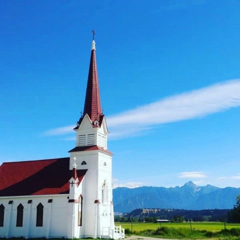
Photographed by Heritage BC
4. St. Eugene Mission Church near Cranbrook, BC
The church Father Nicolas Coccola built remains a local landmark in the St. Mary's Indian Band Reserve.
Credits. This page was last revised on July 9, 2026. It was originally submitted on December 10, 2021, by Duane and Tracy Marsteller of Murfreesboro, Tennessee. This page has been viewed 1,169 times since then and 149 times this year. Photos: 1. submitted on June 8, 2026, by Jimmy Emerson of Dalton, Georgia. 2. submitted on December 10, 2021, by Duane and Tracy Marsteller of Murfreesboro, Tennessee. 3, 4. submitted on February 22, 2022, by Duane and Tracy Marsteller of Murfreesboro, Tennessee.
Editor’s want-list for this marker. Wide shot of marker and surrounding area in context • Can you help?
