Bonnington Falls in Central Kootenay, British Columbia — Canada’s West Coast (North America)
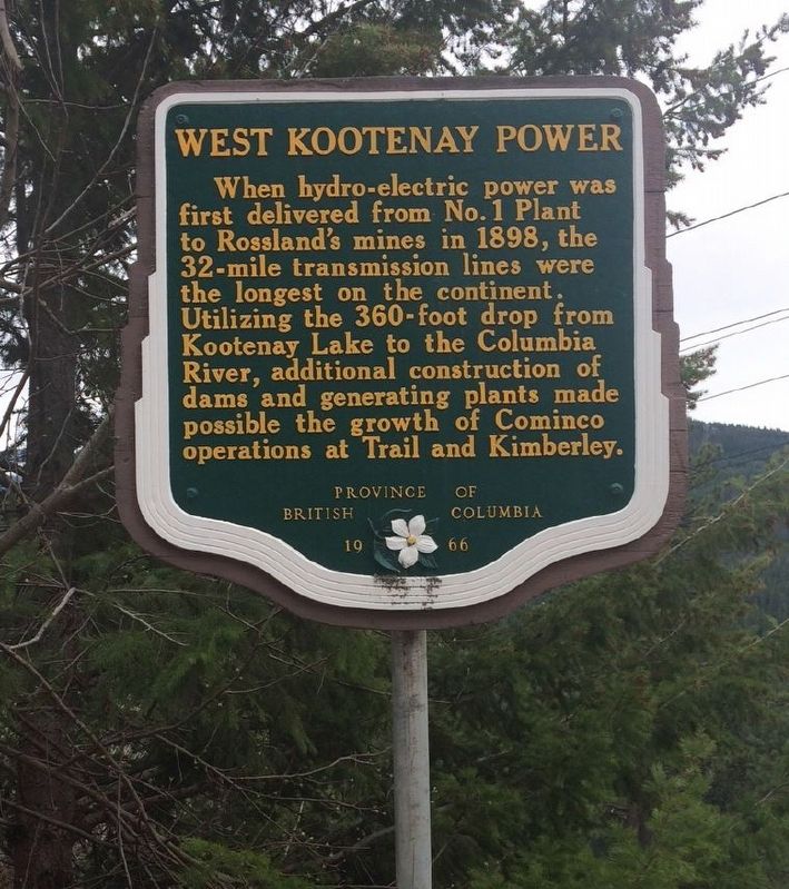
West Kootenay Power

B.C. Ministry of Transportation and Infrastructure via Flickr (CC BY-NC-ND 2.0), June 15, 2016
1. West Kootenay Power Marker
Erected 1966 by Province of British Columbia.
Topics. This historical marker is listed in these topic lists: Industry & Commerce • Waterways & Vessels. A significant historical year for this entry is 1898.
Location. Marker has been reported missing. It was located near 49° 27.789′ N, 117° 29.705′ W. Marker was in Bonnington Falls, British Columbia, in Central Kootenay. Marker was on Nelson Nelway Highway (Provincial Highway 3A) 0.2 kilometers east of South Slocan Village Road, on the right when traveling east. Marker is in a pulloff on the eastbound side. Touch for map. Marker was at or near this postal address: 3750 BC-3A, Bonnington Falls BC V0G 2G0, Canada. Touch for directions.
Other nearby markers. At least 4 other markers are within 19 kilometers of this location, measured as the crow flies. Patrick Lumber Co. (approx. 5 kilometers away); Baker Street (approx. 13.6 kilometers away); Nelson Post Office/Customs House (approx. 14.9 kilometers away); Doukhobor Suspension Bridge (approx. 18.9 kilometers away).
Also see . . .
1. Chapter 2: Industrial Beginnings. Gallery of early industrial and commercial development in the Trail area, part of an online exhibit of photographs taken by William J. Carpenter, Leslie C. Hughes and Robert J. Hughes. (Trail Historical Society) (Submitted on February 21, 2022, by Duane and Tracy Marsteller of Murfreesboro, Tennessee.)
2. West Kootenay Power & Light Company History. A small steam-powered generator led to the creation of a massive hydroelectric power-generation network along the Kootenay River. (Rossland Museum brochure via Issuu) (Submitted on February 21, 2022, by Duane and Tracy Marsteller of Murfreesboro, Tennessee.)

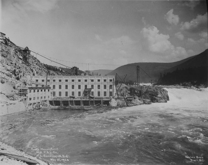
Canada Dept. of Mines & Technical Surveys via Library & Archives Canada PA-015550 (Public domain), May 13, 1925
2. West Kootenay Power & Light Co. power house, Lower Bonnington Dam
The original 1897 dam was a rock-filled timber crib dam. It was rebuilt in 1924 with a new plant that increased generating capacity to 54 megawatts.
Credits. This page was last revised on February 21, 2022. It was originally submitted on December 10, 2021, by Duane and Tracy Marsteller of Murfreesboro, Tennessee. This page has been viewed 141 times since then and 7 times this year. Photos: 1. submitted on December 10, 2021, by Duane and Tracy Marsteller of Murfreesboro, Tennessee. 2. submitted on February 21, 2022, by Duane and Tracy Marsteller of Murfreesboro, Tennessee.
Editor’s want-list for this marker. Wide shot of marker and surrounding area in context • Confirm coordinates • Can you help?