Near Silica in Kootenay Boundary, British Columbia — Canada’s West Coast (North America)
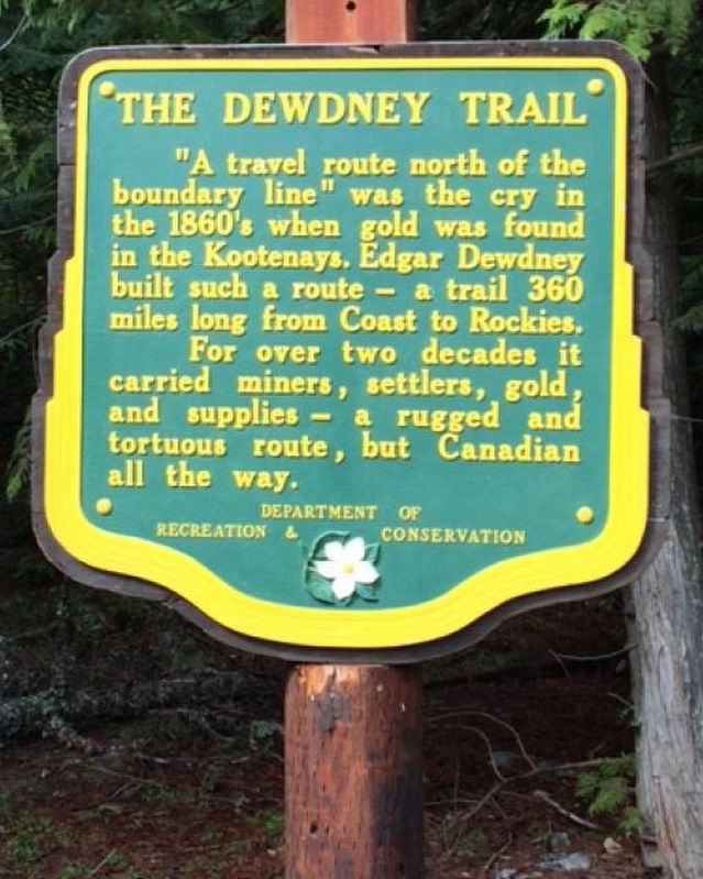
The Dewdney Trail

B.C. Ministry of Transportation and Infrastructure via Flickr (CC BY-NC-ND 2.0), June 23, 2016
1. The Dewdney Trail Marker
For over two decades it carried miners, settlers, gold and supplies — a rugged and tortuous route, but Canadian all the way.
Erected by British Columbia Department of Recreation and Conservation.
Topics. This historical marker is listed in these topic lists: Exploration • Roads & Vehicles. A significant historical year for this entry is 1860.
Location. 49° 1.229′ N, 117° 50.696′ W. Marker is near Silica, British Columbia, in Kootenay Boundary. Marker can be reached from Paterson-Trail Highway (Provincial Highway 22) 1.1 kilometers north of King George Park Road. Touch for map. Marker is in this post office area: Silica BC V0G 1Y0, Canada. Touch for directions.
Other nearby markers. At least 1 other marker is within 8 kilometers of this marker, measured as the crow flies. The Rossland Mines (approx. 6.8 kilometers away).
Also see . . .
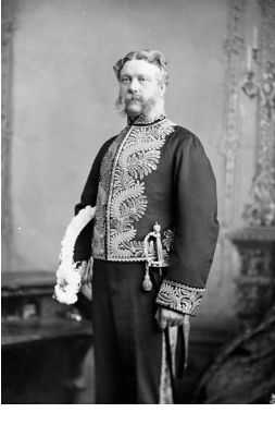
1. The Dewdney Trail (YouTube). Episode of "Gold Trails & Ghost Towns" focusing on the pioneering path overseen by Edgar Dewdney. Note: Episode appears to have been copied from videotape, so image quality is not sharp. (CHBC-TV, uploaded by Leslie Dycke) (Submitted on February 19, 2022, by Duane and Tracy Marsteller of Murfreesboro, Tennessee.)
2. Dewdney Trail. Wikipedia entry on the 450-mile (720 km) trail. (Submitted on February 19, 2022, by Duane and Tracy Marsteller of Murfreesboro, Tennessee.)
Credits. This page was last revised on February 19, 2022. It was originally submitted on December 10, 2021, by Duane and Tracy Marsteller of Murfreesboro, Tennessee. This page has been viewed 146 times since then and 11 times this year. Photos: 1. submitted on December 10, 2021, by Duane and Tracy Marsteller of Murfreesboro, Tennessee. 2. submitted on February 19, 2022, by Duane and Tracy Marsteller of Murfreesboro, Tennessee.
Editor’s want-list for this marker. Wide shot of marker and surrounding area in context • Confirm GPS coordinates • Can you help?
