Port Moody in Metro Vancouver, British Columbia — Canada’s West Coast (North America)
Port Moody

B.C. Ministry of Transportation and Infrastructure via Flickr (CC BY-NC-ND 2.0)
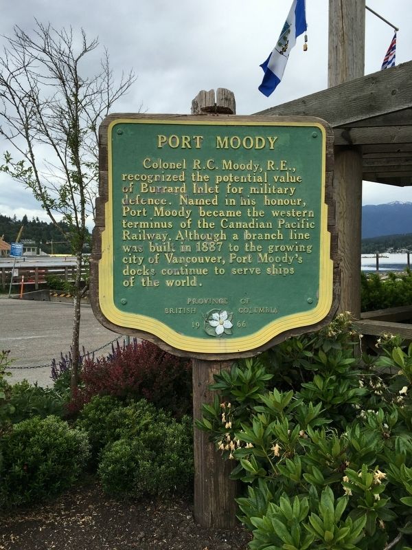
1. Port Moody Marker
Erected 1966 by Province of British Columbia.
Topics. This historical marker is listed in these topic lists: Military • Railroads & Streetcars • Waterways & Vessels. A significant historical year for this entry is 1887.
Location. Marker has been reported missing. It was located near 49° 16.894′ N, 122° 50.995′ W. Marker was in Port Moody, British Columbia, in Metro Vancouver. Marker was on Esplanade Avenue, 0.4 kilometers north of Murray Street, on the right when traveling north. Marker was at the Rocky Point Pier. Touch for map. Marker was at or near this postal address: 2770 Esplanade Ave, Port Moody BC V3H 0C8, Canada. Touch for directions.
Other nearby markers. At least 5 other markers are within 13 kilometers of this location, measured as the crow flies. Irving House (approx. 9.2 kilometers away); The Great Fire (approx. 9.5 kilometers away); Carnegie Library (approx. 9.7 kilometers away); The New Westminster Court House and Land Registry Office (approx. 9.8 kilometers away); Salmon! (approx. 12.6 kilometers away).
Credits. This page was last revised on February 19, 2022. It was originally submitted on December 10, 2021, by Duane and Tracy Marsteller of Murfreesboro, Tennessee. This page has been viewed 63 times since then and 5 times this year. Photo 1. submitted on December 10, 2021, by Duane and Tracy Marsteller of Murfreesboro, Tennessee.
Editor’s want-list for this marker. Wide shot of marker and surrounding area in context • Confirmation of GPS coordinates • Can you help?