Tonopah in Nye County, Nevada — The American Mountains (Southwest)
Mine To Market
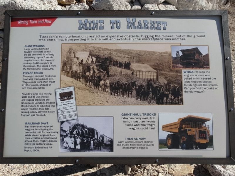
Giant Wagons
Large wagons hitched in tandem were used to haul the ore to the mill for refining. In the early days of Tonopah, long-line teams of horses and mules pulled the wagons to the railroad. This scene is from the Mizpah Mine, circa 1901.
Please Touch
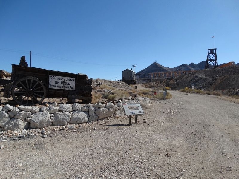
The wagon remnant on display illustrates their average size. Wagon's part were often made in other places, shipped in and then assembled.
Nevada's fame as a mining state and its use of large ore wagons prompted the Studebaker Company of South Bend, Indiana to advertise this wagon model in their 1881 catalog, nearly 20 years before Tonopah was founded.
Railroad Days
Rail line later replaced wagons for shipping the ore to the mill for processing. While steam engines blew their whistles and bellowed smoke then, mighty diesels move the railcars today. Tonopah & Goldfield RR Depot, 1908.
Whoa!
To stop the wagons, a lever was pulled which caused the large wooden brakes to rum against the wheels. Can you find the brake on the old wagon?
Gianta Haul
Trucks today can carry over 400 tons, more than twenty times what the freight wagons could haul.
Then As Now
Giant wagons, steam engines, and trucks have been a favorite photographic subject.
Erected by Tonopah Historic Mining Park.
Topics. This historical marker is listed in these topic lists: Notable Places • Railroads & Streetcars. A significant historical year for this entry is 1901.
Location. 38° 4.17′ N, 117° 13.603′ W. Marker is in Tonopah, Nevada, in Nye County. Marker is on Burro Avenue, on the left when traveling east. Located in Tonopah Historic Mining Park. Touch for map. Marker is at or near this postal address: 110 Burro Avenue, Tonopah NV 89049, United States of America. Touch for directions.
Other nearby markers. At least 8 other markers are within walking distance of this marker. Silver Vein (within shouting distance of this marker); Glory Hole (within shouting distance of this marker); A Miner's Life (within shouting distance of this marker); Silver Top Mine (within shouting distance of this marker); The Tonopah Mining Boom (within shouting distance of this marker); Haul Out The Riches (about 300 feet away, measured in a direct line); Belle's Mine (about 400 feet away); Up From The Depths (about 500 feet away). Touch for a list and map of all markers in Tonopah.
Credits. This page was last revised on January 5, 2022. It was originally submitted on December 12, 2021, by Denise Boose of Tehachapi, California. This page has been viewed 121 times since then and 7 times this year. Photos: 1, 2. submitted on December 12, 2021, by Denise Boose of Tehachapi, California. • Syd Whittle was the editor who published this page.

