Knoxville in Marion County, Iowa — The American Midwest (Upper Plains)
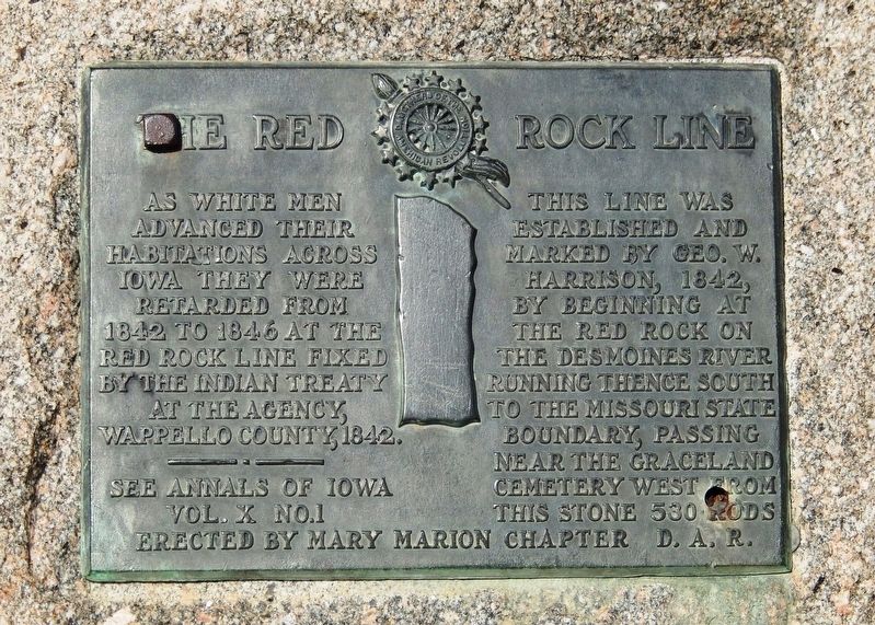
The Red Rock Line
As white men advanced their habitations across Iowa they were retarded from 1842 to 1846 at the Red Rock Line fixed by the Indian Treaty at the Agency, Wappello County, 1842.
This line was established and marked by Geo. W. Harrison, 1842, by beginning at the Red Rock on the Des Moines River running thence south to the Missouri state Boundary, passing near the Graceland Cemetery west from this stone 530 rods
See Annals of Iowa Vol. X No. 1
Erected by Mary Marion Chapter, Daughters of the American Revolution.
Topics and series. This historical marker is listed in these topic lists: Native Americans • Settlements & Settlers. In addition, it is included in the Daughters of the American Revolution series list. A significant historical year for this entry is 1842.
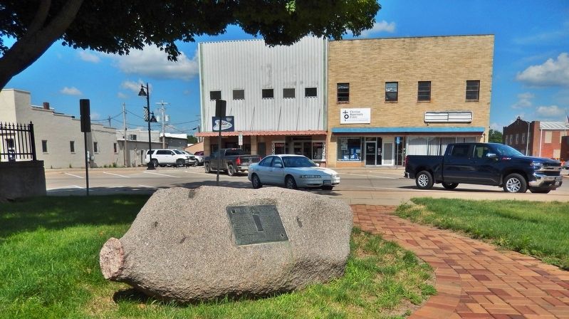
Location. 41° 19.094′ N, 93° 5.803′ W. Marker is in Knoxville, Iowa, in Marion County. Marker is on East Robinson Street just east of South 3rd Street, on the right when traveling east. Marker is located along the walkway near the southeast corner of the Marion County Courthouse grounds. Touch for map. Marker is at or near this postal address: 214 East Main Street, Knoxville IA 50138, United States of America. Touch for directions.
Other nearby markers. At least 8 other markers are within 6 miles of this marker, measured as the crow flies. Dixie Cornell Gebhardt (here, next to this marker); 1942 M5 - 3" Howitzer (within shouting distance of this marker); Erected to the Memory of All Departed Soldiers, Sailors and Marines (about 300 feet away, measured in a direct line); Marion County Freedom Rock (approx. ¾ mile away); Marion County Veterans Memorial (approx. ¾ mile away); Vietnam Memorial (approx. ¾ mile away); Dragoon Trail Historical Site Marker No. 6 (approx. 5.2 miles away); a different marker also named The Red Rock Line (approx. 5.9 miles away). Touch for a list and map of all markers in Knoxville.
Also see . . .
1. Sac and Fox treaty of 1842 (Wikipedia).
The Native American tribes ceded land in Iowa west of the Mississippi River and north of the Missouri border. The Native American people agreed to move west of the "Red Rock line," prior to May 1843 and exit Iowa completely by 1845. The north–south line was delineated primarily by "painted or red rocks on the White Breast," river, near where it flows into the Des Moines River. The city of Red Rock, Iowa was created just to the west of the line.(Submitted on December 13, 2021, by Cosmos Mariner of Cape Canaveral, Florida.)
2. Treaty of October 11, 1842.
Article I(Submitted on December 13, 2021, by Cosmos Mariner of Cape Canaveral, Florida.)
The confederated tribes of Sacs and Foxes cede to the United States, forever, all the lands west of the Mississippi river, to which they have any claim or title, or in which they have any interest whatever; reserving a right to occupy for the term of three years from the time of signing this treaty, all that part of the land hereby ceded which lies west of a line running due north and south from the painted or red rocks on the White Breast fork of the Des Moines river, which rocks will be found about eight miles, when reduced to a straight line, from the junction of the White Breast with the Des Moines.
Credits. This page was last revised on December 13, 2021. It was originally submitted on December 13, 2021, by Cosmos Mariner of Cape Canaveral, Florida. This page has been viewed 473 times since then and 83 times this year. Photos: 1, 2, 3. submitted on December 13, 2021, by Cosmos Mariner of Cape Canaveral, Florida.


