Adams Park in Atlanta in Fulton County, Georgia — The American South (South Atlantic)
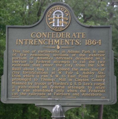
Confederate Entrenchments: 1864
Inscription.
This line of works in Adams Park is one of the few remaining sections of the exterior portion of Atlanta's defenses designed as a barrier to Federal attempts to cut the two railroads that enter the city from the S.W. Built about August 1 it joined the main line city fortifications at W. Fair and Ashby Sts., from where it ran SW to East Point - later prolonged and ran to Thames' Mill in Clayton County. Manned by troops of Hardee's and S. D. Lee's corps, it withstood all attempts to seize it & was abandoned only when the Federals cut the railroads at Fairburn and Jonesboro.
Erected 1958 by Georgia Historical Commission. (Marker Number 060-161.)
Topics and series. This historical marker is listed in this topic list: War, US Civil. In addition, it is included in the Georgia Historical Society series list. A significant day of the year for for this entry is August 1.
Location. 33° 42.621′ N, 84° 27.858′ W. Marker is in Atlanta, Georgia, in Fulton County. It is in Adams Park. Marker can be reached from Adams Park Golf Course, 1.2 miles Campbellton Road. Located on the prominent hill upon the Adams Park Golf Course. Touch for map. Marker is in this post office area: Atlanta GA 30311, United States of America. Touch for directions.
Other nearby markers. At least 8 other markers are within 2 miles of this marker, measured as the crow flies. Battle of Utoy Creek (approx. 0.8 miles away); The Embattled Ridge (approx. 0.8 miles away); Historic Utoy Church (approx. 0.9 miles away); a different marker also named Battle of Utoy Creek (approx. 1.1 miles away); Third Division 23rd Corps Attack / Second Division 23rd Corps Attack (approx. 1.2 miles away); The Extended Siege Lines (approx. 1.3 miles away); Lynching in America / The Lynching of Zeb Long (approx. 2 miles away); Kilpatrick’s Cavalry on the Newnan Stage Road (approx. 2.1 miles away). Touch for a list and map of all markers in Atlanta.
More about this marker. The marker was submitted by Mr. Wilbur Kurtz, Historian and Artist and member of the Atlanta Historical Society in preparation for the Civil War Centennial.
Regarding Confederate Entrenchments: 1864. The Marker in placed on a prominent hill, where the Entrenchments of Bates Confederate Division occupied immediately, after withdrawing from their advanced position in the vicinity of the Cascade Nature Preserve. Major General William B. Bate was wounded here on 10 August 1864 while observing significant skirmish and attempt to secure the position

Photographed By Mrs. Sarahlyn Davies Bennett, May 10, 2009
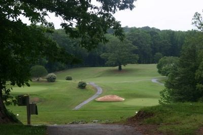
2. The View Today
Looking northwest from the former lines of Bates Division CSA immediately after the main assault on their advanced position along the Sandtown (Campbellton) Road, at Cascade Springs Nature Preserve. Major General William B. Bate was wounded near this site while inspecting his lines.
Additional keywords. Siege Lines SW Atlanta, Bates Lines, Clayburn's Lines, Bate Wounded at Utoy Creek Aug 10, 1864
Credits. This page was last revised on February 8, 2023. It was originally submitted on May 10, 2009, by Lieutenant Colonel Perry Bennett, Army Historian of Atlanta, Georgia. This page has been viewed 2,035 times since then and 69 times this year. Photos: 1, 2. submitted on May 10, 2009, by Lieutenant Colonel Perry Bennett, Army Historian of Atlanta, Georgia. • Craig Swain was the editor who published this page.
