Near Stony Creek in Sussex County, Virginia — The American South (Mid-Atlantic)
Sappony Church
Hampton’s Cavalry: "Too strong to be overcome"
| — | Wilson-Kautz Raid | — |
Photographed by Bernard Fisher, May 9, 2009
1. Sappony Church CWT Marker
this page online
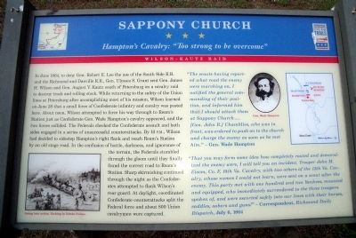
“The scouts having reported what road the enemy were marching on, I notified the general commanding of their position, and informed him that I should attack them at Sappony Church… [Gen. John R.] Chambliss, who was in front, was ordered to push on to the church and charge the enemy as soon as he met him.” - Gen. Wade Hampton
“That you may form some idea how completely routed and demoralized the enemy were, I will tell you an incident. Trooper John M. Eisom, Co. F, 10th Va. Cavalry, with two others of the 13th Va. Cavalry, whose names I could not learn, were sent on a scout after the enemy. This party met with one hundred and two Yankees, mounted and equipped, who immediately surrendered to the three troopers spoken of, and were escorted safely into our lines with their horses, saddles, sabers and guns!” – Correspondent, Richmond Daily Dispatch, July 6, 1864
Erected by Virginia Civil War Trails.
Topics and series. This historical marker is listed in these topic lists: Religion & Religious Structures • War, US Civil.
Photographed by Bernard Fisher, May 9, 2009
2. Sappony Church Map
Location. 36° 56.754′ N, 77° 27.183′ W. Marker is near Stony Creek, Virginia, in Sussex County. It is at the intersection of Sussex Drive (Virginia Route 40) and Concord Sappony Road, on the left when traveling west on Sussex Drive. Touch for map. Marker is in this post office area: Stony Creek VA 23882, United States of America. Touch for directions.

Regionally, this marker is in Coastal Virginia. It is also in the American South, specifically in the Upper South, and in the Tidewater. Globally, it is in North America, the Western Hemisphere, the Western World, and the Anglosphere. Historically, it finds itself in what was once the territory of the Mississippian Culture, one of the original Thirteen Colonies, one of the Confederate States of America, and the Antebellum South.
Other nearby markers. At least 8 other markers are within 5 miles of this marker, measured as the crow flies: Sappony Baptist Church (within shouting distance of this marker); Sussex County / Dinwiddie County (approx. 2.1 miles
Photographed by Bernard Fisher, May 9, 2009
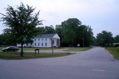
3. Sappony Church Marker
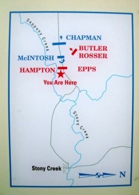
More about this marker. On the lower left is a sketch entitled "Going into action". Etching by Edwin Forbes. On the upper right is a photo of "Gen. Wade Hampton" and a map of the action.
Photographed by Bernard Fisher, May 9, 2009
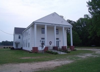
4. Sappony Church
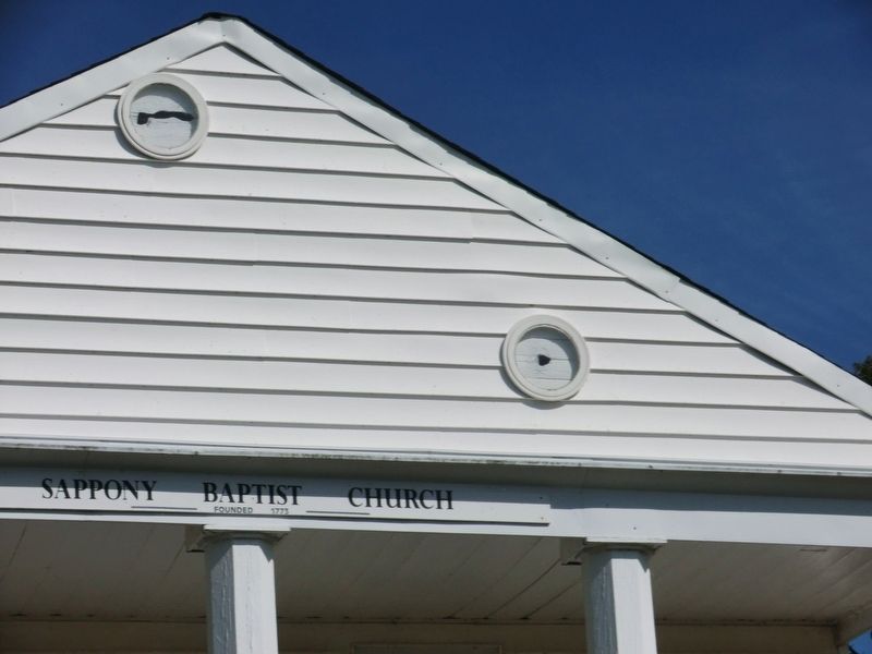
Photographed by Don Morfe, September 15, 2013
5. Sappony Baptist Church
Close up shot showing where the Cannon balls struck the front of the church
Credits. This page was last revised on November 14, 2021. It was originally submitted on May 11, 2009, by Bernard Fisher of Richmond, Virginia. This page has been viewed 2,317 times since then and 79 times this year. Photos: 1, 2, 3, 4. submitted on May 11, 2009, by Bernard Fisher of Richmond, Virginia. 5. submitted on November 3, 2013, by Don Morfe of Baltimore, Maryland.
