Spring Hill in Maury County, Tennessee — The American South (East South Central)
Nashville and Decatur Railroad
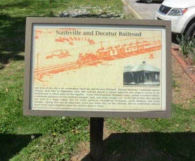
Photographed by Don Morfe, April 23, 2014
1. Nashvill and Decatur Railroad Marker
(caption)
(upper right) Spring Hill Depot, Post Civil War (courtesy Spring Hill Library)
Topics. This historical marker is listed in these topic lists: Railroads & Streetcars • War, US Civil. A significant historical month for this entry is September 1864.
Location. 35° 44.574′ N, 86° 55.629′ W. Marker is in Spring Hill, Tennessee, in Maury County. It can be reached from Kedron Road 0.2 miles Old Kedron Road, on the left when traveling north.
this page online

Regionally, this marker is in Middle Tennessee and in Greater Nashville. It is also in the American South and specifically in the Upper South. Globally, it is in North America, the Western Hemisphere, the Western World, and the Anglosphere. Historically, it finds itself in what was once the territory of the Mississippian Culture, one of the Confederate States of America, and the Antebellum South.
Other nearby markers. At least 8 other markers are within walking distance of this marker: Left of the Union Defensive Position (here, next to this marker); Ewell Farm (here, next to this marker); Federal Defense of Spring Hill (approx. 0.3 miles away); Cleburne's Attack (approx. 0.3 miles away); Cleburne's Pursuit (approx. 0.4 miles away); Confederate Deployment (approx. 0.4 miles away); Forrest's 3:00 p.m. Cavalry Attack (approx. 0.4 miles away); Confederate Attacks at Spring Hill (approx. 0.4 miles away). Touch for a list and map of
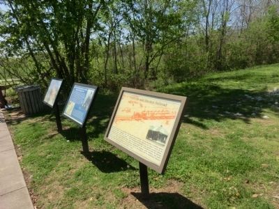
Photographed by Don Morfe, April 23, 2014
2. Nashvill and Decatur Railroad Marker
Credits. This page was last revised on December 20, 2021. It was originally submitted on July 5, 2014, by Don Morfe of Baltimore, Maryland. This page has been viewed 1,652 times since then and 96 times this year. Last updated on December 17, 2021, by Bradley Owen of Morgantown, West Virginia. Photos: 1, 2. submitted on July 5, 2014, by Don Morfe of Baltimore, Maryland. • Mark Hilton was the editor who published this page.
