San Juan Capistrano in Orange County, California — The American West (Pacific Coastal)
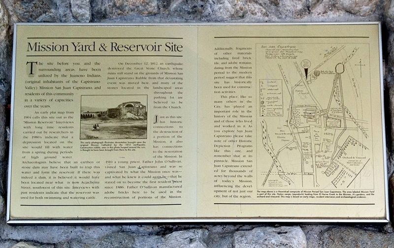
Mission Yard & Reservoir Site
The site before you and the surrounding areas have been utilized by the Juaneno Indians (Original inhabitants of the Capistrano Valley). Mission San Juan Capistrano, and residents of this community in a variety of capacities over the years.
An early plat map from 1904 calls this site out as the "Mission Reservoir". Interviews with long time residents carried out by researchers in the 1980's indicated on the site would be filled with water from a spring during the periods of high ground water. Archaeologist believed that an earthen or stone dam may have been built to trap this water and form a reservoir. If there was a dam, it it believed it would have been located near what is now Acjachema Street, southwest of this site. Interviews with past residents indicate that the reservoir was used for both swimming and watering cattle.
On December 12, 1812, an earthquake destroyed the Great Stone Church, whose ruins still stand on the grounds of Mission San Juan Capistrano Rubble from that devastating event was moved here, and many of the stones located in the landscape areas throughout the parking lot believed to be from the church.
Just as this site has historic connections to the destruction a portion of the Mission, it also has connection to the restoration of the Mission. In 1910 a young priest, Father John O'Sullivan, visited San Juan Capistrano and was so captivated by what the Mission once was- and knew it could again be- that he stayed on to become the first resident priest since 1886. Father O'Sullivan manufactured adobe bricks here to be used in the reconstruction of portions of the Mission.
Additionally, fragments of other materials included fired brick, tile and adobe remains dating from the Mission period to the modern period suggest that this site had historically been used for construction activities. This place, like so many others in the City, has played an important role in the history of the Mission and of those who lived and worked in it. As you explore San Juan Capistrano, please take note of other historic depiction programs like this one, and remember that at its pinnacle, Mission San Juan Capistrano extended for thousands of acres beyond the walls of today's Mission influenced the development of not just our city, but of this region.
Topics. This historical marker is listed in these topic lists: Churches & Religion • Disasters • Exploration • Native Americans • Settlements & Settlers. A significant historical date for this entry is December 12, 1812.
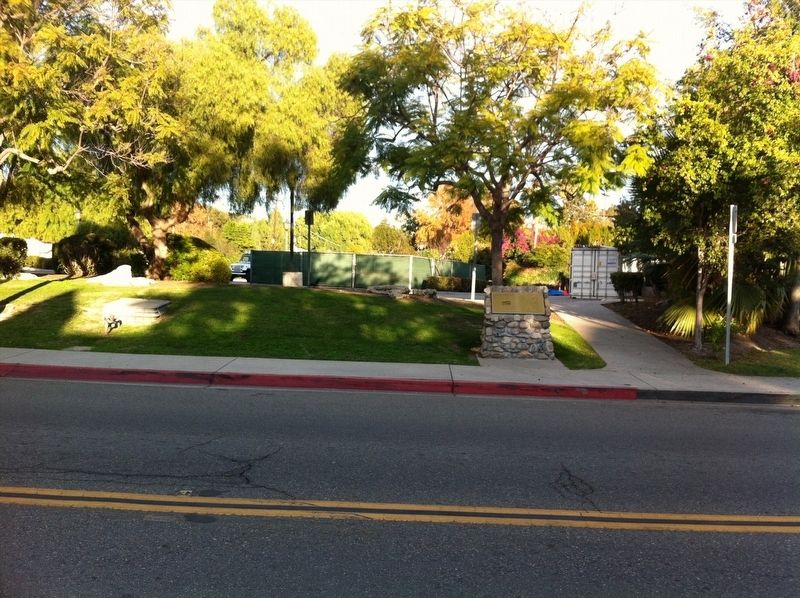
Location. 33° 30.319′ N, 117° 39.775′ W. Marker is in San Juan Capistrano, California, in Orange County. Marker is on El Camino Real just north of Acjachema Street, on the right when traveling north. Touch for map. Marker is at or near this postal address: 26793 Acjachema St, San Juan Capistrano CA 92675, United States of America. Touch for directions.
Other nearby markers. At least 8 other markers are within walking distance of this marker. San Juan Capistrano Regional Library (within shouting distance of this marker); Mission Bells (about 400 feet away, measured in a direct line); New Mission Church (about 400 feet away); Capistrano Union High School (about 700 feet away); The Villa (about 700 feet away); San Juan Elementary School Site (approx. 0.2 miles away); Metalworking Furnaces (approx. 0.2 miles away); The Founding Documents of Mission San Juan Capistrano (approx. 0.2 miles away). Touch for a list and map of all markers in San Juan Capistrano.
Credits. This page was last revised on December 29, 2021. It was originally submitted on December 19, 2021, by Adam Margolis of Mission Viejo, California. This page has been viewed 193 times since then and 24 times this year. Photos: 1, 2. submitted on December 19, 2021, by Adam Margolis of Mission Viejo, California. • Devry Becker Jones was the editor who published this page.

